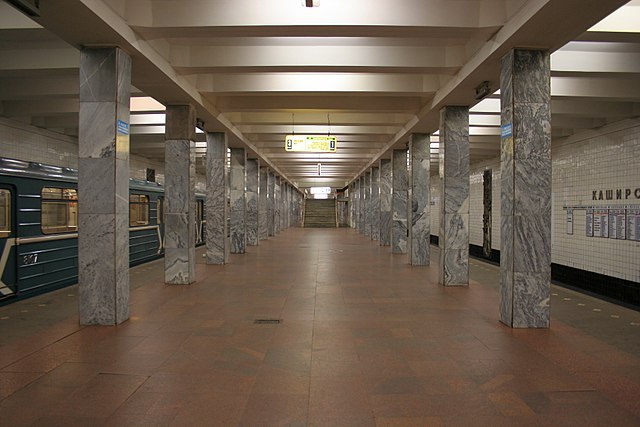
Kashirskaya is a cross-platform station complex on the Moscow Metro. It was opened on 11 August 1969 as part of the Kakhovsky radius extension, and from 1984 was an interchange between the Kakhovskaya and the Orekhovskaya branches of the Zamoskvoretskaya line. Since 2022 it is officially classed as three stations after the Bolshaya Koltsevaya line's separation, and also is the terminus of it.
Western (top) and eastern (bottom) halls of station
Eastern hall (in 2010)
Eastern hall platform (for terminating Kakhovskaya Line and northbound Zamoskvoretskaya Line trains)
Western hall platform (for southbound Zamoskvoretskaya Line trains)
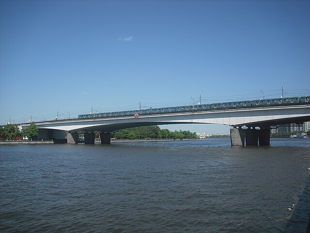
The Zamoskvoretskaya line, formerly Gorkovsko–Zamoskvoretskaya (Го́рьковско-Замоскворе́цкая), is a line of the Moscow Metro. Opened in 1938, chronologically it became the third line. There are 24 stations on the Zamoskvoretskaya line, and it spans 42.8 kilometres (26.6 mi), roughly crossing Moscow in a north–south direction. A normal trip along the entire line takes 55 minutes, with the trains on the line averaging 42 kilometres per hour (26 mph). While most of the line is underground, there are some pockets of surface-level or above-ground track, mainly at the point where the line crosses the Moskva River. The line contains many examples of original Moscow Metro architecture, and contains arguably the most photographed station on the entire network: Mayakovskaya.
Nagatinsky Metro Bridge on the Zamoskvoretskaya line