Kashmir
Videos
Kashmir is the northernmost geographical region of the Indian subcontinent. Until the mid-19th century, the term "Kashmir" denoted only the Kashmir Valley between the Great Himalayas and the Pir Panjal Range. Today, the term encompasses a larger area that includes the India-administered territories of Jammu and Kashmir and Ladakh, the Pakistan-administered territories of Azad Kashmir and Gilgit-Baltistan, and the Chinese-administered territories of Aksai Chin and the Trans-Karakoram Tract.

Pahalgam Valley, Kashmir

Nanga Parbat in Kashmir, the ninth-highest mountain on Earth, is the western anchor of the Himalayas
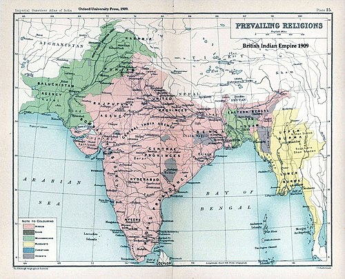
The prevailing religions by district in the 1901 Census of the Indian Empire

A white border painted on a suspended bridge delineates Azad Kashmir from Jammu and Kashmir
Kashmir Valley
Videos
The Kashmir Valley, also known as the Vale of Kashmir, is an intermontane valley in northern Jammu and Kashmir, a region in Indian-administered Kashmir. The valley is surrounded by ranges of the Himalayas, bounded on the southwest by the Pir Panjal Range and on the northeast by the Greater Himalayan range. It is approximately 135 km (84 mi) long and 32 km (20 mi) wide, and drained by the Jhelum River. It forms the bulk of the Kashmir Division of Jammu and Kashmir.

Satellite imagery of the Kashmir Valley, showcasing the snow-capped peaks of the Pir Panjal Range (left in image; southwest in compass) and the Great Himalayas (right in image; northeast in compass) flanking it on either side