Kingman Park is a residential neighborhood in the Northeast quadrant of Washington, D.C., the United States capital city. Kingman Park's boundaries are 15th Street NE to the west; C Street SE to the south; Benning Road to the north; and Anacostia Park to the east. The neighborhood is composed primarily of two-story brick rowhouses. Kingman Park is named after Brigadier General Dan Christie Kingman, the former head of the United States Army Corps of Engineers.
Kingman Park row houses
Aerial view of the Kingman Park neighborhood (outlined in red). The D.C. Armory and Robert F. Kennedy Stadium are center-left. The Whitney Young Memorial Bridge crosses the Anacostia River, center-bottom. Kingman Island (the long island), Heritage Island (the smaller island between Kingman Island and the far shore), and Kingman Lake (the water between Kingman Island and the far shore) can also be seen.
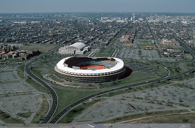
RFK Stadium, with Kingman Park visible above and to the right, at the time the new stadium controversy broke out in 1988.
Northeast (Washington, D.C.)
Northeast is the northeastern quadrant of Washington, D.C., the capital of the United States. It encompasses the area located north of East Capitol Street and east of North Capitol Street.
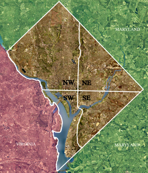
Color-enhanced 2002 USGS satellite image of Washington, D.C. The crosshairs in the image mark the quadrant divisions of Washington, D.C., with the United States Capitol at the center of the dividing lines. To the west of the Capitol is the National Mall, which is visible as a slight green band in the image. The Northwest quadrant is the largest, located north of the National Mall and west of North Capitol Street.
Gallaudet University
Trinity Washington University
Basilica of the National Shrine of the Immaculate Conception