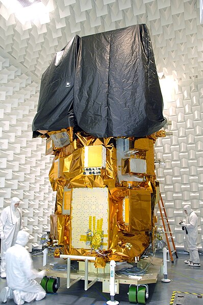
Landsat 8 is an American Earth observation satellite launched on 11 February 2013. It is the eighth satellite in the Landsat program; the seventh to reach orbit successfully. Originally called the Landsat Data Continuity Mission (LDCM), it is a collaboration between NASA and the United States Geological Survey (USGS). NASA Goddard Space Flight Center in Greenbelt, Maryland, provided development, mission systems engineering, and acquisition of the launch vehicle while the USGS provided for development of the ground systems and will conduct on-going mission operations. It comprises the camera of the Operational Land Imager (OLI) and the Thermal Infrared Sensor (TIRS), which can be used to study Earth surface temperature and is used to study global warming.
Landsat 8 during ground testing
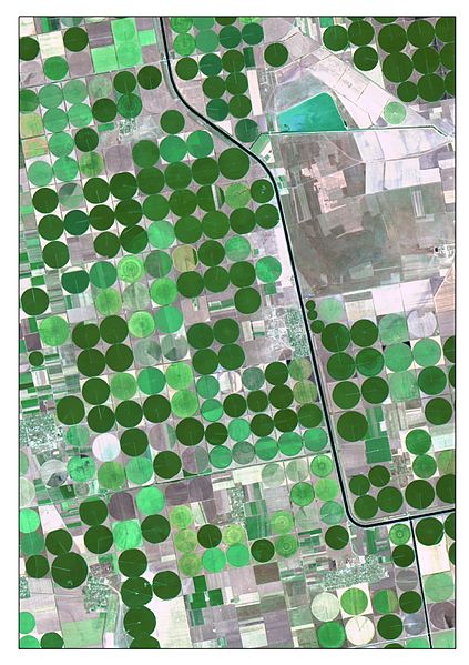
The picture is a satellite image of irrigated crops and Kahov irrigation canal. It was captured on 7 August 2015 by Landsat 8 (OLI). The image is created as a True Color Composite, where R – Red Band (0.64 - 0.67 μm), G – Green Band (0.53 - 0.59 μm) and B – Blue Band (0.45 - 0.51 μm). This band combination is suitable for crop monitoring. For emphasizing characteristics, the image was pan-sharpened by panchromatic band. Nonlinear adaptive procedure of contrasting was also applied.
Thermal Infrared Sensor Design
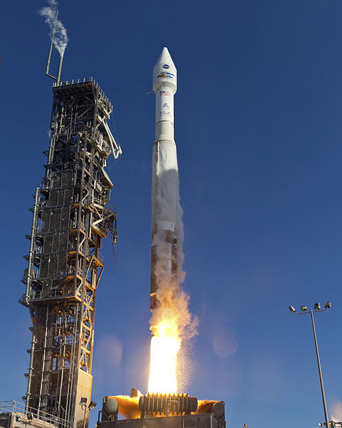
Landsat 8 launches atop an Atlas V.
The Landsat program is the longest-running enterprise for acquisition of satellite imagery of Earth. It is a joint NASA / USGS program. On 23 July 1972, the Earth Resources Technology Satellite was launched. This was eventually renamed to Landsat 1 in 1975. The most recent, Landsat 9, was launched on 27 September 2021.
Landsat 7, launched in 1999, is the 7th of 9 satellites in the Landsat program.
A false-color satellite image of Kolkata, India, from Landsat 7 in 2004, showing rivers, vegetated areas, and developed areas
The spectral band placement for each sensor of Landsat
One year after launch, Landsat 8 imagery had over one million file downloads by data users.


