The London Avenue Canal is a drainage canal in New Orleans, Louisiana, used for pumping rain water into Lake Pontchartrain. The canal runs through the 7th Ward of New Orleans from the Gentilly area to the Lakefront. It is one of the three main drainage canals responsible for draining rainwater from the main basin of New Orleans. The London Avenue Canal's flood walls built atop earthen levees breached on both sides during Hurricane Katrina in 2005.
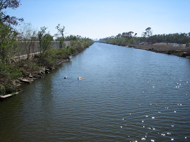
London Avenue Canal; view from Robert E. Lee Bridge looking riverwards, 19 October 2005. Intact concrete flood wall atop levee visible at left. At right, incompletely repaired upper breach visible.
Louisiana State Historic Plaque installed May 19, 2011. Vetted and fact checked by the Louisiana Office of Historic Preservation.
Lake Pontchartrain is an estuary located in southeastern Louisiana in the United States. It covers an area of 630 square miles (1,600 km2) with an average depth of 12 to 14 feet. Some shipping channels are kept deeper through dredging. It is roughly oval in shape, about 40 miles (64 km) from west to east and 24 miles (39 km) from south to north.
Sentinel-2 image
Lake Pontchartrain from southbound causeway entrance
Lake Pontchartrain's north shore at Fontainebleau State Park near Mandeville, Louisiana, in 2004
At the southern terminus of LA 1077 in Madisonville, this lighthouse is on the west estuary of the Tchefuncte River at Lake Pontchartrain and was constructed in 1837.