1.
Admiral
–
Admiral is the rank, or part of the name of the ranks, of the highest naval officers. It is usually abbreviated to Adm or ADM, in the Commonwealth and the U. S. a full admiral is equivalent to a full general in the army, and is above vice admiral and below admiral of the fleet. In NATO, admirals have a code of OF-9 as a four-star rank. The word admiral in Middle English comes from Anglo-French amiral, commander, from Medieval Latin admiralis and these themselves come from Arabic amīr, or amīr al-, commander of, as in amīr al-baḥr, commander of the sea. The term was in use for the Greco-Arab naval leaders of Norman Sicily, the Norman Roger II of Sicily, employed a Greek Christian known as George of Antioch, who previously had served as a naval commander for several North African Muslim rulers. Roger styled George in Abbasid fashion as Amir of Amirs, i. e. Commander of Commanders, the Sicilians and later Genoese took the first two parts of the term and used them as one word, amiral, from their Aragon opponents. The French and Spanish gave their sea commanders similar titles while in Portuguese the word changed to almirante, the word admiral has today come to be almost exclusively associated with the highest naval rank in most of the worlds navies, equivalent to the army rank of general. However, this wasnt always the case, for example, in some European countries prior to the end of World War II, admiral was the third highest naval rank after general admiral and grand admiral. The rank of admiral has also been subdivided into various grades, the Royal Navy used colours to indicate seniority of its admirals until 1864, for example, Horatio Nelsons highest rank was vice admiral of the white. The generic term for these naval equivalents of army generals is flag officer, some navies have also used army-type titles for them, such as the Cromwellian general at sea. Admiral is a German Navy OF-9 four-star flag officer rank, equivalent to the German Army, see also Post-WWII rank is Bakurocho or Chief of Staff, Joint Staff 幕僚長 with limited function as an advisory staff to Minister of Defense, compared to Gensui during 1872–1873 and 1898–1945. Admiral of Castile was a post with a long and important history in Spain
2.
Exploration
–
Exploration is the act of searching for the purpose of discovery of information or resources. Exploration occurs in all animal species, including humans. In human history, its most dramatic rise was during the Age of Discovery when European explorers sailed and charted much of the rest of the world for a variety of reasons. Since then, major explorations after the Age of Discovery have occurred for reasons mostly aimed at information discovery, in scientific research, exploration is one of three purposes of empirical research. The term is used metaphorically. For example, an individual may speak of exploring the Internet, sexuality, the Phoenicians traded throughout the Mediterranean Sea and Asia Minor though many of their routes are still unknown today. The presence of tin in some Phoenician artifacts suggests that they may have traveled to Britain, according to Virgils Aeneid and other ancient sources, the legendary Queen Dido was a Phoenician from Tyre who sailed to North Africa and founded the city of Carthage. Hanno the Navigator, a Carthaginean navigator explored the Western Coast of Africa, the Greek explorer from Marseille, Pytheas was the first to circumnavigate Great Britain, explore Germany, and reach Thule. Africa Exploration The Romans organized expeditions to cross the Sahara desert with five different routes, through the western Sahara, toward the Niger river, through the Tibesti mountains, toward Lake Chad and actual Nigeria through the Nile river, toward actual Uganda. Though the western coast of Africa, toward the Canary Islands, through the Red Sea, toward actual Somalia and perhaps Tanzania. All these expeditions were supported by legionaries and had mainly a commercial purpose, only the one done by emperor Nero seemed to be a preparative for the conquest of Ethiopia or Nubia, in 62 AD two legionaries explored the sources of the Nile river. One of the reasons of the explorations was to get gold using the camel to transport it. The explorations near the African western and eastern coasts were supported by Roman ships, Romans organized several explorations also in Northern Europe, and as far as Asia up to China. 30 BC-640 AD With the acquisition of Ptolemaic Egypt, The Romans begin trading with India, the Empire now has a direct connection to the Spice trade Egypt had established beginning in 118 BC.100 AD-166 AD Romano-Chinese relations begin. Ptolemy writes of the Golden Chersonese and the port of Kattigara, now identified as Óc Eo in northern Vietnam, then part of Jiaozhou. The Chinese historical texts describe Roman embassies, from a land they called Daqin, 2nd century Roman traders reach Siam, Cambodia, Sumatra, and Java. 161 An embassy from Roman Emperor Antoninus Pius or his successor Marcus Aurelius reaches Chinese Emperor Huan of Han at Luoyang, when Zhang returned to China in 125 BC, he reported on his visits to Dayuan, Kangju, and Daxia. Zhang described Dayuan and Daxia as agricultural and urban countries like China, from about 800 Ad to 1040 AD, the Vikings explored Europe and much of the Western Northern Hemisphere via rivers and oceans
3.
James Cook
–
Captain James Cook FRS RN was a British explorer, navigator, cartographer, and captain in the Royal Navy. Cook joined the British merchant navy as a teenager and joined the Royal Navy in 1755 and he saw action in the Seven Years War, and subsequently surveyed and mapped much of the entrance to the Saint Lawrence River during the siege of Quebec. This helped bring Cook to the attention of the Admiralty and Royal Society, in three voyages Cook sailed thousands of miles across largely uncharted areas of the globe. He mapped lands from New Zealand to Hawaii in the Pacific Ocean in greater detail, as he progressed on his voyages of discovery he surveyed and named features, and recorded islands and coastlines on European maps for the first time. He displayed a combination of seamanship, superior surveying and cartographic skills, physical courage, Cook was attacked and killed while attempting to kidnap the native chief of Hawaii during his third exploratory voyage in the Pacific in 1779. He left a legacy of scientific and geographical knowledge which was to influence his successors well into the 20th century, and numerous memorials worldwide have been dedicated to him. James Cook was born on 7 November 1728 in the village of Marton in Yorkshire and baptised on 14 November in the church of St Cuthbert. He was the second of eight children of James Cook, a Scottish farm labourer from Ednam in Roxburghshire, in 1736, his family moved to Airey Holme farm at Great Ayton, where his fathers employer, Thomas Skottowe, paid for him to attend the local school. In 1741, after five years schooling, he work for his father. For leisure, he would climb a hill, Roseberry Topping, enjoying the opportunity for solitude. Cooks Cottage, his parents last home, which he is likely to have visited, is now in Melbourne, having moved from England and reassembled, brick by brick. In 1745, when he was 16, Cook moved 20 miles to the village of Staithes. Historians have speculated that this is where Cook first felt the lure of the sea while gazing out of the shop window. After 18 months, not proving suitable for work, Cook travelled to the nearby port town of Whitby to be introduced to friends of Sandersons, John. The Walkers, who were Quakers, were prominent local ship-owners in the coal trade and their house is now the Captain Cook Memorial Museum. Cook was taken on as a merchant navy apprentice in their fleet of vessels. His first assignment was aboard the collier Freelove, and he spent several years on this and various other coasters, sailing between the Tyne and London. As part of his apprenticeship, Cook applied himself to the study of algebra, geometry, trigonometry, navigation and his three-year apprenticeship completed, Cook began working on trading ships in the Baltic Sea
4.
Seven Years' War
–
The Seven Years War was a war fought between 1754 and 1763, the main conflict occurring in the seven-year period from 1756 to 1763. It involved every European great power of the time except the Ottoman Empire and spanned five continents, affecting Europe, the Americas, West Africa, India, and the Philippines. The conflict split Europe into two coalitions, led by the Kingdom of Great Britain on one side and the Kingdom of France on the other. Meanwhile, in India, the Mughal Empire, with the support of the French, faced with this sudden turn of events, Britain aligned herself with Prussia, in a series of political manoeuvres known as the Diplomatic Revolution. Conflict between Great Britain and France broke out in 1754–1756 when the British attacked disputed French positions in North America, meanwhile, rising power Prussia was struggling with Austria for dominance within and outside the Holy Roman Empire in central Europe. In 1756, the major powers switched partners, realizing that war was imminent, Prussia preemptively struck Saxony and quickly overran it. The result caused uproar across Europe, because of Austrias alliance with France to recapture Silesia, which had been lost in a previous war, Prussia formed an alliance with Britain. Reluctantly, by following the diet, most of the states of the empire joined Austrias cause. The Anglo-Prussian alliance was joined by smaller German states, Sweden, seeking to re-gain Pomerania joined the coalition, seeing its chance when virtually all of Europe opposed Prussia. Spain, bound by the Pacte de Famille, intervened on behalf of France, the Russian Empire was originally aligned with Austria, fearing Prussias ambition on the Polish–Lithuanian Commonwealth, but switched sides upon the succession of Tsar Peter III in 1762. Naples, Sicily, and Savoy, although sided with the Franco-Spanish alliance, like Sweden, Russia concluded a separate peace with Prussia. The war ended with the Treaty of Paris between France, Spain and Great Britain and the Treaty of Hubertusburg between Saxony, Austria and Prussia, in 1763. The Native American tribes were excluded from the settlement, a subsequent conflict, Prussia emerged as a new European great power. Although Austria failed to retrieve the territory of Silesia from Prussia its military prowess was noted by the other powers. The involvement of Portugal, Spain and Sweden did not return them to their status as great powers. France was deprived of many of its colonies and had saddled itself with heavy war debts that its inefficient financial system could barely handle. Spain lost Florida but gained French Louisiana and regained control of its colonies, e. g. Cuba and the Philippines, France and Spain avenged their defeat in 1778 when the American Revolutionary War broke out, with hopes of destroying Britains dominance once and for all. The Seven Years War was perhaps the first true world war, having taken place almost 160 years before World War I and it was characterized in Europe by sieges and the arson of towns as well as open battles with heavy losses
5.
American Revolutionary War
–
From about 1765 the American Revolution had led to increasing philosophical and political differences between Great Britain and its American colonies. The war represented a culmination of these differences in armed conflict between Patriots and the authority which they increasingly resisted. This resistance became particularly widespread in the New England Colonies, especially in the Province of Massachusetts Bay. On December 16,1773, Massachusetts members of the Patriot group Sons of Liberty destroyed a shipment of tea in Boston Harbor in an event that became known as the Boston Tea Party. Named the Coercive Acts by Parliament, these became known as the Intolerable Acts in America. The Massachusetts colonists responded with the Suffolk Resolves, establishing a government that removed control of the province from the Crown outside of Boston. Twelve colonies formed a Continental Congress to coordinate their resistance, and established committees, British attempts to seize the munitions of Massachusetts colonists in April 1775 led to the first open combat between Crown forces and Massachusetts militia, the Battles of Lexington and Concord. Militia forces proceeded to besiege the British forces in Boston, forcing them to evacuate the city in March 1776, the Continental Congress appointed George Washington to take command of the militia. Concurrent to the Boston campaign, an American attempt to invade Quebec, on July 2,1776, the Continental Congress formally voted for independence, issuing its Declaration on July 4. Sir William Howe began a British counterattack, focussing on recapturing New York City, Howe outmaneuvered and defeated Washington, leaving American confidence at a low ebb. Washington captured a Hessian force at Trenton and drove the British out of New Jersey, in 1777 the British sent a new army under John Burgoyne to move south from Canada and to isolate the New England colonies. However, instead of assisting Burgoyne, Howe took his army on a campaign against the revolutionary capital of Philadelphia. Burgoyne outran his supplies, was surrounded and surrendered at Saratoga in October 1777, the British defeat in the Saratoga Campaign had drastic consequences. Giving up on the North, the British decided to salvage their former colonies in the South, British forces under Lieutenant-General Charles Cornwallis seized Georgia and South Carolina, capturing an American army at Charleston, South Carolina. British strategy depended upon an uprising of large numbers of armed Loyalists, in 1779 Spain joined the war as an ally of France under the Pacte de Famille, intending to capture Gibraltar and British colonies in the Caribbean. Britain declared war on the Dutch Republic in December 1780, in 1781, after the British and their allies had suffered two decisive defeats at Kings Mountain and Cowpens, Cornwallis retreated to Virginia, intending on evacuation. A decisive French naval victory in September deprived the British of an escape route, a joint Franco-American army led by Count Rochambeau and Washington, laid siege to the British forces at Yorktown. With no sign of relief and the situation untenable, Cornwallis surrendered in October 1781, Whigs in Britain had long opposed the pro-war Tory majority in Parliament, but the defeat at Yorktown gave the Whigs the upper hand
6.
Falkland Islands
–
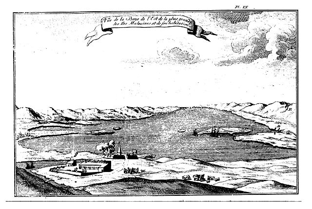
The Falkland Islands are an archipelago in the South Atlantic Ocean on the Patagonian Shelf. The principal islands are about 300 miles east of South Americas southern Patagonian coast, the archipelago, with an area of 4,700 square miles, comprises East Falkland, West Falkland and 776 smaller islands. As a British overseas territory, the Falklands have internal self-governance, the islands capital is Stanley on East Falkland. Controversy exists over the Falklands discovery and subsequent colonisation by Europeans, at various times, the islands have had French, British, Spanish, and Argentine settlements. Britain reasserted its rule in 1833, although Argentina maintains its claim to the islands, in April 1982, Argentine forces temporarily occupied the islands. British administration was restored two months later at the end of the Falklands War, most Falklanders favour the archipelago remaining a UK overseas territory, but its sovereignty status is part of an ongoing dispute between Argentina and the United Kingdom. The population primarily consists of native-born Falkland Islanders, the majority of British descent, other ethnicities include French, Gibraltarian and Scandinavian. Immigration from the United Kingdom, the South Atlantic island of Saint Helena, under the British Nationality Act 1983, Falkland Islanders are British citizens. The islands lie on the boundary of the oceanic and tundra climate zones. They are home to bird populations, although many no longer breed on the main islands because of competition from introduced species. Major economic activities include fishing, tourism and sheep farming, with an emphasis on high-quality wool exports, oil exploration, licensed by the Falkland Islands Government, remains controversial as a result of maritime disputes with Argentina. The Falkland Islands take their name from the Falkland Sound, a strait separating the two main islands. The name Falkland was applied to the channel by John Strong, Strong named the strait in honour of Anthony Cary, 5th Viscount of Falkland, the Treasurer of the Navy who sponsored their journey. The name Falklands was not applied to the islands until 1765, the term Falklands is a standard abbreviation used to refer to the islands. The Spanish name for the archipelago, Islas Malvinas, derives from the French Îles Malouines — the name given to the islands by French explorer Louis-Antoine de Bougainville in 1764, Bougainville, who founded the islands first settlement, named the area after the port of Saint-Malo. The port, located in the Brittany region of western France, was in turn named after St. Malo, in Spanish, the territory was designated as Islas Malvinas. The nomenclature used by the United Nations for statistical processing purposes is Falkland Islands, although Fuegians from Patagonia may have visited the Falkland Islands in prehistoric times, the islands were uninhabited at the time of their discovery by Europeans. Claims of discovery date back to the 16th century, but no consensus exists on whether these early explorers discovered the Falklands or other islands in the South Atlantic, whether or not the settlements were aware of each others existence is debated by historians
7.
Bougainville Island
–
Bougainville Island is the main island of the Autonomous Region of Bougainville of Papua New Guinea. This region is known as Bougainville Province or the North Solomons. Its land area is 9,300 km2, the population of the province is 175,160, which includes the adjacent island of Buka and assorted outlying islands including the Carterets. Mount Balbi at 2,700 m is the highest point, although Bougainville Island is geographically part of the Solomon Islands archipelago, it is not a part of the state of Solomon Islands. Bougainville was first settled some 28,000 years ago, Three to four thousand years ago, Austronesian people arrived, bringing with them domesticated pigs, chickens, dogs and obsidian tools. The first European contact with Bougainville was in 1768, when the French explorer Louis de Bougainville arrived and named the island for himself. Germany laid claim to Bougainville in 1899, annexing it into German New Guinea, Christian missionaries arrived on the island in 1902. During World War I, Australia occupied German New Guinea, including Bougainville and it became part of the Australian Territory of New Guinea under a League of Nations mandate in 1920. In 1942, during World War II, Japan invaded the island, following the war, the Territory of New Guinea, including Bougainville, returned to Australian control. On 9 September 1975, the Parliament of Australia passed the Papua New Guinea Independence Act 1975, the Act set 16 September 1975 as date of independence and terminated all remaining sovereign and legislative powers of Australia over the territory. Bougainville was to part of an independent Papua New Guinea, however, on 11 September 1975, in a failed bid for self-determination. The republic failed to any international recognition, and a settlement was reached in August 1976. Bougainville was then absorbed politically into Papua New Guinea with increased self-governance powers, between 1988 and 1998, civil war on the island claimed over 15,000 lives. The Peace talks brokered by New Zealand began in 1997, leading to autonomy for the island, a multinational Peace Monitoring Group under Australian leadership was deployed. In 2001, a agreement was signed including promise of a referendum on independence from PNG. Bougainville is the largest island in the Solomon Islands archipelago and it is part of the Solomon Islands rain forests ecoregion. Bougainville and the island of Buka are a single landmass separated by a deep 300-metre-wide strait. The island is 9000 square kilometres, and there are several active, mount Bagana in the north central part of Bougainville is conspicuously active, spewing out smoke that is visible many kilometres distant
8.
Papua New Guinea
–
Its capital, located along its southeastern coast, is Port Moresby. The western half of New Guinea forms the Indonesian provinces of Papua, Papua New Guinea is one of the most culturally diverse countries in the world. There are 852 known languages in the country, of which 12 have no known living speakers, most of the population of more than 7 million people live in customary communities, which are as diverse as the languages. It is also one of the most rural, as only 18 percent of its live in urban centres. The country is one of the worlds least explored, culturally and geographically and it is known to have numerous groups of uncontacted peoples, and researchers believe there are many undiscovered species of plants and animals in the interior. Papua New Guinea is classified as an economy by the International Monetary Fund. Strong growth in Papua New Guineas mining and resource sector led to the becoming the sixth fastest-growing economy in the world in 2011. Growth was expected to slow once major resource projects came on line in 2015, mining remains a major economic factor, however. Local and national governments are discussing the potential of resuming mining operations in Panguna mine in Bougainville Province, nearly 40 percent of the population lives a self-sustainable natural lifestyle with no access to global capital. Most of the still live in strong traditional social groups based on farming. Their social lives combine traditional religion with modern practices, including primary education, at the national level, after being ruled by three external powers since 1884, Papua New Guinea established its sovereignty in 1975. This followed nearly 60 years of Australian administration, which started during the Great War and it became an independent Commonwealth realm with Queen Elizabeth II as its head of state and became a member of the Commonwealth of Nations in its own right. Archaeological evidence indicates that humans first arrived in Papua New Guinea around 42,000 to 45,000 years ago and they were descendants of migrants out of Africa, in one of the early waves of human migration. Agriculture was independently developed in the New Guinea highlands around 7000 BC, a major migration of Austronesian-speaking peoples to coastal regions of New Guinea took place around 500 BC. This has been correlated with the introduction of pottery, pigs, in the 18th century, traders brought the sweet potato to New Guinea, where it was adopted and became part of the staples. Portuguese traders had obtained it from South America and introduced it to the Moluccas, the far higher crop yields from sweet potato gardens radically transformed traditional agriculture and societies. Sweet potato largely supplanted the previous staple, taro, and resulted in a significant increase in population in the highlands. In 1901, on Goaribari Island in the Gulf of Papua, missionary Harry Dauncey found 10,000 skulls in the islands Long Houses, traders from Southeast Asia had visited New Guinea beginning 5,000 years ago to collect bird of paradise plumes
9.
Musketeer
–
A musketeer was a type of soldier equipped with a musket. Musketeers were an important part of modern armies, particularly in Europe. The musketeer was a precursor to the rifleman, muskets were replaced by rifles in most western armies during the mid-1850s. The traditional designation of musketeer for an infantry private survived in the Imperial German Army until World War I, muskets were used in China at least from the 14th century and musketeers were utilized in the Ming and Qing dynasties. There was also illustration and description of how the Chinese had adopted the Ottoman kneeling position in firing while favoring European-made muskets. The Chinese also built the first repeating fire-arm, several barrels behind a wooden shield. These weapons were most effective being fired from walls or high positions, needham considered this weapon to be a primitive machine-gun. The famous Janissary corps of the Ottoman army were using matchlock muskets as early as the 1440s, the Ottoman Empire, centering on Turkey and extending into Arabia, used muskets to conquer Constantinople and were one of the earliest users of muskets in a military conflict. It also utilized large cannons, the Great Turkish Bombard and incendiary devices and they are also probably the first to use muskets aboard ships. Musket warfare became a part of Indian warfare when they were introduced to India by the Moghuls. They were an important defense against the tank-like War Elephants, both the Mughals and Indians used musketeers in cover formations while sending volleys of musket fire on unsuspecting soldiers, horses, and elephants. Many Indian gunsmiths existed during the 17th and 18th centuries, creating regular muskets and it was nigh on invincible in its era, capitalizing on the brute strength and close-range abilities of the pikemen and the long-range projectile capabilities of the muskets. In practice, it appeared as a loosely formed phalanx in function, Streltsy were the units of Russian guardsmen from the 16th to the early 18th centuries, armed with firearms and halberds. They are also known as Strelets Troops. The first streltsy units were created by Ivan the Terrible sometime between 1545 and 1550 and armed with the arquebus and they first saw combat at the Siege of Kazan in 1552. Military service in this unit became lifelong and hereditary, the bearded strelsty were organized into regiments, each with a long coat and pointed cloth hat of a distinctive colour. By 1680 there were 20 regiments of Moscow streltsy totaling 20,048 men, in addition there were significant numbers of frontier and garrison streltsy serving outside Moscow, although these were less formally drilled and equipped. The Muscovite government was short of cash so that the streltsy were often not paid well
10.
Integral
–
In mathematics, an integral assigns numbers to functions in a way that can describe displacement, area, volume, and other concepts that arise by combining infinitesimal data. Integration is one of the two operations of calculus, with its inverse, differentiation, being the other. The area above the x-axis adds to the total and that below the x-axis subtracts from the total, roughly speaking, the operation of integration is the reverse of differentiation. For this reason, the integral may also refer to the related notion of the antiderivative. In this case, it is called an integral and is written. The integrals discussed in this article are those termed definite integrals, a rigorous mathematical definition of the integral was given by Bernhard Riemann. It is based on a procedure which approximates the area of a curvilinear region by breaking the region into thin vertical slabs. A line integral is defined for functions of two or three variables, and the interval of integration is replaced by a curve connecting two points on the plane or in the space. In a surface integral, the curve is replaced by a piece of a surface in the three-dimensional space and this method was further developed and employed by Archimedes in the 3rd century BC and used to calculate areas for parabolas and an approximation to the area of a circle. A similar method was developed in China around the 3rd century AD by Liu Hui. This method was used in the 5th century by Chinese father-and-son mathematicians Zu Chongzhi. The next significant advances in integral calculus did not begin to appear until the 17th century, further steps were made in the early 17th century by Barrow and Torricelli, who provided the first hints of a connection between integration and differentiation. Barrow provided the first proof of the theorem of calculus. Wallis generalized Cavalieris method, computing integrals of x to a power, including negative powers. The major advance in integration came in the 17th century with the independent discovery of the theorem of calculus by Newton. The theorem demonstrates a connection between integration and differentiation and this connection, combined with the comparative ease of differentiation, can be exploited to calculate integrals. In particular, the theorem of calculus allows one to solve a much broader class of problems. Equal in importance is the mathematical framework that both Newton and Leibniz developed
11.
Royal Society
–
Founded in November 1660, it was granted a royal charter by King Charles II as The Royal Society. The society is governed by its Council, which is chaired by the Societys President, according to a set of statutes and standing orders. The members of Council and the President are elected from and by its Fellows, the members of the society. As of 2016, there are about 1,600 fellows, allowed to use the postnominal title FRS, there are also royal fellows, honorary fellows and foreign members, the last of which are allowed to use the postnominal title ForMemRS. The Royal Society President is Venkatraman Ramakrishnan, who took up the post on 30 November 2015, since 1967, the society has been based at 6–9 Carlton House Terrace, a Grade I listed building in central London which was previously used by the Embassy of Germany, London. The Royal Society started from groups of physicians and natural philosophers, meeting at variety of locations and they were influenced by the new science, as promoted by Francis Bacon in his New Atlantis, from approximately 1645 onwards. A group known as The Philosophical Society of Oxford was run under a set of rules still retained by the Bodleian Library, after the English Restoration, there were regular meetings at Gresham College. It is widely held that these groups were the inspiration for the foundation of the Royal Society, I will not say, that Mr Oldenburg did rather inspire the French to follow the English, or, at least, did help them, and hinder us. But tis well known who were the men that began and promoted that design. This initial royal favour has continued and, since then, every monarch has been the patron of the society, the societys early meetings included experiments performed first by Hooke and then by Denis Papin, who was appointed in 1684. These experiments varied in their area, and were both important in some cases and trivial in others. The Society returned to Gresham in 1673, there had been an attempt in 1667 to establish a permanent college for the society. Michael Hunter argues that this was influenced by Solomons House in Bacons New Atlantis and, to a lesser extent, by J. V. The first proposal was given by John Evelyn to Robert Boyle in a letter dated 3 September 1659, he suggested a scheme, with apartments for members. The societys ideas were simpler and only included residences for a handful of staff and these plans were progressing by November 1667, but never came to anything, given the lack of contributions from members and the unrealised—perhaps unrealistic—aspirations of the society. During the 18th century, the gusto that had characterised the early years of the society faded, with a number of scientific greats compared to other periods. The pointed lightning conductor had been invented by Benjamin Franklin in 1749, during the same time period, it became customary to appoint society fellows to serve on government committees where science was concerned, something that still continues. The 18th century featured remedies to many of the early problems
12.
France in the Seven Years' War
–
France was one of the leading participants in the Seven Years War which lasted between 1754 and 1763. France entered the war with the hope of achieving a victory against Prussia, Britain and their German allies. While the first few years of war proved successful for the French, in 1759 the situation reversed, in an effort to reverse their losses, France concluded an alliance with their neighbor, Spain, in 1761. In spite of this the French continued to suffer defeats throughout 1762 eventually forcing them to sue for peace, the 1763 Treaty of Paris confirmed the loss of French possessions in North America and Asia to the British. France also finished the war with very heavy debts, which struggled to repay for the remainder of the 18th century. The previous major conflict in Europe, the War of the Austrian Succession, France and Britain were engaged in an intensifying global rivalry after they superseded Spain as the leading colonial powers. Hoping to establish supremacy, both engaged in several minor wars in North America. French colonies in Louisiana, Illinois, and Canada had largely surrounded British colonies strung out in a strip along the coast. All the French needed to totally envelop the British was control of the Ohio Country, attempting to gain control of this territory, France built a complex system of alliances with the areas Native American tribes and brought them into conflict with Britain. In the mid-18th century, France was a monarchy, all power resided with the King. Louis XV was a weak personality easily manipulated by his advisors, chief amongst them was Madame Pompadour, his mistress who exercised enormous influence over appointments and matters of grand strategy. Other advisors rose and fell with rapid succession, continuing the lack of the stability which had plagued the monarchy in the early 18th century, while the war began in North America, in 1756 France became drawn into a major war in Europe. Allied to Austria, Sweden and Russia the French tried to defeat the Prussians who had only the British as major allies, despite repeated attempts between 1757 and 1762, the French and their allies failed to win the conclusive victory against Prussia despite a constant war of attrition. They were partly frustrated by a led by the Duke of Brunswick made up of British forces. France had opened the war against Britain in Europe by capturing Minorca, the British navy, however, had initiated a tight blockade of the French coast which prevented supplies and troops moving freely and sapped morale. He oversaw the construction of a fleet of transports to convey the troops during 1759. Defeats of the French navy at Lagos and Quiberon Bay put an end to these plans, a diversionary force under François Thurot had managed to land in Northern Ireland before he was hunted down and killed by the British navy. In the wake of the disaster at Quiberon, Thurot was lionised as a hero in France
13.
Aide-de-camp
–
An aide-de-camp is a personal assistant or secretary to a person of high rank, usually a senior military, police or government officer, a member of a royal family, or a head of state. This is not to be confused with an adjutant, who is the administrator of a military unit. The first aide-de-camp is typically the foremost personal aide, in some countries, the aide-de-camp is considered to be a title of honour, and participates at ceremonial functions. The badge of office for an aide-de-camp is usually the aiguillette, whether it is worn on the left or the right shoulder is dictated by protocol. A controversy was raised in 2006, when president Néstor Kirchner decided to promote his army aide-de-camp, Lieutenant Colonel Graham to colonel, upon taking office, former president Cristina Kirchner decided to have, for the first time, female officers as her aides-de-camp. In each of the forces, the chief of staff and other senior officers have their own adjutants, normally of the rank of major or lieutenant colonel. An aiguillette is worn on the shoulder by aides-de-camp and adjutants as a symbol of their position. In Belgium the title of Honorary Aide-de-camp to the King can be granted by the court for services rendered. Notable people include Major General Baron Édouard Empain, Count Charles John dOultremont, generals being field marshals, have four, lieutenant generals two, major generals one”. In British colonies and modern-day British overseas territories, the aide-de-camp is appointed to serve the governor, in 1973, the Governor of Bermuda, Sir Richard Sharples, and his aide-de-camp, Captain Hugh Sayers, were murdered on the grounds of Government House. On the last day of British rule in Hong Kong on 30 June 1997 and he then gave the Vice Regal Salute before proceeding, with the Pattens, to leave Government House for the last time. Prince Charles is a personal aide-de-camp to Queen Elizabeth II, Honorary aides-de-camp to the Governor-General or state governors are entitled to the post-nominal ADC during their appointment. Officers of and above the ranks of admiral, major general. Within the navy, an aide-de-camp is called a flag lieutenant, aides-de-camp in Canada are appointed to the Queen and some members of the royal family, the governor general, lieutenant governors, and to certain other appointments. All aides-de-camp also wear the cypher or badge of the principal to whom they are appointed, aides-de-camp to the governor general wear the governor generals badge and aides-de-camp to a lieutenant governor wear the lieutenant governors badge. They are appointed officers of the Canadian Forces. In certain instances, civilians may be appointed, non-uniformed civilians do not wear the aiguillette, but do wear their lieutenant governors badge as a symbol of their appointment. Aides-de-camp to royal and vice-regal personages wear the aiguillette on the right shoulder, aides-de-camp to all others wear their aiguillette on the left shoulder
14.
Louis-Joseph de Montcalm
–
Louis-Joseph de Montcalm-Gozon, Marquis de Saint-Veran was a French soldier best known as the commander of the forces in North America during the Seven Years War. Montcalm was born near Nîmes in France to a noble family and he saw service in the War of the Polish Succession and the War of the Austrian Succession, where his distinguished service led to promotion to brigadier general. In 1756 King Louis XV sent him to New France to lead its defence against the British in the Seven Years War, montcalms service in New France was marked by conflict between himself and the Governor General of the colony, Pierre de Rigaud, Marquis de Vaudreuil-Cavagnial. These men were the leaders of the war effort in New France during the Seven Years War, Montcalm is a controversial figure among military historians, some of whom have strongly criticized his decisions at Quebec. But he has also been memorialized, especially in France, Quebec. He joined the French Army in 1721 as an ensign in the Régiment dHainault, on the death of his father in 1735, he became the Marquis de Saint-Veran, inheriting the honours, rights, and debts of that position. His finances improved soon after by his marriage to Angelique Louise Talon du Boulay, despite a marriage arranged for money and influence, they were a devoted couple. They made their home at Candiac and had a number of children of whom five survived to adulthood. His father purchased a captaincy for him in 1729 and he served in the War of Polish Succession, seeing action at the 1733 Siege of Kehl, Montcalm and the Chevalier de Lévis were both in the Siege of Prague. He was promoted to Colonel of the Régiment dAuxerrois in 1743 and he was released on parole after several months imprisonment, and promoted to Brigadier for his actions during the 1746 campaign. After prisoner exchanges made possible his return to service, he joined the Italian campaign again in 1747. He was wounded again by a ball in the Battle of Assietta. When Marshal Belle-Isle retired that winter, his army was left under the command of its brigadiers, the war came to an end in 1748 with the signing of the Treaty of Aix-la-Chapelle. In 1749 he was awarded an opportunity to raise a new regiment in peacetime. Upon Montcalm’s arrival in Montreal, he was immediately apprised of the situation along the border with British North America, when Montcalm arrived back at Fort Frontenac, he found a force of 3500 men assembled, being regular French troops, Canadian militia, and Native Americans. On August 9, the crossed the lake and rapidly besieged the English fort. By the morning of August 13, the French had set up nine cannons, the English commander was killed during the offensive, and the fort was quickly surrendered soon thereafter. 1700 prisoners were taken, including 80 officers, as well as money, military correspondence, food provisions, guns, and boats, and the fort burnt and razed to the ground
15.
Battle of Fort Oswego (1756)
–
The Battle of Fort Oswego was one in a series of early French victories in the North American theatre of the Seven Years War won in spite of New Frances military vulnerability. In addition to 1,700 prisoners, Montcalms force seized the forts 121 cannons, the fall of Fort Oswego effectively interrupted the British presence on Lake Ontario and removed it as a threat to the nearby French-controlled Fort Frontenac. The battle was notable for demonstrating that traditional European siege tactics were viable in North America when applied properly in the right circumstances, part of the British plans for 1755 included an expedition to take Fort Niagara at the western end of Lake Ontario. The planned route for this expedition followed the Oswego River to the lake, the planned expedition to Fort Niagara never took place due to logistical difficulties, and the fortifications around Oswego were manned during the winter of 1755–56. The French in 1755 had the large naval vessels on Lake Ontario. In March 1756 they launched an attack on Fort Bull on Wood Creek. Fort Bull was a key depot on the line for the Oswego forts. In the successful attack, they destroyed many provisions intended for the Oswego garrison, general Louis-Joseph de Montcalm arrived in Montreal in May 1756 to lead the French army troops. He and Governor Vaudreuil took a dislike to one another. Concerned over the massing of British troops at the end of Lake George. Vaudreuil meanwhile began massing troops at Fort Frontenac for an assault on Oswego. Following favorable reports from the parties, Montcalm and Vaudreuil decided to make the attempt. Governor Shirley received word in March 1756 that he was to be replaced by John Campbell, Shirley also hired 2,000 armed battoemen, men experienced in sailing and shipbuilding. When Loudoun arrived in Albany in late July, he immediately cancelled Shirleys plans for an Oswego-based expedition, the complex of defenses at Oswego consisted of three separate forts. On the east side of the Oswego River lay Fort Ontario and it was garrisoned by 370 men from Pepperrells Regiment, and was in fairly good repair. Fort Oswego was on the west side of the river, and had a structure of stone and clay surrounded by earthworks to the south and west. A recently constructed Fort George consisted of a wooden palisade fort that lacked even loopholes through which defenders could fire. The latter two forts did not have very much shelter for the garrison, and there were only a few cannon for the entire complex of defenses
16.
Siege of Fort William Henry
–
The Siege of Fort William Henry was conducted in August 1757 by French General Louis-Joseph de Montcalm against the British-held Fort William Henry. After several days of bombardment, Monro surrendered to Montcalm, whose force included nearly 2,000 Indians from a number of tribes. The terms of surrender included the withdrawal of the garrison to Fort Edward and they killed and scalped many soldiers, took as captives women, children, servants, and slaves, and slaughtered sick and wounded prisoners. Early accounts of the events called it a massacre, and implied that as many as 1,500 people were killed, the memory of the killings influenced the actions of British military leaders, especially those of British General Jeffery Amherst, for the remainder of the war. The French and Indian War started in 1754 over territorial disputes between the North American colonies of France and Great Britain in areas that are now western Pennsylvania, the first few years of the war had not gone particularly well for the British. A major expedition by General Edward Braddock in 1755 ended in disaster, in a major setback, a French and Indian army led by General Louis-Joseph de Montcalm captured the garrison and destroyed fortifications in the Battle of Fort Oswego in August 1756. In July 1756 the Earl of Loudoun arrived to command of the British forces in North America, replacing William Shirley. Loudouns plan for the 1757 campaign was submitted to the government in London in September 1756, and was focused on an expedition aimed at the heart of New France. It called for a purely defensive postures along the frontier with New France, including the corridor of the Hudson River. The area between William Henry and Carillon was a wilderness dominated by Lake George that historian Ian Steele described as a waterway that left opposing cannons only a few days apart. Loudoun consequently did not receive any feedback from London on his campaign until March 1757. When William Pitts instructions finally reached Loudoun in March 1757, they called for the expedition to first target Louisbourg on the Atlantic coast of Île Royale, although this did not materially affect the planning of the expedition, it was to have significant consequences on the frontier. The French forces on the Saint Lawrence would be too far from Louisbourg to support it, Loudoun assigned his best troops to the Louisbourg expedition, and placed Brigadier General Daniel Webb in command of the New York frontier. He was given about 2,000 regulars, primarily from the 35th and 60th Regiments, the provinces were to supply Webb with about 5,000 militia. He was initially hesitant to commit his limited resources against Fort William Henry without knowing more about the disposition of British forces, intelligence provided by spies in London arrived in the spring, indicating that the British target was probably Louisbourg. This suggested that troop levels on the British side of the frontier might be low enough to make an attack on Fort William Henry feasible. As early as December 1756, New Frances governor, the Marquis de Vaudreuil, fueled by stories circulated by Indian participants in the capture of Oswego, this drive was highly successful, drawing nearly 1,000 warriors from the Pays den Haut to Montreal by June 1757. Another 800 Indians were recruited from tribes that lived closer to the Saint Lawrence and its walls were 30 feet thick, with log facings surrounding an earthen filling
17.
Battle of Carillon
–
The Battle of Carillon, also known as the 1758 Battle of Ticonderoga, was fought on July 8,1758, during the French and Indian War. It was fought near Fort Carillon on the shore of Lake Champlain in the area between the British colony of New York and the French colony of New France. The battle was the bloodiest of the war, with over 3,000 casualties suffered, French losses were about 400, while more than 2,000 were British. Many military historians have cited the Battle of Carillon as a example of tactical military incompetence. Abercrombie, confident of a victory, ignored several viable military options, such as flanking the French breastworks, waiting for his artillery. Montcalm, while concerned about the military position of the fort. The fort, abandoned by its garrison, was captured by the British the following year and this battle gave the fort a reputation for impregnability that had an effect on future military operations in the area. Despite several large-scale military movements through the area, in both the French and Indian War and the American Revolutionary War, this was the major battle fought near the forts location. The fort was sited with Lake Champlain to the east, with Mount Independence rising on the far side, immediately to the south of the fort lay the mouth of the La Chute River, which drains Lake George. The river was largely non-navigable, and there was a trail from the northern end of Lake George to the location of a sawmill the French had built to assist in the forts construction. The trail crossed the La Chute twice, once about 2 miles from Lake George, and again at the sawmill, to the north of the fort was a road going to Fort St. Frédéric. To the west was a low rise of land, beyond which lay Mount Hope, a rise that commanded part of the portage trail, but was too far from the fort to pose it any danger. The most serious defect in the forts location was Mount Defiance. This 900 foot hill, which was steep and densely forested, provided an excellent firing position for cannon aimed at the fort. Nicolas Sarrebource de Pontleroy, Montcalms chief engineer, said of the site, Were I to be entrusted with the siege of it, I should require only six mortars. Prior to 1758, the French and Indian War had gone very poorly for the British, whose military met few of its objectives. Embarking on a strategy that emphasized defense in Europe, where France was strong, and offense in North America, large-scale campaigns were planned to capture Fort Duquesne on the Pennsylvania frontier and the fortress at Louisbourg. The third campaign, assigned to General James Abercrombie, was to launch an attack against Canada through the Champlain Valley, Howe was appointed a brigadier general, and placed as Abercrombies second in command
18.
Fort Carillon
–
Fort Carillon, the precursor of Fort Ticonderoga, was constructed by Pierre de Rigaud de Vaudreuil, Governor of Canada, to protect Lake Champlain from a British invasion. Situated on the lake some fifteen miles south of Fort Saint Frédéric, it was built to prevent an attack on Canada, the area was chosen so as to control the southern point of Lake Champlain as well as access to the Hudson Valley. The fort is surrounded by water on three sides, and on half of the side by a moat. Handicapped by corruption, the construction continued at a slow pace, by mid-July 1756, four bastions with cannon were placed at a height of 5. 5m. Two of the bastions were directed to the northeast and northwest and they were the Reine and Germaine bastions, with two demilunes further extending the works on the land side. The two other bastions provided cover for the area outside the fort. They were the Joannes and Languedoc bastions, which overlooked the lake to the south, the walls were seven feet high and fourteen feet thick, and the whole works was surrounded by a glacis and a dry moat five feet deep and 15 feet wide. The fort was armed with cannon brought in from Fort St. Frédéric, to correct this, a second but smaller fort was built closer to the lake, known as Redoute des Grenadiers. By January 1757, the fort was still incomplete and composed of earth and moats, the French and Canadians did not want to wait passively for the British assault however, and decided to attack first. In April,8,000 men, under the command of Marquis de Montcalm, in August 1757, they crossed Lake George to take Fort William Henry. The operation was a success and Montcalm brought back his men to Fort Carillon for the summer, in 1756, the Canadian and French troops developed “le Jardin du Roi” on the sandy plain below the heights. It was intended to feed the summer garrison charged with constructing the new fort, by 1758, Fort Carillon and its surroundings were composed of a lower town, an upper town, two hospitals, hangars, and barracks for the soldiers. The lower town itself took the form of a triangle with the fort as its tip. There, taverns with wine cellars for the soldiers, bakeries and it was important to construct batteries for the lower town, and the earth removed for construction of the lower town was taken closer to the fort. On July 22,1759, when orders were given to set fire to the town, heavy smoke rose from the two hospitals, the hangars of the lower and upper town, and the soldiers barracks. All was to be abandoned to the advancing British army, none of the buildings were ever reconstructed as was the case in Louisbourg, Cape Breton. The troupes de la terre were composed of soldiers of the French Army, sent from France to America. At Fort Carillon in 1758, these troops were made up of the battalions of seven regiments sent from different regions of France
19.
French and Indian War
–
The French and Indian War comprised the North American theater of the worldwide Seven Years War of 1754–1763. At the start of the war, the French North American colonies had a population of roughly 60,000 European settlers, the outnumbered French particularly depended on the Indians. Following months of localised conflict, the nations declared war on each other in 1756. The name French and Indian War, used mainly in the United States, British and European historians use the term the Seven Years War, as do English speaking Canadians. French Canadians call it La guerre de la Conquête or the Fourth Intercolonial War, fighting took place primarily along the frontiers between New France and the British colonies, from Virginia in the south to Newfoundland in the north. It began with a dispute over control of the confluence of the Allegheny and Monongahela rivers, called the Forks of the Ohio, and the site of the French Fort Duquesne. The dispute erupted into violence in the Battle of Jumonville Glen in May 1754, in 1755, six colonial governors in North America met with General Edward Braddock, the newly arrived British Army commander, and planned a four-way attack on the French. None succeeded, and the effort by Braddock proved a disaster, he lost the Battle of the Monongahela on July 9,1755. In 1755, the British captured Fort Beauséjour on the border separating Nova Scotia from Acadia, orders for the deportation were given by William Shirley, Commander-in-Chief, North America, without direction from Great Britain. The Acadians, both captured in arms and those who had sworn the loyalty oath to His Britannic Majesty, were expelled. Native Americans were likewise driven off their land to make way for settlers from New England, after the disastrous 1757 British campaigns, the British government fell. France concentrated its forces against Prussia and its allies in the European theatre of the war, between 1758 and 1760, the British military launched a campaign to capture the Colony of Canada. They succeeded in capturing territory in surrounding colonies and ultimately the city of Quebec, though the British later lost the Battle of Sainte-Foy west of Quebec, the French ceded Canada in accordance with the Treaty of Paris. The outcome was one of the most significant developments in a century of Anglo-French conflict, France ceded its territory east of the Mississippi to Great Britain. It ceded French Louisiana west of the Mississippi River to its ally Spain, in compensation for Spains loss to Britain of Florida. Frances colonial presence north of the Caribbean was reduced to the islands of Saint Pierre and Miquelon, the conflict is known by multiple names. In British America, wars were often named after the sitting British monarch, such as King Williams War or Queen Annes War. As there had already been a King Georges War in the 1740s, British colonists named the war in King Georges reign after their opponents
20.
Quebec City
–
Quebec City, French, Ville de Québec, officially Québec) is the capital city of the Canadian province of Quebec. Founded in 1608 by Samuel de Champlain, Quebec City is one of the oldest cities in North America. The citys landmarks include the Château Frontenac, a hotel which dominates the skyline, and La Citadelle, the National Assembly of Quebec, the Musée national des beaux-arts du Québec, and the Musée de la civilisation are found within or near Vieux-Québec. Thus, Québec is officially spelled with an accented é in both Canadian English and French, although the accent is not used in common English usage. Quebec City is one of the oldest European settlements in North America, while many of the major cities in Latin America date from the sixteenth century, among cities in Canada and the U. S. few were created earlier than Quebec City. Also, Quebecs Old Town is the only North American fortified city north of Mexico whose walls still exist, French explorer Jacques Cartier built a fort at the site in 1535, where he stayed for the winter before going back to France in spring 1536. He came back in 1541 with the goal of building a permanent settlement, Quebec was founded by Samuel de Champlain, a French explorer and diplomat on 3 July 1608, and at the site of a long abandoned St. Lawrence Iroquoian settlement called Stadacona. Champlain, also called The Father of New France, served as its administrator for the rest of his life, the name Canada refers to this settlement. Although called the cradle of the Francophone population in North America, the place seemed favourable to the establishment of a permanent colony. In 1629 there was the surrender of Quebec, without battle, however, Samuel de Champlain argued that the English seizing of the lands was illegal as the war had already ended, he worked to have the lands returned to France. As part of the negotiations of their exit from the Anglo-French War. These terms were signed into law with the Treaty of Saint-Germain-en-Laye, the lands in Quebec and Acadia were returned to the French Company of One Hundred Associates. In 1665, there were 550 people in 70 houses living in the city, one-quarter of the people were members of religious orders, secular priests, Jesuits, Ursulines nuns and the order running the local hospital, Hotel-Dieu. Quebec City was the headquarters of many raids against New England during the four French, in the last war, the French and Indian War, Quebec City was captured by the British in 1759 and held until the end of the war in 1763. France ceded New France, including the city, to Britain in 1763, at the end of French rule in 1763, forests, villages, fields and pastures surrounded the town of 8,000 inhabitants. The town distinguished itself by its architecture, fortifications, affluent homes of masonry and shacks in the suburbs of Saint-Jean. Despite its urbanity and its status as capital, Quebec City remained a small city with close ties to its rural surroundings. Nearby inhabitants traded their farm surpluses and firewood for imported goods from France at the two city markets, during the American Revolution revolutionary troops from the southern colonies assaulted the British garrison in an attempt to liberate Quebec City, in a conflict now known as the Battle of Quebec
21.
New France
–
The territory was divided into five colonies, each with its own administration, Canada, Hudsons Bay, Acadia, Newfoundland, and Louisiana. Acadia had a history, with the Great Upheaval, remembered on July 28 each year since 2003. The descendants are dispersed in the Maritime Provinces of Canada, in Maine and Louisiana in the United States, with populations in Chéticamp, Nova Scotia. In the sixteenth century, the lands were used primarily to draw from the wealth of natural resources, in the seventeenth century, successful settlements began in Acadia, and in Quebec by the efforts of Champlain. By 1765, the population of the new Province of Quebec reached approximately 70,000 settlers. In 1763 France had ceded the rest of New France, except the islands of Saint Pierre and Miquelon, to Great Britain and Spain at the Treaty of Paris, in 1800, Spain returned its portion of Louisiana to France under the secret Treaty of San Ildefonso. However, French leader Napoleon Bonaparte in turn sold it to the United States in the Louisiana Purchase of 1803, New France eventually became part of the United States and Canada, with the only vestige remaining under French rule being the tiny islands Saint Pierre and Miquelon. In the United States, the legacy of New France includes numerous placenames as well as pockets of French-speaking communities. In Canada, institutional bilingualism and strong Francophone identities are arguably the most enduring legacy of New France, the Conquest is viewed differently among Francophone Canadians, and between Anglophone and Francophone Canadians. Around 1523, the Florentine navigator Giovanni da Verrazzano convinced King Francis I, late that year, Verrazzano set sail in Dieppe, crossing the Atlantic on a small caravel with 50 men. After exploring the coast of the present-day Carolinas early the year, he headed north along the coast. The first European to discover the site of present-day New York, he named it Nouvelle-Angoulême in honour of the king, verrazzanos voyage convinced the king to seek to establish a colony in the newly discovered land. Verrazzano gave the names Francesca and Nova Gallia to that land between New Spain and English Newfoundland, in 1534, Jacques Cartier planted a cross in the Gaspé Peninsula and claimed the land in the name of King Francis I. It was the first province of New France, however, initial French attempts at settling the region met with failure. French fishing fleets continued to sail to the Atlantic coast and into the St. Lawrence River, French merchants soon realized the St. Lawrence region was full of valuable fur-bearing animals, especially the beaver, which were becoming rare in Europe. Eventually, the French crown decided to colonize the territory to secure, another early French attempt at settlement in North America took place in 1564 at Fort Caroline, now Jacksonville, Florida. Intended as a haven for Huguenots, Caroline was founded under the leadership of René Goulaine de Laudonnière and it was sacked by the Spanish led by Pedro Menéndez de Avilés who then established the settlement of St. Augustine on 20 September 1565. Acadia and Canada were inhabited by indigenous nomadic Algonquian peoples and sedentary Iroquoian peoples and these lands were full of unexploited and valuable natural riches, which attracted all of Europe
22.
Saint Lawrence River
–
The Saint Lawrence River is a large river in the middle latitudes of North America. The Saint Lawrence River flows in a roughly north-easterly direction, connecting the Great Lakes with the Atlantic Ocean and forming the primary drainage outflow of the Great Lakes Basin. It traverses the Canadian provinces of Quebec and Ontario, and is part of the boundary between Ontario, Canada, and the U. S. state of New York. This river also provides the basis of the commercial Saint Lawrence Seaway, the estuary begins at the eastern tip of Île dOrléans, just downstream from Quebec City. The river becomes tidal around Quebec City, the St. Lawrence River runs 3,058 kilometres from the farthest headwater to the mouth and 1,197 km from the outflow of Lake Ontario. The farthest headwater is the North River in the Mesabi Range at Hibbing, the average discharge below the Saguenay River is 16,800 cubic metres per second. At Quebec City, it is 12,101 m3/s, the average discharge at the rivers source, the outflow of Lake Ontario, is 7,410 m3/s. The St. Lawrence River includes Lake Saint-Louis south of Montreal, Lake Saint Francis at Salaberry-de-Valleyfield, pierre Archipelago and the smaller Mingan Archipelago. Other islands include Île dOrléans near Quebec City and Anticosti Island north of the Gaspé and it is the second longest river in Canada. Lake Champlain and the Ottawa, Richelieu, Saguenay, and Saint-François rivers drain into the St. Lawrence. The St. Lawrence River is in an active zone where fault reactivation is believed to occur along late Proterozoic to early Paleozoic normal faults related to the opening of Iapetus Ocean. The faults in the area are related and are called the Saint Lawrence rift system. According to the United States Geological Survey, the St. Lawrence Valley is a province of the larger Appalachian division, containing the Champlain. However, in Canada, where most of the valley is, it is considered part of a distinct Saint Lawrence Lowlands physiographic division. Lawrence River itself was Jacques Cartier, at that time, the land along the river was inhabited by the St. Lawrence Iroquoians, at the time of Cartiers second voyage in 1535. Because Cartier arrived in the estuary on St. Lawrences feast day, the St. Lawrence River is partly within the U. S. and as such is that countrys sixth oldest surviving European place-name. The earliest regular Europeans in the area were the Basques, who came to the St Lawrence Gulf, the Basque whalers and fishermen traded with indigenous Americans and set up settlements, leaving vestiges all over the coast of eastern Canada and deep into the Saint Lawrence River. Basque commercial and fishing activity reached its peak before the Armada Invencibles disaster, initially, the whaling galleons from Labourd were not affected by the Spanish defeat
23.
Plains of Abraham
–
The Plains of Abraham is a historic area within The Battlefields Park in Quebec City, Quebec, Canada. Only in 1908 was the land ceded to Quebec City, though administered by the specifically created, the park is today used by 4 million visitors and tourists annually for sports, relaxation, outdoor concerts, and festivals. The Plains of Abraham Museum serves as the information and reception centre. It features an exhibition about the siege of Québec and the 1759 and 1760 battles of the Plains of Abraham. Other displays feature the history of the site through archaeological artifacts found in the park, open year round and located at 835 Wilfrid-Laurier Avenue, the museum serves as the starting point for tours and includes a gift shop. The plains are likely named after Abraham Martin, a fisherman, Martin moved to Quebec City in 1635 with his wife Marguerite Langlois and received 32 acres of land divided between the lower town and promontory from the Company of New France. Later, the journals of the Chevalier de Levis and the Marquis de Montcalm referred to the Heights of Abraham, as did the diaries of British soldiers, who also employed the phrase Plains of Abraham. On 13 September 1759, the area was the scene of the Battle of the Plains of Abraham, part of the French and Indian War, the plains thereafter remained nondescript fields, with only a monument to Wolfe as a reminder of the events that took place. As Quebec City grew, development of the area took place unabated, only in 1901 did government intervention come, when the proposed subdivision of 88 acres of the region was halted by the purchase of the land by the Dominion Crown. At the same time, however, another area of the plains was taken and, despite public protest, covered by a Ross rifle factory, which included a water tank built upon an existing Martello tower. The Mayor of Quebec City, Jean-Georges Garneau, in 1908 appointed a commission under the chairmanship of Chief Justice of the Quebec Superior Court François Langelier. The events were popular with Quebec residents, leading Laurier to opine that Quebecers were monarchical by religion, by habit, the official memorial record of the anniversary was titled The Kings Book of Quebec, with the assent of the King, the volume was published in 1911. The site has become a park within Quebec City, the National Battlefields Commission has compared its use to that of Central Park in New York City. It has thus seen various events staged on it, most regularly during the Fête nationale du Québec, the Quebec Winter Carnival, and the Quebec City Summer Festival. On 10 September 1959, Canada Post issued Plains of Abraham, 1759–1959, designed by Ephrum Philip Weiss with a picture engraved by Yves Baril, the 5¢ stamps are perforated 12 and were printed by Canadian Bank Note Company. The site is mentioned in the 1975 song Acadian Driftwood, by The Band, as well as in the song The Maker, by Daniel Lanois
24.
Saint Helen's Island
–
Saint Helens Island is an island in the Saint Lawrence River, in the territory of the city of Montreal, Quebec, Canada. It is situated immediately southeast of the Island of Montreal, in the extreme southwest of Quebec and it forms part of the Hochelaga Archipelago. The Le Moyne Channel separates it from Notre Dame Island, Saint Helens Island and Notre Dame Island together make up Parc Jean-Drapeau. It was named in 1611 by Samuel de Champlain in honour of his wife, Hélène de Champlain, the island belonged to the Le Moyne family of Longueuil from 1665 until 1818, when it was purchased by the British government. A fort, powderhouse and blockhouse were built on the island as defences for the city, in 1838 plans were in place by the British Ordnance Department to establish an observatory, but it was moved to Toronto instead. The newly formed Canadian government acquired the island in 1870, it was converted into a park in 1874. The public used it as a beach and swam in the river, in the 1940s, during World War II, Saint Helens Island, along with various other regions within Canada, such as the Saguenay-Lac-Saint-Jean and Hull, Quebec, had Prisoner-of-war camps. St. Helens prison was number forty seven and remained unnamed just like most of Canadas other war prisons, the prisoners of war were sorted and classified into categories including their nationality and civilian or military status. In this camp, POWs were mostly of Italian and German nationality, also, prisoners were forced into hard labour which included farming and lumbering the land. By 1944 the camp would be closed and shortly afterwards destroyed because of a report on the treatment of prisoners. The archipelago of which Saint Helens Island is a part was chosen as the site of Expo 67, in preparation for Expo 67, the island was greatly enlarged and consolidated with several nearby islands, using earth excavated during the construction of the Montreal metro. The nearby island, Notre Dame Island, was built from scratch, after Expo, the site continued to be used as a fairground, now under the name Man and His World or Terre des Hommes. Most of the Expo installations were dismantled and the island was returned to parkland, several important attractions are found on the island, including the Stewart Museum, the La Ronde amusement park, the Biosphere, and an Aquatic Complex that includes three exterior pools. During the summer season, on Sundays, electronic music fans can enjoy live DJs during the Piknic Elektronic event, the island can be accessed by public transit, by car, by bicycle or by foot. The Concordia Bridge links St. Helens Island to Montreals Cité du Havre neighbourhood on the Island of Montreal as well as Notre Dame Island, the island is also accessible via the Jacques Cartier Bridge from both the Island of Montreal and Longueuil on the south shore. The Yellow Line of the Montreal Metro has a stop on St. Helens Island, “Blockhouses in Canada, 1749-1841, a Comparative Report and Catalogue. ”Occasional Papers in Archaeology and History, Canadian Historic Site,1980. Parc Jean-Drapeau Site Internet de la Biosphère - The Biosphères Web Site Sainte-Hélène Island at Expo 67
25.
Treaty of Paris (1763)
–
The signing of the treaty formally ended the Seven Years War, known as the French and Indian War in the North American theatre, and marked the beginning of an era of British dominance outside Europe. Great Britain and France each returned much of the territory that they had captured during the war, additionally, Great Britain agreed to protect Roman Catholicism in the New World. The treaty did not involve Prussia and Austria as they signed a separate agreement, France had captured Minorca and British trading posts in Sumatra, while Spain had captured the border fortress of Almeida in Portugal, and Colonia del Sacramento in South America. In the treaty, most of territories were restored to their original owners. France and Spain restored all their conquests to Britain and Portugal, Britain restored Manila and Havana to Spain, and Guadeloupe, Martinique, Saint Lucia, Gorée, and the Indian factories to France. In return, France ceded Canada, Dominica, Grenada, Saint Vincent and the Grenadines, France also ceded the eastern half of French Louisiana to Britain, that is, the area from the Mississippi River to the Appalachian Mountains. France had already secretly given Louisiana to Spain in the Treaty of Fontainebleau, in addition, while France regained its factories in India, France recognized British clients as the rulers of key Indian native states, and pledged not to send troops to Bengal. Britain agreed to demolish its fortifications in British Honduras, but retained a logwood-cutting colony there, Britain confirmed the right of its new subjects to practise Catholicism. In turn France gained the return of its colony, Guadeloupe. Voltaire had notoriously dismissed Canada as Quelques arpents de neige, A few acres of snow, the Treaty of Paris is frequently noted as the point at which France gave Louisiana to Spain. The transfer, however, occurred with the Treaty of Fontainebleau but was not publicly announced until 1764, the Treaty of Paris was to give Britain the east side of the Mississippi. New Orleans on the east side remained in French hands, the Mississippi River corridor in what is modern day Louisiana was to be reunited following the Louisiana Purchase in 1803 and the Adams–Onís Treaty in 1819. The 1763 treaty states in Article VII, While the war was all over the world. While the war had weakened France, it was still a European power, British Prime Minister Lord Bute wanted a peace that would not aggravate France towards a second war. This explains why Great Britain agreed to return so much while being in such a strong position, though the Protestant British feared Roman Catholics, Great Britain did not want to antagonize France through expulsion or forced conversion. Also, it did not want French settlers to leave Canada to strengthen other French settlements in North America and this explains Great Britains willingness to protect Roman Catholics living in Canada. Unlike Lord Bute, the French Foreign Minister the Duke of Choiseul expected a return to war, however, France needed peace to rebuild. French diplomats believed that without France to keep the Americans in check, in Canada, France wanted open emigration for those, such as nobility, who would not swear allegiance to the British Crown
26.
British Empire
–
The British Empire comprised the dominions, colonies, protectorates, mandates and other territories ruled or administered by the United Kingdom and its predecessor states. It originated with the possessions and trading posts established by England between the late 16th and early 18th centuries. At its height, it was the largest empire in history and, for over a century, was the foremost global power. By 1913, the British Empire held sway over 412 million people, 23% of the population at the time. As a result, its political, legal, linguistic and cultural legacy is widespread, during the Age of Discovery in the 15th and 16th centuries, Portugal and Spain pioneered European exploration of the globe, and in the process established large overseas empires. Envious of the great wealth these empires generated, England, France, the independence of the Thirteen Colonies in North America in 1783 after the American War of Independence caused Britain to lose some of its oldest and most populous colonies. British attention soon turned towards Asia, Africa, and the Pacific, after the defeat of France in the Revolutionary and Napoleonic Wars, Britain emerged as the principal naval and imperial power of the 19th century. In the early 19th century, the Industrial Revolution began to transform Britain, the British Empire expanded to include India, large parts of Africa and many other territories throughout the world. In Britain, political attitudes favoured free trade and laissez-faire policies, during the 19th Century, Britains population increased at a dramatic rate, accompanied by rapid urbanisation, which caused significant social and economic stresses. To seek new markets and sources of raw materials, the Conservative Party under Benjamin Disraeli launched a period of imperialist expansion in Egypt, South Africa, Canada, Australia, and New Zealand became self-governing dominions. By the start of the 20th century, Germany and the United States had begun to challenge Britains economic lead, subsequent military and economic tensions between Britain and Germany were major causes of the First World War, during which Britain relied heavily upon its empire. The conflict placed enormous strain on the military, financial and manpower resources of Britain, although the British Empire achieved its largest territorial extent immediately after World War I, Britain was no longer the worlds pre-eminent industrial or military power. In the Second World War, Britains colonies in Southeast Asia were occupied by Imperial Japan, despite the final victory of Britain and its allies, the damage to British prestige helped to accelerate the decline of the empire. India, Britains most valuable and populous possession, achieved independence as part of a larger movement in which Britain granted independence to most territories of the empire. The transfer of Hong Kong to China in 1997 marked for many the end of the British Empire, fourteen overseas territories remain under British sovereignty. After independence, many former British colonies joined the Commonwealth of Nations, the United Kingdom is now one of 16 Commonwealth nations, a grouping known informally as the Commonwealth realms, that share a monarch, Queen Elizabeth II. The foundations of the British Empire were laid when England and Scotland were separate kingdoms. In 1496, King Henry VII of England, following the successes of Spain and Portugal in overseas exploration, Cabot led another voyage to the Americas the following year but nothing was ever heard of his ships again
27.
Acadians
–
The Acadians are the descendants of French colonists who settled in Acadia during the 17th and 18th centuries, some of whom are also Métis. The colony was located in what is now Eastern Canadas Maritime provinces, as well as part of Quebec, although today most of the Acadians and Québécois are French-speaking Canadians, Acadia was a distinctly separate colony of New France. It was geographically and administratively separate from the French colony of Canada, as a result, the Acadians and Québécois developed two distinct histories and cultures. They also developed a slightly different French language, France has one official language and to accomplish this they have an administration in charge of the language. Since the Acadians were separated from this council, their French language evolved independently, the settlers whose descendants became Acadians came from many areas in France, but especially regions such as Île-de-France, Normandy, Brittany, Poitou and Aquitaine. Acadian family names have come from areas in France. For example, the Maillets are from Paris, the LeBlancs of Normandy, the surname Melanson is from Brittany, the Acadians lived for almost 80 years in Acadia, prior to the British Conquest of Acadia in 1710. After the conquest, they refused to sign an oath for the next forty-five years. During the French and Indian War, British colonial officers suspected, the British, together with New England legislators and militia, carried out the Great Expulsion of 1755–1764 during and after the war years. They deported approximately 11,500 Acadians from the maritime region, approximately one-third perished from disease and drowning. Although one historian compared this event to contemporary ethnic cleansing, other historians suggested that the event is comparable with other deportations in history, many Acadians migrated to present day Louisiana state, where they developed what became known as Cajun culture. Some of those were settled secondarily to Louisiana by Henri Peyroux de la Coudreniere, later on, many Acadians returned to the Maritime provinces of Canada, most specifically New Brunswick. Most who returned ended up in New Brunswick because they were barred by the British from resettling their lands, before the US Revolutionary War, the Crown settled New England Planters in former Acadian communities and farmland as well as, after the war, Loyalists. British policy was to assimilate Acadians with the local populations where they resettled, Acadians speak a dialect of French called Acadian French. Many of those in the Moncton, New Brunswick, area speak Chiac, during the seventeenth century, about sixty French families were established in Acadia. They developed friendly relations with the Wabanaki Confederacy, learning their hunting and fishing techniques, the Acadians lived mainly in the coastal regions of the Bay of Fundy, farming land reclaimed from the sea through diking. Living in a borderland region between French Quebec and British territories, the Acadians often became entangled in the conflict between the powers. Over a period of years, six wars took place in Acadia and Nova Scotia in which the Confederacy
28.
Antoine-Joseph Pernety
–
Antoine-Joseph Pernety, known as Dom Pernety was a French writer. At various times he was a Benedictine, and librarian of Frederic the Great of Prussia, together with the Polish Count Tadeusz Grabianka, also influenced by the Christian mysticism of Swedenborg he founded in 1760 the secret society of ‘Rite hermétique’ or Illuminati of Avignon. In particular, he gave the first description of the Falklands stone runs phenomenon, in 1767 Pernety moved to Berlin. In 1779 he became a member of Illuminés of Avignon, in 1780 the oracle la Sainte Parole began to advise the Illuminés of Avignon to leave Berlin to establish elsewhere the foundations of a new Sion. In 1783 Pernety left Berlin at the command of the oracle, in October 1784 the oracle told the group that it should move to Avignon. In 1793 Illuminés of Avignon were suppressed by law, in 1782 Pernety translated from Latin into French Emanuel Swedenborgs Heaven and Hell and in 1786 Swedenborgs Divine Love and Wisdom. Manuel bénédictin, contenant lImitation de Jésus-Christ, la Règle de saint Benoist, les Exercices tirés de cette règle, dictionnaire portatif de peinture, sculpture et gravure avec un traité pratique des différentes manières de peindre, dont la théorie est développée dans les articles qui en sont susceptibles. Ouvrage utile aux artistes, aux élèves & aux amateurs Online text, les Fables égyptiennes et grecques dévoilées et réduites au même principe, avec une explication des hiéroglyphes et de la guerre de Troye. Réédition, La Table démeraude, Paris,1982, dictionnaire mytho-hermétique, dans lequel on trouve les allégories fabuleuses des poètes, les métaphores, les énigmes et les termes barbares des philosophes hermétiques expliqués. Dissertation sur lAmérique & les Américains, examen des Recherches philosophiques sur lAmérique et les Américains, et de la Défense de cet ouvrage. Les Vertus, le pouvoir, la clémence et la gloire de Marie, Works by or about Antoine-Joseph Pernety at Internet Archive Works by or about Dom Pernety at Internet Archive
29.
Port Louis, Falkland Islands
–
Port Louis is a settlement on northeastern East Falkland. It was established by Louis de Bougainville in 1764 as the first French settlement on the islands, the settlement has seen several name changes. The original French settlers named the settlement Port Saint Louis, which was changed to Puerto Soledad upon the Spanish take over, Vernet reverted to a Spanish version of the original name when he formed his settlement, Puerto Luis. The British renamed the settlement Ansons Harbour for a while before reverting once more to the original French name, for a time, the town became the Spanish capital of the islands, which were claimed by Spain and administered from Montevideo as a naval outpost. The Spanish removed the governor in 1806 abandoned the settlement in 1811, in October 1820, following damage to his ship Heroína in a storm, Colonel David Jewett was forced to put into the islands to shelter in Puerto Soledad. This was the culmination of a disastrous eight-month voyage that saw a mutiny and most of his crew disabled by scurvy, while in harbour, there was another attempt at mutiny by the crew who wished to return to Buenos Aires. With many of his crew disabled by scurvy, Jewett sought the assistance of the British Antarctic explorer James Weddell in preparing his ship for sea once more, on 6 November 1820, Jewett raised the flag of the United Provinces of the River Plate at Port Louis. After resting in the islands and repairing his ship, Jewett returned to Buenos Aires, in 1823, the United Provinces of the River Plate granted fishing rights to Jorge Pacheco and Luis Vernet. The partnership of Pacheco and Vernet did not last, with Vernet forming a new company in 1825, in 1828, the United Provinces of the River Plate granted Vernet all of East Falkland together with exclusive fishing and sealing rights. Included in the grant was a clause that provided a colony was established three years, it would be exempt from taxes. Settling in the former Spanish capital of Puerto Soledad, Vernet reverted to the use of its original name Puerto Luis, by 1831, the colony was well established and advertising for new colonists, although the Lexingtons report suggests that the conditions on the islands were quite miserable. The colony was largely archaic, and the Argentine government hoped that Vernets appointment would bolster the economic and political status of the colony, Vernet was well aware of British claims to the islands. Prior to both the 1826 and 1828 expedition, he approached the British consulate with the grant of the United Provinces of the River Plate, while visiting the consulate, he expressed the wish that if the British returned they would take his colony under their protection. Vernet also provided reports on the suitability of the Islands for the British Government. Vernet used Puerto Soledad/Puerto Luis as a hunting base. The United Provinces of the River Plate granted him a monopoly in the islands, Vernet later seized the American ship Harriet for breaking the restrictions on seal hunting. Property on board the ship was seized and the captain was returned to Buenos Aires to stand trial, Vernet also returned for the trial. The American Consul in the United Provinces of the River Plate protested the actions by Vernet, the consul dispatched the warship USS Lexington to Puerto Luis to retake the confiscated property, as well as the Superior and Breakwater which had also been seized
30.
Louis XV of France
–
Louis XV, known as Louis the Beloved, was a monarch of the House of Bourbon who ruled as King of France and Navarre from 1 September 1715 until his death. He succeeded his great-grandfather Louis XIV at the age of five, Cardinal Fleury was his chief minister from 1726 until the Cardinals death in 1743, at which time the young king took sole control of the kingdom. During his reign, Louis returned the Austrian Netherlands, territory won at the Battle of Fontenoy of 1745, Louis also ceded New France in North America to Spain and Great Britain at the conclusion of the Seven Years War in 1763. He incorporated the territories of Lorraine and Corsica into the kingdom of France and he was succeeded by his grandson Louis XVI in 1774. French culture and influence were at their height in the first half of the eighteenth century, however, many scholars believe that Louis XVs decisions damaged the power of France, weakened the treasury, discredited the absolute monarchy, and made it more vulnerable to distrust and destruction. Evidence for this view is provided by the French Revolution, which broke out 15 years after his death, norman Davies characterized Louis XVs reign as one of debilitating stagnation, characterized by lost wars, endless clashes between the Court and Parliament, and religious feuds. A few scholars defend Louis, arguing that his negative reputation was based on propaganda meant to justify the French Revolution. Jerome Blum described him as a perpetual adolescent called to do a mans job, Louis XV was born in the Palace of Versailles on 15 February 1710 during the reign of Louis XIV. His grandfather, Louis Le Grand Dauphin, had three sons with his wife Marie Anne Victoire of Bavaria, Louis, Duke of Burgundy, Philippe, Duke of Anjou, and Charles, Duke of Berry. Louis XV was the son of the Duke of Burgundy and his wife Marie Adélaïde of Savoy, the eldest daughter of Victor Amadeus II, Duke of Savoy. At birth, Louis XV received a title for younger sons of the French royal family. In April 1711, Louis Le Grand Dauphin suddenly died, making Louis XVs father, the Duke of Burgundy, at that time, Burgundy had two living sons, Louis, Duke of Brittany and his youngest son, the future Louis XV. A year later, Marie Adélaïde, Duchess of Burgundy, contracted smallpox and her husband, said to be heartbroken by her death, died the same week, also having contracted smallpox. Within a week of his death, it was clear that the two children had also been infected. The elder son was treated by bloodletting in an unsuccessful effort to save him. Fearing that the Dauphin would die, the Court had both the Dauphin and the Duke of Anjou baptised, the Dauphin died the same day,8 March 1712. His younger brother, the Duke of Anjou, was treated by his governess, Madame de Ventadour. The two year old Dauphin survived the smallpox, on 1 September 1715, Louis XIV died of gangrene, having reigned for 72 years
31.
French frigate Boudeuse (1766)
–
Boudeuse was a 26-gun, 12-pounder-armed sailing frigates named La Boudeuse on 6 June 1765. She is most famous for being the ship of Louis Antoine de Bougainville between 1766 and 1769. She also served in the American and French Revolutionary Wars, during which she captured two enemy vessels and she was broken up for firewood at Malta in early 1800. Boudeuse, under Antoine de Bougainville, departed from Nantes on 15 November 1766 for the first French circumnavigation of the globe, along with the Étoile. On board was the botanist Philibert Commerçon and his valet, later unmasked by the surgeon as Jeanne Baré, Commerçons mistress. The expedition saw islands of the Tuamotu group on the 22 March, on 2 April they saw the peak of Mehetia and famously visited the island of Otaheite shortly after. De Bougainville narrowly missed becoming their discoverer, unaware of a previous visit, Bougainville claimed the island for France and named it New Cythera. They left Tahiti and sailed westward to southern Samoa and the New Hebrides, on June 4 he almost ran into heavy breakers and had to change course to the north and east. He had almost found the Great Barrier Reef and he sailed through what is now known as the Solomon Islands that, due of the hostility of the people there, he avoided. Bougainville named them Bougainville Island for himself, the expedition was attacked by people from New Ireland so they made for the Moluccas. At Batavia they received news of Wallis and Carteret who had preceded Bougainville, in 1775-76 Boudeuse underwent refitting at Brest. Boudeuse later took part in the American War of Independence under Commandante Grenier, on 13 January 1779, she captured the 16-gun sloop HMS Weazel off Sint Eustatius. The French took Weazel to the Antilles where they disarmed her by taking all her guns for Admiral dEstaings squadron and they then sold her at Guadeloupe in 1781. On 28 February, Boudeuse took Saint Martin island, on 6 July 1779, she participated in the Battle of Grenada as a member of the rear guard. During the French Revolutionary Wars, in the Action of 8 June 1794, the British had captured Alceste in Toulon harbour in August 1793 and then handed her over to the Sardinians. On 28 January 1799, Boudeuse, under the command of Lieutenant Calaman, Boudeuse was loaded with essential supplies for the beleaguered French garrison in Malta which at the time was under a blockade. Portuguese and Royal Navy ships were assisting the Maltese rebellion by imposing a sea blockade on French shipping, under the cover of inclement weather, Boudeuse managed to run the blockade and on 4 February 1799 she entered the French-controlled Grand Harbour and moored under the Lower Barracca. In July 1800, the French authorities broke up Boudeuse for firewood because supplies of firewood for bakeries had run out, european and American voyages of scientific exploration Demerliac, Alain La Marine de Louis XVI, Nomenclature des navires français de 1774 À1792
32.
Circumnavigation
–
Circumnavigation means to travel all the way around the entire planet, or an island, or continent. This article is concerned with circumnavigation of the Earth, the first known circumnavigation of Earth was the Magellan-Elcano expedition, which sailed from Seville, Spain, in 1519 and returned in 1522 after crossing the Atlantic, Pacific and Indian oceans. The word circumnavigation is a formed from the verb circumnavigate, from the past participle of the Latin verb circumnavigare. If a person walks completely around either Pole, they cross all meridians, the trajectory of a true circumnavigation forms a continuous loop on the surface of Earth separating two halves of comparable area. A basic definition of a global circumnavigation would be a route which covers roughly a great circle, in practice, people use different definitions of world circumnavigation to accommodate practical constraints, depending on the method of travel. The first single voyage of global circumnavigation was that of the ship Victoria and it was a Castilian voyage of discovery, led initially by Ferdinand Magellan between 1519 and 1521, and then by the Basque Juan Sebastián Elcano from 1521 to 1522. It then continued across the Pacific discovering a number of islands on its way, Elcano and a small group of 18 men were actually the only members of the expedition to make the full circumnavigation. However, traveling west from Europe, in 1521, Magellan reached a region of Southeast Asia, Magellan thereby achieved a nearly complete personal circumnavigation of the globe for the first time in history. In 1577, Elizabeth I sent Francis Drake to start an expedition against the Spanish along the Pacific coast of the Americas, Drake set out from Plymouth, England in November 1577, aboard Pelican, which Drake renamed Golden Hind mid-voyage. In June 1579, Drake landed somewhere north of Spains northern-most claim in Alta California, Drake completed the second circumnavigation of the world in September 1580, becoming the first commander to lead an entire circumnavigation. For the wealthy, long voyages around the world, such as was done by Ulysses S. Grant, became possible in the 19th century, however, it was later improvements in technology and rising incomes that made such trips relatively common. The nautical global circumnavigation record is held by a wind-powered vessel. It can be seen that the route roughly approximates a great circle, in yacht racing, a round-the-world route approximating a great circle would be quite impractical, particularly in a non-stop race where use of the Panama and Suez Canals would be impossible. The second map on the shows the route of the Vendée Globe round-the-world race in red. It can be seen that the route does not pass through any pairs of antipodal points and it is allowed to have one single waypoint to lengthen the calculated track. The voyage followed the North Atlantic Ocean, Equator, South Atlantic Ocean, Southern Ocean, South Atlantic Ocean, Equator, since the advent of world cruises in 1922, by Cunards Laconia, thousands of people have completed circumnavigations of the globe at a more leisurely pace. Typically, these voyages begin in New York City or Southampton, routes vary, either travelling through the Caribbean and then into the Pacific Ocean via the Panama Canal, or around Cape Horn. From there ships usually make their way to Hawaii, the islands of the South Pacific, Australia, New Zealand, then northward to Hong Kong, South East Asia, and India
33.
Nantes
–
Nantes is a city in western France, located on the Loire River,50 km from the Atlantic coast. The city is the sixth largest in France, with almost 300,000 inhabitants within its limits. Together with Saint-Nazaire, a located on the Loire estuary. Nantes is the seat of the Loire-Atlantique département and of the Pays de la Loire région. Historically and culturally, Nantes belongs to Brittany, a former duchy, the fact that it is not part of the modern administrative Brittany région is subject to debate. Nantes appeared during the Antiquity as a port on the Loire and it became the seat of a bishopric at the end of the Roman era, before being conquered by the Breton people in 851. Nantes was the residence of the dukes of Brittany in the 15th century. The French Revolution was a period of turmoil resulted in an economic decline. Nantes managed to develop a strong industry after 1850, chiefly in ship building, however, deindustrialisation in the second half of the 20th century pushed the city to reorient its economy towards services. In 2012, the Globalization and World Cities Research Network ranked Nantes as a Gamma- world city and it is the fourth highest ranking city in France after Paris, Lyon and Marseilles. The Gamma- category gathers other large cities such as Algiers, Orlando, Porto, Turin, Nantes has often been praised for its quality of life and it was awarded the European Green Capital Award in 2013. The settlement is mentioned in Ptolemys Geography as Κονδηούινϰον and Κονδιούινϰον, during the Gallo-Roman period, this name was latinised and adapted as Condevincum, Condevicnum, Condivicnum, Condivincum, etc. Condevincum seems to be related to the Gaulish word condate meaning confluence, at the end of the Roman period, Condevincum became known as Portus Namnetum and civitas Namnetum. This phenomenon can be observed on most of the ancient cities of France throughout the 4th century, for instance, Lutecia became Paris, city of the Parisii, Darioritum became Vannes, city of the Veneti. Portus Namnetum evolved in Nanetiæ and Namnetis in the 5th century, the name of the Namnetes people could either come from the Gaulish root *nant-, from the pre-Celtic root *nanto or from the other tribe name Amnites, which could mean men of the river. The name Nantes is pronounced and the city inhabitants are called Nantais, in Gallo, the romance dialect traditionally spoken in the region around Nantes, the city is called Naunnt or Nantt, according to the various spelling systems. The Gallo pronunciation is the same as the French one, although northern speakers pronounce it with a long, in Breton language, Nantes is known as Naoned or An Naoned. The latter, meaning the Nantes, is common and reflects the fact that articles are more frequent in Breton toponyms than in French ones
34.
Philibert Commerson
–
Philibert Commerson, sometimes spelled Commerçon by contemporaries, was a French naturalist, best known for accompanying Louis Antoine de Bougainville on his voyage of circumnavigation in 1766–1769. Commerson was born at Châtillon-les-Dombes in France and he studied in Montpellier, and for a time was a practicing physician. He was in contact with Carl Linnaeus, who encouraged him to fish of the Mediterranean. Commerson returned to live at Châtillon-les-Dombes, where he occupied himself in creating a garden in 1758. After the death of his wife in 1764, he moved to Paris, in 1766, Commerson joined Bougainville on his voyage of circumnavigation after being recommended for the position of naturalist by the Paris Academy of Sciences. Among the wildlife that Commerson observed was a kind of dolphin in the Strait of Magellan. Commersons partner and assistant, Jeanne Baré, accompanied him on the voyage, Baré acted as a nurse to Commerson, who was often ill, as well as assisting him in his scientific work. Her gender was only discovered while the expedition was at Tahiti. Commerson was an observer of the Tahitian people and culture. Commerson and Bougainville together were responsible for spreading the myth of Tahitians as the embodiment of the concept of the noble savage and it would merit not a casual observer but entire academies. Commerson also studied and collected plants wherever the expedition stopped, among others, on the return voyage to France in 1768, he remained behind at Mauritius, in order to botanize there and on Madagascar, an island that fascinated him. Pierre Sonnerat, who would become a renowned botanist, was his personal secretary on the Isle de France. Commerson died at Mauritius at the age of 45 and his extensive collections from the voyage did not, unfortunately, receive their deserved recognition. Although his numerous manuscripts and herbaria were brought to Paris after his death they were never organized and evaluated. Unaware of his death in 1773, the Paris Academy of Sciences elected him as a fellow botanist just a few months later, European and American voyages of scientific exploration French naturalists List of biologists
35.
Bougainvillea
–
Bougainvillea is a genus of thorny ornamental vines, bushes, and trees with flower-like spring leaves near its flowers. Different authors accept between four and 18 species in the genus and they are native plants of West Africa Gambia, South America from Brazil west to Peru and south to southern Argentina. Bougainvillea are also known as buganvilla, bugambilia, pokok bunga kertas, bougenville, Napoleón, jahanamiya, veranera, trinitaria, the vine species grow anywhere from 1 to 12 m tall, scrambling over other plants with their spiky thorns. The thorns are tipped with a black, waxy substance and they are evergreen where rainfall occurs all year, or deciduous if there is a dry season. The leaves are alternate, simple ovate-acuminate, 4–13 cm long, Bougainvillea glabra is sometimes referred to as paper flower because the bracts are thin and papery. The fruit is a narrow five-lobed achene, Bougainvillea are relatively pest-free plants, but they may suffer from worms, snails and aphids. The larvae of some Lepidoptera species also use them as food plants and it is possible that the first European to observe these plants was Jeanne Baré, Commerçons lover and assistant who was an expert in botany. Because she was not allowed on ship as a woman, she disguised herself as a man in order to make the journey, twenty years after Commerçons discovery, it was first published as Buginvillæa in Genera Plantarum by A. L. de Jussieu in 1789. The genus was subsequently spelled in several ways until it was corrected to Bougainvillea in the Index Kewensis in the 1930s. Originally, B. spectabilis and B. glabra were hardly differentiated until the mid-1980s when botanists recognized them to be distinct species. Meanwhile, Kew Gardens distributed plants it had propagated to British colonies throughout the world, soon thereafter, an important event in the history of bougainvillea took place with the discovery of a crimson specimen in Cartagena, Colombia, by Mrs. R. V. Originally thought to be a species, it was named B. buttiana in her honour. However, it was discovered to be a natural hybrid of a variety of B. glabra. Natural hybrids were found to be common occurrences all over the world. Bougainvillea are popular plants in most areas with warm climates. Locarno in Switzerland, with its mild Mediterranean climate, is famous for its bougainvillea, although it is frost-sensitive and hardy in USDA Hardiness Zones 9b and 10, bougainvillea can be used as a houseplant or hanging basket in cooler climates. In the landscape, it makes an excellent hot season plant and its high salt tolerance makes it a natural choice for color in coastal regions. It can be pruned into a standard, but is grown along fence lines, on walls, in containers and hanging baskets
36.
Jeanne Baret
–
Jeanne Baret was a member of Louis Antoine de Bougainvilles expedition on the ships La Boudeuse and Étoile in 1766–1769. Baret is recognized as the first woman to have completed a voyage of circumnavigation of the globe, Jeanne Baret joined the expedition disguised as a man, calling herself Jean Baret. She enlisted as valet and assistant to the expeditions naturalist, Philibert Commerçon, according to Bougainvilles account, Baret was herself an expert botanist. Jeanne Baret was born on July 27,1740, in the village of La Comelle in the Burgundy region of France and her record of baptism survives and identifies her as the legitimate issue of Jean Baret and Jeanne Pochard. Her father is identified as a day laborer and seems likely to have been illiterate, nothing definitive is known of Barets childhood or young adulthood. She later told Bougainville that she had been orphaned and lost her fortune in a lawsuit before taking to disguising herself as a man. Burgundy was at time one of the more backward provinces of France in terms of the condition of the peasant classes. One of the mysteries of Barets life is how she obtained at least the rudiments of an education, another biographer, John Dunmore, suggests that she may have been taught by the parish priest or taken on as a charity case by a member of the local gentry. At some point between 1760 and 1764, Baret became employed as housekeeper to Commerson, who had settled in Toulon-sur-Arroux, some 20 km to the south of La Comelle, upon his marriage in 1760. It is also evident that Baret and Commerson shared a personal relationship. French law at that time required women who became pregnant out of wedlock to obtain a certificate of pregnancy in which they could name the father of their unborn child. Barets certificate, from August 1764, survives, it was filed in a town 30 km away, shortly afterwards, Baret and Commerson moved together to Paris, where she continued in the role of his housekeeper. Baret apparently changed her name to Jeanne de Bonnefoy during this period and her child, born in December 1764, was given the name Jean-Pierre Baret. Baret gave the child up to the Paris Foundlings Hospital and he was quickly placed with a foster mother but died in the summer of 1765. In 1765, Commerson was invited to join Bougainvilles expedition and he hesitated in accepting because he was often in poor health, he required Barets assistance as a nurse as well as in running his household and managing his collections and papers. His appointment allowed him a servant, paid as a royal expense, at some point, the idea of Baret disguising herself as a man in order to accompany Commerson was conceived. To avoid scrutiny, she was to join the expedition immediately before the ship sailed, Baret and Commerson joined the Bougainville expedition at the port of Rochefort in late December 1766. They were assigned to sail on the storeship, the Étoile and this gave Baret significantly more privacy than she would have had otherwise on board the crowded ship
37.
Tuamotus
–
Its major islands are Anaa, Fakarava, Hao and Makemo. The Tuamotu islands were settled by Polynesians, so Tuamotuans share a common culture. French Polynesia is an island group designated as an overseas country of France. The Tuamotus combine with the Gambier Islands to form the Îles Tuamotu-Gambier which is one of the five divisions of French Polynesia. The Tuamotus are grouped into sixteen communes, Anaa, Arutua, Fakarava, Fangatau, Hao, Hikueru, Makemo, Manihi, Napuka, Nukutavake, Puka Puka, Rangiroa, Reao, Takaroa, Tatakoto, and Tureia. The communes on Tuamotu are part of two different electoral districts represented in the Assembly of French Polynesia, the other five communes in western Tuamotu – Arutua, Fakarava, Manihi, Rangiroa, and Takaroa – form the Îles Tuamotu Ouest electoral district. At the 2007 census, the Tuamotus had a population of 18,317 inhabitants, of these,769 inhabitants live in a 215-nautical-mile radius around Mururoa and Fangataufa, the sites of former French nuclear tests. The common language spoken in the Tuamotus is Tuamotuan, except in Puka-Puka which uses the Marquesan language, the islands economy is predominantly composed of subsistence agriculture. The most important sources of income are the cultivation of black pearls. Tourism-related income remains meager, especially by comparison to the industry of the neighboring Society Islands. A modest tourism infrastructure is found on the atolls of Rangiroa, despite the vast spread of the archipelago, it covers a total land area of only about 885 km2. The climate is tropical, without pronounced seasons. The annual average temperature is a relatively continuous 26 °C, water sources such as lakes or rivers are absent, leaving catchments of rain as the only source of fresh water. The annual average rainfall is 1400 mm, rainfall is not markedly different throughout the year, although it is lowest during the months of September and November. Geological stability of the archipelago is high, as it was created by the weakly active Easter Fracture Zone, no volcanic eruptions have been recorded historically. The sparse soil of the coral islands does not permit a diverse vegetation, the coconut palm, which forms the basis for copra production, is of special economic importance. On a few islands, vanilla is also cultivated, agriculture is generally otherwise limited to simple subsistence. Fruit and vegetable staples include yams, taro, and breadfruit, pandanus leaves are traditionally woven together as roof thatch, as well as for other items, such as mats and hats
38.
Mehetia
–
Mehetia or Meetia is a volcanic island in the Windward Islands, in the east of the Society Islands in French Polynesia. This island is a young active stratovolcano 110 kilometres east of the Taiarapu Peninsula of Tahiti. It belongs to the Teahitia-Mehetia hotspot, the island has an area of 2.3 square kilometres and its highest point is 435 metres. Mehetias well-defined volcanic crater contains an active hot point. In 1981 the island was the centre of earthquakes, the first European sighting was by the Spanish expedition of Pedro Fernández de Quirós on 9 February 1606, that charted it as Decena. Later on it was sighted by Samuel Wallis in HMS Dolphin 1767 and it was also sighted by Spanish navigator Domingo de Boenechea on November 6,1772 on ship Aguila. He named this island San Cristóbal, Mehetia is administratively part of the commune of Taiarapu-Est and of its easternmost commune associée Tautira. The island is uninhabited and doesnt have much vegetation but has a coral reef on the underwater slopes. List of volcanoes in French Polynesia Global Volcanism Program, Mehetia Spanish voyages Mehetia in Smithsonian Institution Global Volcanism Program database Mehetia
39.
Tahiti
–
Tahiti is the largest island in the Windward group of French Polynesia, this overseas collectivity of the French Republic is sometimes referred to as a French overseas country. The island was formed from volcanic activity and is high and mountainous with surrounding coral reefs, the population is 183,645 inhabitants, making it the most populous island of French Polynesia and accounting for 68.5 percent of its total population. Tahiti is the economic, cultural and political centre of French Polynesia, the capital, Papeete, is located on the northwest coast with the only international airport in the region, Faaā International Airport, situated 5 km from the town centre. Tahiti was originally settled by Polynesians between 300 and 800 CE and they represent about 70 percent of the islands population with the rest made up of Europeans, Chinese and those of mixed heritage. The island was part of the Kingdom of Tahiti until its annexation by France in 1880, when it was proclaimed a colony of France, French is the only official language although the Tahitian language is widely spoken. Tahiti is the highest and largest island in French Polynesia lying close to Moorea island and it is located 4,400 kilometres south of Hawaii,7,900 km from Chile and 5,700 km from Australia. The island is 45 km across at its widest point and covers an area of 1,045 km2, the highest peak is Mont Orohena. Mount Roonui, or Mount Ronui in the southeast rises to 1,332 m, the island consists of two roughly round portions centred on volcanic mountains and connected by a short isthmus named after the small town of Taravao, situated there. The northwestern portion is known as Tahiti Nui, while the much smaller portion is known as Tahiti Iti or Taiarapū. Tahiti Nui is heavily populated along the coast, especially around the capital, the interior of Tahiti Nui is almost entirely uninhabited. Tahiti Iti has remained isolated, as its half is accessible only to those travelling by boat or on foot. The rest of the island is encircled by a road which cuts between the mountains and the sea. A scenic and winding road climbs past dairy farms and citrus groves with panoramic views. Tahitis landscape features lush rainforests and many rivers and waterfalls, including the Papenoo River on the side. November to April is the wet season, the wettest month of which is January with 13.2 in of rain in Papeetē, August is the driest with 1.9 inches. The average temperature ranges between 21 and 31 °C with little seasonal variation, the lowest and highest temperatures recorded in Papeete are 16 and 34 °C, respectively. The first Tahitians arrived from Southeast Asia in about 200 BCE and this hypothesis of an emigration from Southeast Asia is supported by a number of linguistic, biological and archaeological proofs. For example, the languages of Fiji and Polynesia all belong to the same Oceanic sub-group, Fijian-Polynesian, in 1769, for instance, James Cook mentions a great traditional ship in Tahiti that was 33 m long, and could be propelled by sail or paddles
40.
Samuel Wallis
–
Samuel Wallis was a British naval officer and explorer of the Pacific Ocean. Wallis was born near Camelford, Cornwall, the two ships were parted by a storm shortly after sailing through the Strait of Magellan, Wallis continuing to Tahiti, which he named King George the Thirds Island in honour of the King. Wallis himself was ill and remained in his cabin, lieutenant Tobias Furneaux was the first to set foot, hoisting a pennant and turning a turf, Dolphin stayed in Matavai Bay in Tahiti for over a month. Wallis went on to name or rename five more islands in the Society Islands and six atolls in the Tuamotu Islands, as well as confirming the locations of Rongerik and he renamed the Polynesian island of Uvea as Wallis after himself, before reaching Tinian in the Mariana Islands. He continued to Batavia, where many of the crew died from dysentery, then via the Cape of Good Hope to England, arriving in May 1768. He was able to pass on information to James Cook who was due to depart shortly for the Pacific. In 1780 Wallis was appointed Commissioner of the Admiralty, historical Dictionary of the Discovery and Exploration of the Pacific Islands. Strahan and T. Cadell, Volume I, Volume II-III South Seas Companion Biographical entry
41.
HMS Dolphin (1751)
–
HMS Dolphin was a 24-gun sixth-rate frigate of the Royal Navy. Launched in 1751, she was used as a ship from 1764. She was the first ship to circumnavigate the world twice and she remained in service until she was paid off in September 1776, and she was broken up in early 1777. Built to the 1745 Establishment, Dolphin was originally ordered from the yard of Earlsman Sparrow in Rotherhithe. Following Sparrows bankruptcy in 1748, the order was moved to Woolwich Dockyard, in order to reduce the likely incidence of shipworm, Dolphins hull was copper-sheathed ahead of her first voyage of circumnavigation in 1764. Not long after her commissioning, the hostilities of the Seven Years War had escalated and spread to Europe, the Pacific Ocean was beginning to be opened up by exploratory European vessels, and interest had developed in this route as an alternate to reach the East Indies. No longer in a state of war, the Admiralty had more funds, ships, accordingly, an expedition was soon formed with instructions to investigate and establish a South Atlantic base from which Britain could keep an eye on voyages bound for the Pacific. Another purpose was to explore for unknown lands which could then be claimed and exploited by the Crown. The Dolphin was selected as lead vessel for this voyage, and her captain was Commodore John Byron, a 42-year-old veteran of the sea, and younger brother to the profligate William Byron, 5th Baron Byron. Between June 1764 and May 1766 HMS Dolphin completed the circumnavigation of the globe and this was the first such circumnavigation of less than 2 years. Later Byron visited islands of Tuamotus, Tokelau and Nikunau in the Gilbert Islands, putting them on European maps for the first time, Dolphin circumnavigated the world for a second time, under the command of Samuel Wallis. Her masters mate, John Gore, was among a number of the crew from Byrons circumnavigation who crewed with Wallis. The master on this voyage, George Robertson, subsequently wrote a book The discovery of Tahiti, Dolphin round the world under the command of Captain Wallis, R. N. in the years 1766,1767, and 1768, written by her master. Dolphin sailed in 1766 in the company of HMS Swallow, under the command of Philip Carteret, Dolphin dropped anchor at the peninsula of Tahiti Iti on 17 June 1767 but quickly left to find a better anchorage. Wallis chose Matavai Bay on 23 June, although the Spanish had visited the Marquesas Islands in 1595, some 170 years earlier, Wallis officially took possession of Otaheiti, which he named King George III Island. Early on a large canoe approached Dolphin and at a signal its occupants launched a storm of stones at the British, Dolphins gunnery cut the canoe in two, killing most of its occupants. Wallis then sent his carpenters ashore to cut the eighty-some canoes there in half, eventually, friendly relations were established between the British sailors and the locals. The relationships became particularly friendly when the sailors discovered that the women were eager to exchange sex for iron and this trade became so extensive that the loss of nails started to threaten Dolphins physical integrity
42.
Samoa
–
The Independent State of Samoa, commonly known as Samoa and, until 1997, known as Western Samoa, is a unitary parliamentary democracy with eleven administrative divisions. The two main islands are Savaii and Upolu with four smaller islands surrounding the landmasses, the Lapita people discovered and settled the Samoan islands around 3,500 years ago. They developed a language and cultural identity. Samoa is a member of the Commonwealth of Nations, Western Samoa was admitted to the United Nations on 15 December 1976. The entire island group, which includes American Samoa, was called Navigator Islands by European explorers before the 20th century because of the Samoans seafaring skills. The oldest date so far for remains in Samoa has been calculated by New Zealand scientists to a true age of circa 3,000 years ago from a Lapita site at Mulifanua during the 1970s. The origins of the Samoans are closely studied in research about Polynesia in various scientific disciplines such as genetics, linguistics. Contact with Europeans began in the early 18th century, jacob Roggeveen, a Dutchman, was the first known European to sight the Samoan islands in 1722. This visit was followed by French explorer Louis-Antoine de Bougainville, who named them the Navigator Islands in 1768, contact was limited before the 1830s, which is when English missionaries and traders began arriving. Christian missionary work in Samoa began in 1830 by John Williams, of the London Missionary Society arriving in Sapapalii from The Cook Islands and Tahiti. However, Robert Louis Stevenson, who lived in Samoa from 1889 until his death in 1894, wrote in A Footnote to History, Eight Years of Trouble in Samoa, … the Samoans are gentle people. The Germans in particular began to show great commercial interest in the Samoan Islands, especially on the island of Upolu, the United States laid its own claim and formed alliances with local native chieftains, most conspicuously on the islands of Tutuila and Manua. Britain also sent troops to protect British business enterprise, harbour rights and this was followed by an eight-year civil war, during which each of the three powers supplied arms, training and in some cases combat troops to the warring Samoan parties. The Samoan crisis came to a critical juncture in March 1889 when all three colonial contenders sent warships into Apia harbour, and a larger-scale war seemed imminent, a massive storm on 15 March 1889 damaged or destroyed the warships, ending the military conflict. The Second Samoan Civil War reached a head in 1898 when Germany, the United Kingdom, the Siege of Apia occurred in March 1899. Samoan forces loyal to Prince Tanu were besieged by a force of Samoan rebels loyal to Mataafa Iosefo. Supporting Prince Tanu were landing parties from four British and American warships, after several days of fighting, the Samoan rebels were finally defeated. American and British warships shelled Apia on 15 March 1899, including the USS Philadelphia, the eastern island-group became a territory of the United States and was known as American Samoa
43.
New Hebrides
–
New Hebrides, named for the Hebrides Scottish archipelago, was the colonial name for the island group in the South Pacific Ocean that now is the nation of Vanuatu. Native people had inhabited the islands for three years before the first Europeans arrived in 1606 from a Spanish expedition led by Pedro Fernandes de Queirós. The islands were colonized by both the British and French in the 18th century, shortly after Captain James Cook visited the islands. The two countries signed an agreement making the islands an Anglo-French condominium, which divided the New Hebrides into two separate communities, one Anglophone and one Francophone. This divide continues even after independence, with teaching in either one language or the other. The condominium lasted from 1906 until 1980, when the New Hebrides gained their independence as Vanuatu, the New Hebrides was a rare form of colonial territory in which sovereignty was shared by two powers, Britain and France, instead of just one. Under the Condominium there were three separate governments – one French, one British, and one joint administration that was elected after 1975. The French and British governments were called residencies, each headed by a resident appointed by the metropolitan government, the residency structure greatly emphasized dualism, with both consisting of an equal number of French and British representatives, bureaucrats and administrators. Every member of one residency always had a mirror opposite number on the other side who they could consult. The symmetry between the two residencies was almost exact, the joint government consisted of both local and European officials. It had jurisdiction over the service, public radio station, public works, infrastructure. The two main cities of Santo and Port Vila also had city councils, but these did not have a deal of authority. While initial settlers were predominantly British living in Australia, the late 19th century saw an influx of French. Within a few decades, there were twice as many French on the islands as there were British, despite this, the two nations came together to form a condominium, a specialized form government where both nations would have all of their own administrations and jointly rule the islands. The only place they came together was in the Joint Court and this meant convictions in court were chosen based on either British or French law, depending on the circumstances. Other than the Joint Court, everything existed in pairs, “Cynics called the Condominium ‘the Pandemonium, as the dual administration produced amazing duplication. There were two forces with their own laws, including road laws, two health services, two education systems, two currencies, and two prison systems. For instance, if you were convicted, you could choose whether to be convicted under British or French law