Lower New York Bay
Videos
Lower New York Bay is a section of New York Bay south of the Narrows. The eastern end of the Bay is marked by two spits of land, Sandy Hook, New Jersey, and Rockaway, Queens. The waterway between the

View over the Lower New York Bay from Wolfe's Pond Park on Staten Island, New York
The Narrows
Videos
The Narrows is the tidal strait separating the boroughs of Staten Island and Brooklyn in New York City. It connects the Upper New York Bay and Lower New York Bay and forms the principal channel by whi
Lower New York Bay
…Lower New York Bay is a section of New York Bay south of the Narrows (the strait between Staten Island and Brooklyn). The eastern end of the Bay is marked by two spits of land, Sandy Hook, New Jersey, and Rockaway, Queens…

Brooklyn (bottom) and Staten Island (upper right), connected by the Verrazzano–Narrows Bridge

An 1832 published view of The Narrows and New York Bay by the Swiss/French artist Karl Bodmer (1809–1893), drawn during his American travels in the 1830s. Pictured with the early 19th century to mid-20th century military post of Fort Lafayette (1815–1960, originally named Fort Diamond) on Hendricks Reef, visible off the Brooklyn / Long Island eastern shore of the Narrows / Bay.
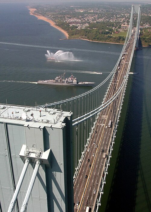
The Verrazzano–Narrows Bridge, shown with the United States Navy warship USS Leyte Gulf (CG-55) passing underneath it, spans The Narrows