M-26 is a 96.355-mile-long (155.068 km) state trunkline highway in the U.S. state of Michigan, running from two miles (3.2 km) east of Rockland to its junction with US Highway 41 (US 41) in Copper Harbor. It generally runs southwest-to-northeast in the western half or Michigan's Upper Peninsula. The northernmost segment, which closely parallels the shore of Lake Superior on the west side of the Keweenaw Peninsula, is highly scenic.
The Portage Lake Lift Bridge carries US 41/M-26 across the Keweenaw Waterway from Houghton to Hancock.
The Portage Lake Lift Bridge at night from north of Hancock, MI
Northern terminus
U.S. Route 41 in Michigan
US Highway 41 (US 41) is a part of the United States Numbered Highway System that runs from Miami, Florida, to the Upper Peninsula of the US state of Michigan. In Michigan, it is a state trunkline highway that enters the state via the Interstate Bridge between Marinette, Wisconsin, and Menominee, Michigan. The 278.769 miles (448.635 km) of US 41 that lie within Michigan serve as a major conduit. Most of the highway is listed on the National Highway System. Various sections are rural two-lane highway, urbanized four-lane divided expressway and the Copper Country Trail National Scenic Byway. The northernmost community along the highway is Copper Harbor at the tip of the Keweenaw Peninsula. The trunkline ends at a cul-de-sac east of Fort Wilkins State Park after serving the Central Upper Peninsula and Copper Country regions of Michigan.
The Portage Lake Lift Bridge carries US 41/M-26 across the Keweenaw Waterway from Houghton to Hancock
US 41/M-28 along the Marquette Bypass with Lake Superior in the background
The "Covered Trail" south of Copper Harbor
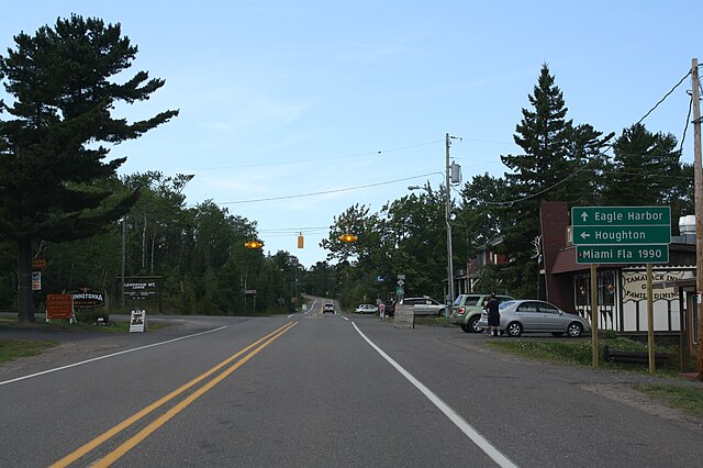
Mileage sign in Copper Harbor in 2009 showing distance to Miami