Madera Canyon is a canyon in the northwestern face of the Santa Rita Mountains, twenty-five miles southeast of Tucson, Arizona. As part of the Coronado National Forest, Madera Canyon has campsites, picnic areas, and miles of hiking trails. The canyon is also used as a resting place for migrating birds, and it is thus known as a premier birdwatching area. Madera Canyon was originally named White House Canyon, after a prominent white adobe house was built there in the late 19th century. The canyon was renamed sometime in the early 1900s, although some locals still use the original name.
The canyon floor.
Bat houses in the canyon
A bedrock mortar along Madera Creek.
The White House in the late 1880s.
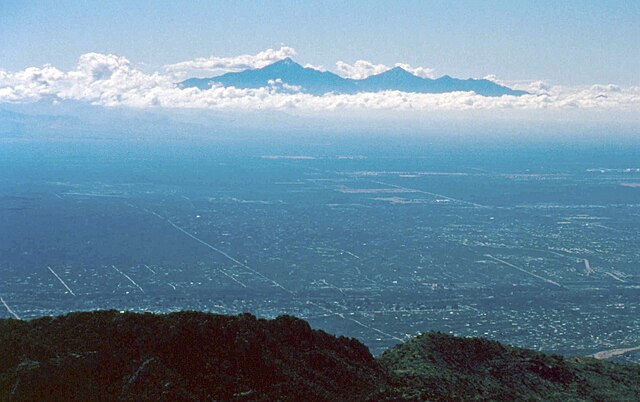
The Santa Rita Mountains, located about 40 miles (64 km) southeast of Tucson, Arizona, extend 26 miles (42 km) from north to south, then trending southeast. They merge again southeastwards into the Patagonia Mountains, trending northwest by southeast. The highest point in the range, and the highest point in the Tucson area, is Mount Wrightson, with an elevation of 9,453 feet (2,881 m), The range contains Madera Canyon, one of the world's premier birding areas. The Smithsonian Institution's Fred Lawrence Whipple Observatory is located on Mount Hopkins. The range is one of the Madrean sky islands.
View of the northern end of the Santa Ritas from the Santa Rita Experimental Range
Helvetia, Arizona, in 1909
View of the Santa Ritas from the Catalina Mountains
Mount Wrightson from Madera Canyon in 2012


