The Makgadikgadi Pan, a salt pan situated in the middle of the dry savanna of north-eastern Botswana, is one of the largest salt flats in the world. The pan is all that remains of the formerly enormous Lake Makgadikgadi, which once covered an area larger than Switzerland, but dried up tens of thousands of years ago. Recent studies of human mitochondrial DNA suggest that modern Homo sapiens first began to evolve in this region some 200,000 years ago, when it was a vast, exceptionally fertile area of lakes, rivers, marshes, woodlands and grasslands especially favorable for habitation by evolving hominins and other mammals.
The Makgadikgadi pans are clearly visible to the right of the dark-green broom-shaped Okavango Delta in this satellite image of Botswana
Panoramic view of the salt pan
Victoria Falls share geology with Makgadikgadi and Kalahari
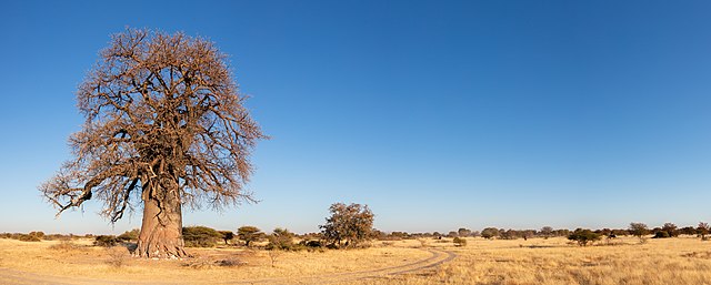
Baobab (Adansonia) in the Makgadikgadi Pan's National Park
Botswana, officially the Republic of Botswana, is a landlocked country in Southern Africa. Botswana is topographically flat, with approximately 70 percent of its territory being the Kalahari Desert. It is bordered by South Africa to the south and southeast, Namibia to the west and north, and Zimbabwe to the northeast. It is connected by the Kazungula Bridge to Zambia, across the world's 2nd shortest border between two countries.
The 'Two Rhino' painting at Tsodilo, a UNESCO World Heritage Site
Domboshaba Ruins Stone Wall (top) and clay pottery plate (bottom)
Sechele I who led a Batswana Merafe Coalition against Boers in 1852
3 Dikgosi Monument: Khama III, Sebele I & Bathoen I who negotiated a Protectorate


