The Malheur National Forest is a National Forest in the U.S. state of Oregon. It contains more than 1.4 million acres (5,700 km2) in the Blue Mountains of eastern Oregon. The forest consists of high desert grasslands, sage, juniper, pine, fir, and other tree species. Elevations vary from about 4,000 feet (1,200 m) to the 9,038-foot (2,755 m) peak of Strawberry Mountain. The Strawberry Mountains extend east to west through the center of the forest. U.S. Route 395 runs south to north through the forest, while U.S. Route 26 runs east to west.
Strawberry Lake in the Malheur National Forest
Monument Rock in Malheur NF
Oregon is a state in the Pacific Northwest region of the United States. Oregon is a part of the Western United States, with the Columbia River delineating much of Oregon's northern boundary with Washington, while the Snake River delineates much of its eastern boundary with Idaho. The 42° north parallel delineates the southern boundary with California and Nevada. The western boundary is formed by the Pacific Ocean.
Oregon border welcome sign at Denio, Nevada
Paul Shoaway of the Umatilla tribe, 1899
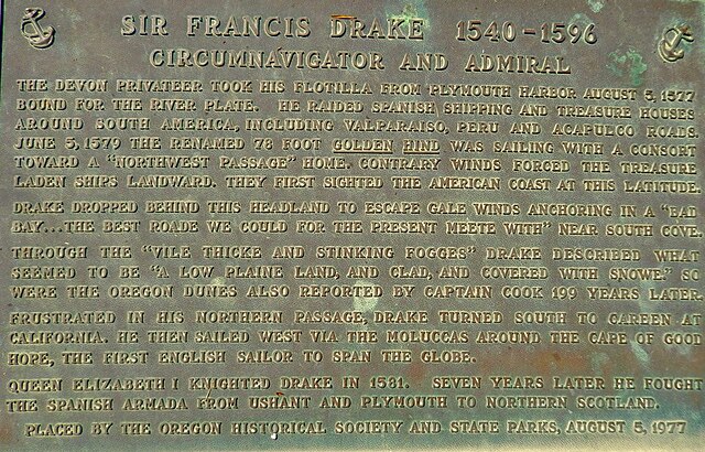
Monument near Coos Bay, Oregon, of Francis Drake's first North American Encounter. Plaque by Oregon State Parks and Oregon Historical Society.
Fort Astoria, as established by John Jacob Astor in 1813