Massey, New Zealand
Videos
Page
Massey is a northern suburb in West Auckland, New Zealand. It was formerly a northern suburb of Waitakere City, which existed from 1989 to 2010 before the city was amalgamated into Auckland Council. The suburb was named after former Prime Minister of New Zealand William Massey. Massey is a relatively large suburb and can be divided into three reasonably distinctive areas, Massey West, Massey East and Massey North. Parts of Massey East are also known as 'Royal Heights', which is home to the Royal Heights shopping centre.

The roundabout Don Buck Road / Triangle Road in Massey North.
West Auckland, New Zealand
Videos
Page
West Auckland is one of the major geographical areas of Auckland, the largest city in New Zealand. Much of the area is dominated by the Waitākere Ranges, the eastern slopes of the Miocene era Waitākere volcano which was upraised from the ocean floor, and now one of the largest regional parks in New Zealand. The metropolitan area of West Auckland developed between the Waitākere Ranges to the west and the upper reaches of the Waitematā Harbour to the east. It covers areas such as Glen Eden, Henderson, Massey and New Lynn.
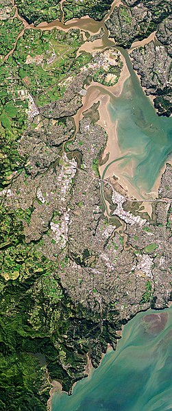
Metropolitan West Auckland captured by a Planet Labs satellite in 2016
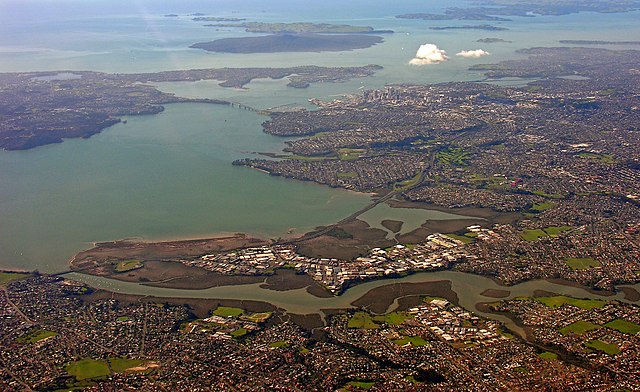
The Whau River has often been used as a border between western and central Auckland

The Waitākere rock koromiko, Veronica bishopiana, is endemic to the Waitākere Ranges

Many early settlements in West Auckland were along the west coast beaches (pictured: Karekare)