The McKittrick Oil Field is a large oil and gas field in western Kern County, California. The town of McKittrick overlies the northeastern portion of the oil field. Recognized as an oil field in the 19th century, but known by Native Americans for thousands of years due to its tar seeps, the field is ranked 19th in California by total ultimate oil recovery, and has had a cumulative production of over 303 million barrels (48,200,000 m3) of oil. The principal operators of the field as of 2008 were Chevron Corp. and Aera Energy LLC, but many independent oil exploration and production companies were also active on the field. The California Department of Oil, Gas and Geothermal Resources (DOGGR) estimates approximately 20 million recoverable barrels of oil remain in the ground.
The McKittrick Oil Field in Kern County, California. Other oil fields are shown in gray.
Oil wells and piping on the McKittrick Field, about a mile west of the town of McKittrick.
McKittrick Tar Seep North of Highway 58. The person is lighting a natural-gas bubble.
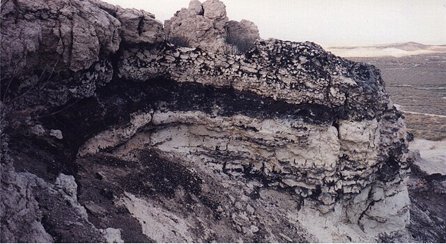
Outcrop of diatomite with streaks of oil, McKittrick oilfield. There are numerous oil seeps in this area. 2000 photo.
McKittrick is an unincorporated community in Kern County, California, United States. McKittrick is 14 miles (23 km) northwest of Taft, at an elevation of 1,056 feet (322 m). The population was 115 at the 2010 census, down from 160 at the 2000 census. For statistical purposes, the United States Census Bureau has defined McKittrick as a census-designated place (CDP).
Historic landmark sign along SR58.
View of the community from the south.


