The Mendocino Complex Fire was a large complex of wildfires that burned in northern California for more than three months in 2018. It consisted of two wildfires, the River Fire and Ranch Fire, which burned in Mendocino, Lake, Colusa, and Glenn Counties in the U.S. State of California, with the Ranch Fire being California's single-largest recorded wildfire at the time until the Dixie Fire in 2021. The Ranch Fire burned eight miles northeast of Ukiah, and the River Fire burned six miles north of Hopland, to the south of the larger Ranch Fire. First reported on July 27, 2018, both fires burned a combined total of 459,123 acres (1,858 km2), before they were collectively 100% contained on September 18, though hotspots persisted until the complex was fully brought under control on January 4, 2019. The Ranch Fire alone burned 410,203 acres (1,660 km2), making it the largest wildfire in modern California history at the time until the August Complex fire that occurred in 2020. The Ranch Fire also surpassed the size of the 315,577-acre Rush Fire, which burned across California and Nevada, as well as the Santiago Canyon Fire of 1889, which was previously believed to have been California's all-time largest wildfire.

Pyrocumulonimbus rising above the Mendocino Complex, as viewed from Ukiah, California, on July 29, 2018
Satellite image of the Ranch Fire on August 15, 2018.
The community of Upper Lake was evacuated during the Mendocino Complex fires.
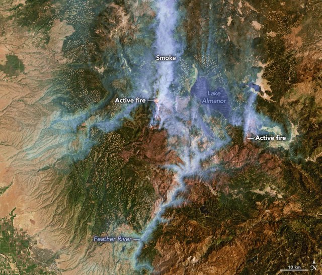
The 2021 Dixie Fire was an enormous wildfire in Butte, Plumas, Lassen, Shasta, and Tehama counties in Northern California. Named after a nearby Dixie Road, the fire began in the Feather River Canyon near Cresta Dam in Butte County on July 13, 2021, and burned 963,309 acres (389,837 ha) before it was declared 100 percent contained on October 25, 2021. It was the largest single source wildfire in recorded California history, and the second-largest wildfire overall, The fire damaged or destroyed several communities, including Greenville on August 4, Canyondam on August 5, and Warner Valley on August 12.
A pyrocumulus cloud rising from the Dixie Fire, looking east from a country road north of Chico on the evening of July 22, 2021
Dixie Fire on August 4, 2021, as seen by Landsat 7
Airtanker at Chico Municipal Airport on August 8, 2021
The Devil's Punchbowl is just above and left of the dot of the first letter i in "Dixie" at 40°01′04″N 120°48′08″W / 40.0179°N 120.8022°W / 40.0179; -120.8022


