The Mogalakwena River is one of the main watercourses in Limpopo Province, South Africa. It is also a major tributary of the Limpopo River.
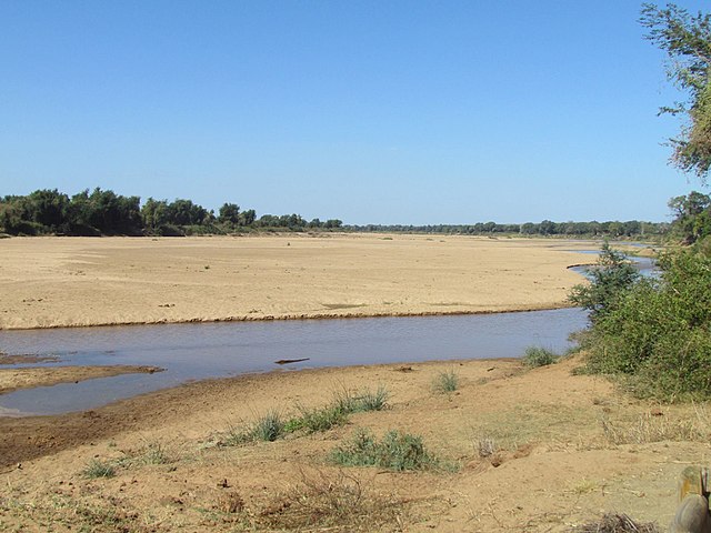
View of the sandy river bed in winter, near Magagamatala in northern Limpopo
SPOT Satellite photograph of the northern Waterberg showing at right the Mogalakwena River at 900 m. The villages alongside are Kabeane, Jakkalskuil and Ga-Molekwa (also called Galakwena) in Mogalakwena Local Municipality.
The Little Mogalakwena (or Motse) River near Marken, Limpopo, is a left bank tributary of the Mogalakwena
The Limpopo River rises in South Africa and flows generally eastward through Mozambique to the Indian Ocean. The term Limpopo is derived from Rivombo (Livombo/Lebombo), a group of Tsonga settlers led by Hosi Rivombo who settled in the mountainous vicinity and named the area after their leader. The river has been called the Vhembe by local Venda communities of the area where now that name has been adopted by the South African government as its District Municipality in the north, a name that was also suggested in 2002 as a possible title for the province but was voted against. The river is approximately 1,750 km (1,090 mi) long, with a drainage basin of 415,000 km2 (160,000 sq mi) in size. The mean discharge measured over a year is 170 m3/s (6,000 cu ft/s) to 313 m3/s (11,100 cu ft/s) at its mouth. The Limpopo is the second largest African river that drains to the Indian Ocean, after the Zambezi River.
Limpopo River in Mozambique
The river as seen from Crook's Corner in Kruger National Park, South Africa. Straight ahead of the river is Mozambique. Across the river is Zimbabwe.
Crossing Limpopo in Mozambique


