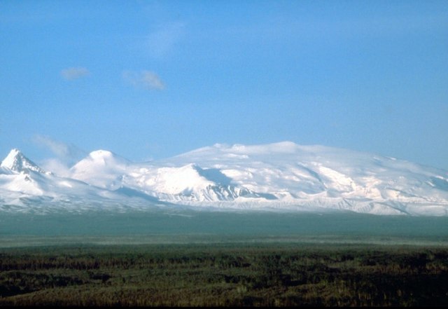
Mount Drum is a stratovolcano in the Wrangell Mountains of east-central Alaska in the United States. It is located at the extreme western end of the Wrangells, 18 miles (29 km) west-southwest of Mount Sanford and the same distance west-northwest of Mount Wrangell. It lies just inside the western boundary of Wrangell-Saint Elias National Park and Preserve and is 25 miles (40 km) east of the Copper River.
Mount Drum from the northwest
Eastbound travelers along the eastern reaches of the Glenn Highway enjoy prominent views of Mount Drum. This photo was taken in the Glennallen vicinity in 1974.
Wrangell–St. Elias National Park and Preserve
Wrangell–St. Elias National Park and Preserve is an American national park and preserve managed by the National Park Service in south central Alaska. The park and preserve were established in 1980 by the Alaska National Interest Lands Conservation Act. The protected areas are included in an International Biosphere Reserve and are part of the Kluane/Wrangell–St. Elias/Glacier Bay/Tatshenshini-Alsek UNESCO World Heritage Site. The park and preserve form the largest area managed by the National Park Service with a total of 13,175,799.07 acres, an expanse larger than nine U.S. states and around the same size as Bosnia and Herzegovina or Croatia. 8,323,147.59 acres are designated as the national park, and the remaining 4,852,652.14 acres are designated as the preserve. The area designated as the national park alone is larger than the 47 smallest American national parks combined and is more than twice the size of all but two other national parks. Its area makes up over 15% of all national park designated land in the United States.

Mount St. Elias, the second highest mountain of both the United States and Canada
Hikers on a pass between Mount Sanford and Mount Drum
Nabesna Glacier
Mount Wrangell


