Mount Rainier National Park
Videos
Mount Rainier National Park is a national park of the United States located in southeast Pierce County and northeast Lewis County in the U.S. state of Washington. The park was established on March 2,

Mount Rainier from above Myrtle Falls

Ohanapecosh Glacier, as seen from the Wonderland Trail

At the summit of Mount Rainier, 1888. Left to right: D. W. Bass, P. B. Van Trump, John Muir, N. O. Booth, Edward Sturgis Ingraham

Mount Rainier National Park panorama
Mount Rainier
Videos
Mount Rainier, also known as Tahoma, is a large, active stratovolcano in the Cascade Range of the Pacific Northwest in the United States. The mountain is located in Mount Rainier National Park about 5
Mount Rainier National Park
…was established on March 2, 1899, as the fourth national park in the United States, preserving 236,381 acres (369.3 sq mi; 956.6 km2) including all of Mount Rainier, a 14,410-foot (4,390 m) stratovolcano. The mountain rises abruptly from the surrounding land with elevations in the park ranging from 1,600 feet to…

Mount Rainier's northwestern slope viewed aerially just before sunset on September 6, 2020

Mount Rainier seen from the International Space Station
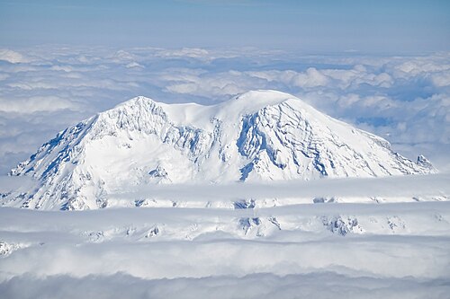
West face of Mount Rainier from an aircraft

A panorama of the northeast face of Mount Rainier