Mount St. Helens
Videos
Mount St. Helens is an active stratovolcano located in Skamania County, Washington, in the Pacific Northwest region of the United States. It lies 52 miles northeast of Portland, Oregon, and 98 miles s

3,000 ft (900 m) high steam plume on May 19, 1982, two years and a day after the 1980 major eruption that created the visible gap on the north side of the mountain
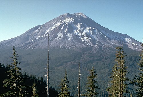
Mount St. Helens pictured the day before the 1980 eruption, which removed much of the northern face of the mountain, leaving a large crater

Aerial view with Mount Adams in background

East Dome on the east flank of Mount St. Helens in 2013.
Stratovolcano
Videos
A stratovolcano, also known as a composite volcano, is a typically conical volcano built up by many alternating layers of hardened lava and tephra. Unlike shield volcanoes, stratovolcanoes are charact
Mount St. Helens
…Mount St. Helens (known as Lawetlat'la to the local Cowlitz people, and Loowit or Louwala-Clough to the Klickitat) is an active stratovolcano located in Skamania County, Washington, in the Pacific Northwest region of the United States. It lies 52 miles (83 km) northeast of Portland, Oregon…

Mount Rainier, a 4,390-metre-tall (14,410 ft) stratovolcano, the highest mountain in the US state of Washington

Exposed internal structure of alternating layers of lava and pyroclastic rock in the eroded Broken Top stratovolcano in Oregon

Mount Etna on the island of Sicily, in southern Italy

Snow-like blanket of Mount Pinatubo's ashfall deposits in a parking lot on Clark Air Base (15 June 1991)