Namib
Videos
Photos
The Namib is a coastal desert in Southern Africa. According to the broadest definition, the Namib stretches for more than 2,000 kilometres (1,200 mi) along the Atlantic coasts of Angola, Namibia, and northwest South Africa, extending southward from the Carunjamba River in Angola, through Namibia and to the Olifants River in Western Cape, South Africa. The Namib's northernmost portion, which extends 450 kilometres (280 mi) from the Angola-Namibia border, is known as Moçâmedes Desert, while its southern portion approaches the neighboring Kalahari Desert. From the Atlantic coast eastward, the Namib gradually ascends in elevation, reaching up to 200 kilometres (120 mi) inland to the foot of the Great Escarpment. Annual precipitation ranges from 2 millimetres (0.079 in) in the aridest regions to 200 millimetres (7.9 in) at the escarpment, making the Namib the only true desert in southern Africa. Having endured arid or semi-arid conditions for roughly 55–80 million years, the Namib may be the oldest desert in the world and contains some of the world's driest regions, with only western South America's Atacama Desert to challenge it for age and aridity benchmarks.

An image of the Namib Desert by the MODIS instrument

Namib desert and ocean

Sossusvlei, one of Namib's major tourist attractions, is a salt and clay pan surrounded by large dunes. The flats pictured here were caused by the Tsauchab stream after summer rains

Thick morning fog rolls in from the ocean, near Sossusvlei; moisture from the fog allows the native flora to survive the aridity
Southern Africa
Videos
Photos
Southern Africa is the southernmost region of Africa. No definition is agreed upon, but some groupings include the United Nations geoscheme, the intergovernmental Southern African Development Community, and the physical geography definition based on the physical characteristics of the land.

A November 2002 satellite image of Southern Africa
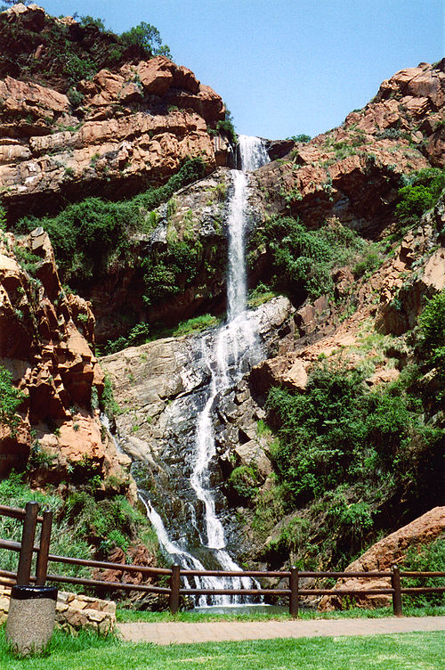
A waterfall in the Witwatersrand region near Johannesburg
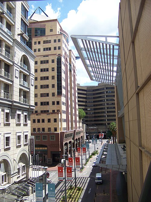
The Sandton section of Johannesburg, the financial centre of South Africa