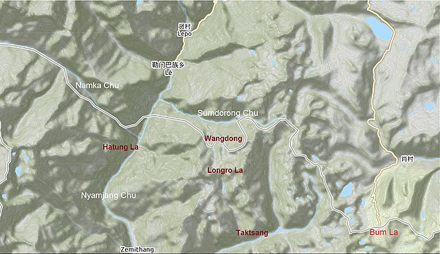
Namka Chu or Kejielang River
is a tributary of Nyamjang Chu that flows along the disputed border between India and China. The Indian side of the border is the Tawang district in Arunachal Pradesh. The Tibetan side of the border is in Tsona Dzong, Shannan province of Tibet. Namka Chu originates near the trijunction of Tibet, Bhutan and India and flows east for 26 km before joining Nyamjang Chu. It is about 200 kilometers away from the Misamari railhead and 60 kilometers from the Tawang road head. The Namka Chu valley was the scene of some of the most fierce fighting between India and China during the 1962 Sino-Indian war.
Namka Chu and vicinity
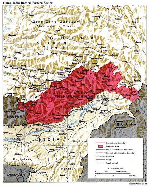
The Sino–Indian War, also known as the China–India War or the Indo–China War, was an armed conflict between China and India that took place from October to November 1962. It was a military escalation of the Sino–Indian border dispute. Fighting occurred along India's border with China, in India's North-East Frontier Agency east of Bhutan, and in Aksai Chin west of Nepal.
Indian soldiers patrolling Spanggur Tso at the Sino–Indian border in January 1962
The McMahon Line is the red line marking the northern boundary of the disputed area.
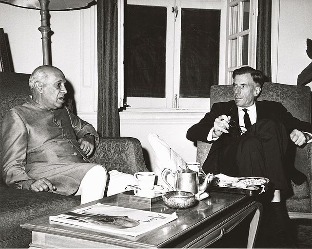
U.S. Ambassador to India John Kenneth Galbraith and Prime Minister Nehru conferring at the time of the conflict. This photograph was taken by the United States Information Service (USIS) and sent to President John F. Kennedy with a letter from Galbraith dated 9 November 1962.