Nazca lines
Videos
Page
The Nazca lines are a group of geoglyphs made in the soil of the Nazca Desert in southern Peru. They were created between 500 BC and 500 AD by people making depressions or shallow incisions in the desert floor, removing pebbles and leaving different-colored dirt exposed. There are two major phases of the Nazca lines, Paracas phase, from 400 to 200 BC, and Nazca phase, from 200 BC to 500 AD. In the years leading up to 2020, between 80 and 100 new figures had been found with the use of drones, and archaeologists believe that there are more to be found.

Aerial photograph of one of the Nazca lines, taken in July 2015, that shows the design known as "The monkey"

Nazca Lines seen from SPOT Satellite
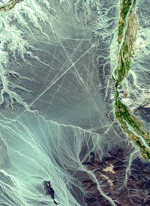
Satellite picture of an area containing lines: north is to the right (coordinates: 14°42′S 75°00′W / 14.7°S 75.°W / -14.7; -75.)

The Spider
Geoglyph
Videos
Page
A geoglyph is a large design or motif – generally longer than 4 metres (13 ft) – produced on the ground by durable elements of the landscape, such as stones, stone fragments, gravel, or earth. A positive geoglyph is formed by the arrangement and alignment of materials on the ground in a manner akin to petroforms, while a negative geoglyph is formed by removing part of the natural ground surface to create differently coloured or textured ground in a manner akin to petroglyphs.

Geoglyphs on deforested land in the Amazon rainforest

The prehistoric English hill figure of the Uffington White Horse

The Nazca Lines in Peru. This photograph shows a depiction of a hummingbird

Bunjil geoglyph at the You Yangs, Lara, Australia, by Andrew Rogers. The creature has a wingspan of 100 metres and 1,500 tonnes of rock were used to construct it.