The Nisqually River is a river in west central Washington in the United States, approximately 81 miles (130 km) long. It drains part of the Cascade Range southeast of Tacoma, including the southern slope of Mount Rainier, and empties into the southern end of Puget Sound. Its outlet was designated in 1971 as the Nisqually Delta National Natural Landmark.
Nisqually River near Ashford during a flood in 2006 that destroyed a campground in Mount Rainier National Park
Near its source in Mount Rainier National Park, the Nisqually River flows under a bridge of Route 706.
Mount Rainier and headwaters of the river from the Nisqually Glacier
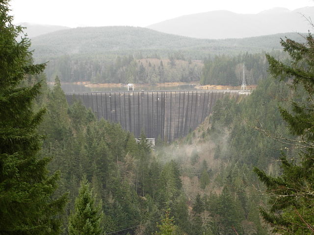
Alder Dam near Elbe, Washington
Mount Rainier, also known as Tahoma, is a large active stratovolcano in the Cascade Range of the Pacific Northwest in the United States. The mountain is located in Mount Rainier National Park about 59 miles (95 km) south-southeast of Seattle. With a summit elevation of 14,411 ft (4,392 m), it is the highest mountain in the U.S. state of Washington, the most topographically prominent mountain in the contiguous United States, and the tallest in the Cascade Volcanic Arc.
Mount Rainier's northwestern slope viewed aerially just before sunset on September 6, 2020
Mount Rainier seen from the International Space Station
West face of Mount Rainier from an aircraft
A panorama of the northeast face of Mount Rainier