North Sumatra
Videos
North Sumatra is a province of Indonesia located in the northern part of the island of Sumatra. Its capital and largest city is Medan. It is bordered by Aceh on the northwest and Riau and West Sumatra on the southeast, with two different coastlines located on the Indian Ocean and the Strait of Malacca, and a maritime border with Malaysia to the east. North Sumatra is Indonesia's fourth most populous province after West Java, East Java, and Central Java, and is also the most populous province outside of Java Island. North Sumatra is also the third-largest province in area on the island of Sumatra after South Sumatra and Riau provinces. It covers an area of 72,460.74 km2, which is approximately the same size as Sierra Leone or Scotland or Maine.
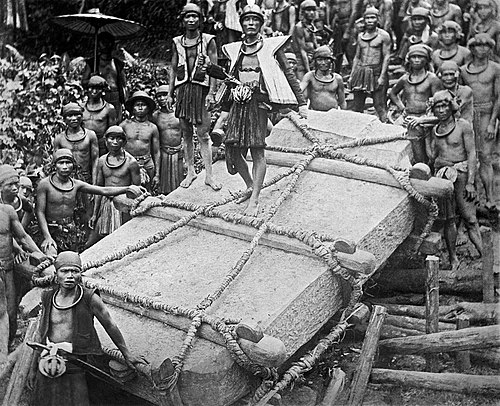
Darodaro or big stones (megaliths) that were hauled upwards and used as memorials by the Nias people in Bawomataluo village; this has been practised by people on the island since a thousand years ago

Situs Hopong in Dolok Sanggul, these stoned-statues sites are probably one of evidence of prehistoric Batak civilization

Chinese-shaped coin founded in Situs Kota Cina, Labuhan Deli presumably used for trading during the Yuan dynasty, 12 to 13th century

Bahal temple, also known as Portibi, is a Buddhist candi complex in Bahal village, North Sumatra. The temple site is linked to the Pannai Kingdom circa the 11th to 13th century CE.
Batak
Videos
Batak is a collective term used to identify a number of closely related Austronesian ethnic groups predominantly found in North Sumatra, Indonesia, who speak Batak languages. The term is used to include the Karo, Pakpak, Simalungun, Toba, Angkola, and Mandailing, related ethnic groups with distinct languages and traditional customs (adat).

Toba Batak male and female wearing traditional clothes

A traditional Toba Batak house (see Batak architecture).

Bark book with charms written in native Batak script, 1910.

Traditional boat (c. 1870), photograph by Kristen Feilberg.