Kraichgau
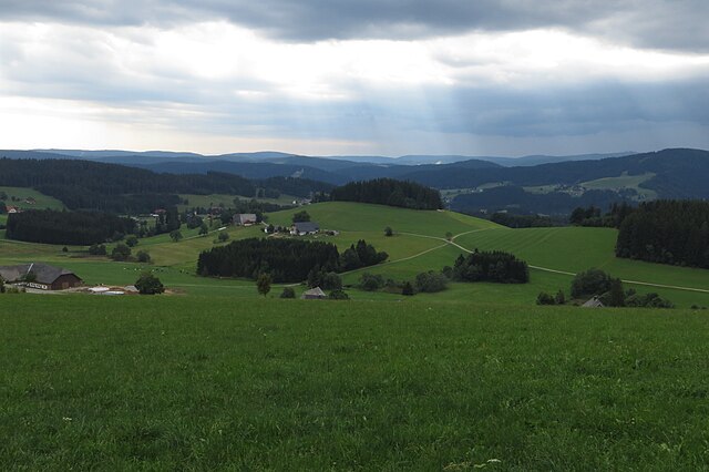
The Kraichgau is a hilly region in Baden-Württemberg, southwestern Germany. It is bordered by the Odenwald and the Neckar to the North, the Black Forest to the South, the Upper Rhine Plain to the West. To the east, its boundary is considered to be the Heuchelberg; the largest towns of the Kraichgau are Sinsheim and Bretten. On the western end of the Kraichgau is the town of Bruchsal, the gateway to the Rhineland plains; the word "Kraich" arose from the Celtic word "Creuch," meaning "mud" or "loam." The territory of a Gau signifies an open area, free from woods, such as farmland or meadows. The area of Kraichgau was first mentioned in the Early Middle Ages, in the Lorsch codex, as "Creichgowe" in the year 769. In 773, it was called "Chrehgauui," in 778 "Craichgoia." By 1594, the name was closer to its modern form, being referred to as "Kreuchgau." Aalkistensee
Hornisgrinde
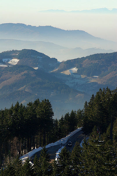
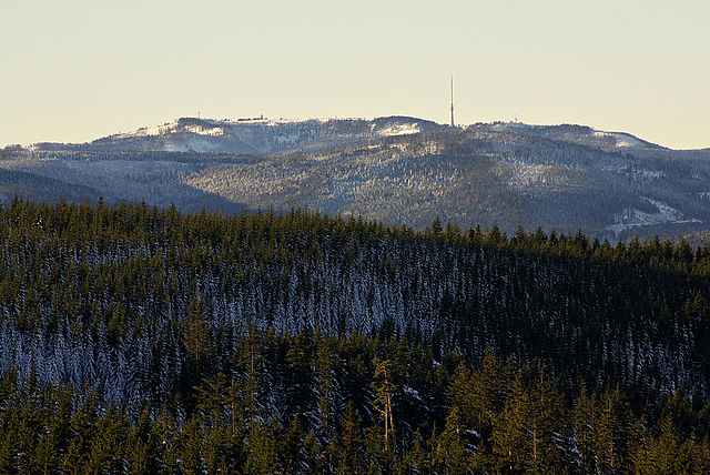
The Hornisgrinde, 1,164 m, is the highest mountain in the Northern Black Forest of Germany. The Hornisgrinde lies in northern Ortenaukreis district; the name is derived from Latin, translates to "boggy head," referring to the raised bog. Another interpretation of the name is derived from the terms Horn and grind and meant the same as kahler Bergrücken, which carries a moorland on its height; the summit of the Hornisgrinde is framed of the Muhrkopf near Unterstmatt in the north and the Mummelsee in the south. In the west the slope is cut through by the Schwarzwaldhochstraße in 900 to 1000 m, in the east drops the tendency steeply to the ice-age cirque Biberkessel with the landing Blindsee lake; the summit changes to the Katzenkopf mountain in the southwest at 1123 m, into the southeast drops the burr toward Seibelseckle. The Katzenkopf mountain and the southeast burr of the Hornisgrinde form the cirque of the Mummelsee; the Grinden - treeless wet heathlands on the highest areas, were created following forest clearance and the subsequent use of the land as grazing in the 15th century.
By contrast the raised bog, up to five metres thick, in the southeastern area of the summit plateau is treeless. It is reckoned to be at least 6,000 years old. Parts of the plateau with the raised bog and the Karwand to the Biberkessel were designated as the Hornisgrinde-Biberkessel Nature Reserve in 1992; the Hornisgrinde belongs to the precipitation-richest places in Germany. The average yearly precipitation amounts to 1931 mm. Over 99% of the measuring points of the German weather service indicate lower values; the driest month is February. There's 1.4 times more precipitation in the precipitation-richest month than in the driest one. The seasonal precipitation fluctuations lie in the upper third. In over 81% of all places the monthly precipitation varies less; the Dreifürstenstein is a sandstone plate, located at the southeast edge of the plateau. It originates from the year 1722 and marked the border between the Margraviate of Baden, the duchy Württemberg and the Diocese of Strasbourg. Today the point represents the boundary border between Baden's municipalities Sasbach, Seebach and Württemberg's municipality Baiersbronn.
With a height of 1,151 m above sea level the Dreifürstenstein is the highest point of Württemberg. In 1938 the entire southern range of the summit level was declared as the military restricted area. First being in use since 1942 by the German Forces as an air defense position, the French took over the location in 1945; these operated on the Hornisgrinde an observing station on behalf of the French foreign secret service DGSE. The location was used parallel by the Bundeswehr and NATO. After the plant went out of operation in 1994, it lay fallow several years; the restricted area was released in 1997. In 1999 the neighbor municipalities took over the federal area; some of the buildings and masts are preserved, however they're purging more and more. The long-distance footpath, the West Way runs across the ridge, the Black Forest High Road runs over the western and southern sides of the mountain, with a large car park at the Mummelsee. From there an educational path with information boards by the Ruhestein nature conservation centre leads across the summit plateau, crossing the raised bog on a board walk.
At the southern end, above the Mummelsee, stands the 23-metre-high Hornisgrinde Tower. The construction of this observation tower in 1910 was an initiative by the Black Forest Club branch in Baden. New red sandstone was used as the building material. Together with the Mummelsee, the tower was one of the most popular destinations in the region at that time. In 1942 it was commandeered by the Luftwaffe. After World War II it was used by the French military. In 2000 the Seebach forestry association acquired the tower from the Federation and transferred it to the municipality of Seebach as a lease. On 29 May 2005 the tower was opened again to the public. At the highest point of the mountain, in the midst of the summit level is a further tower, the 7 meters high signal tower established around 1840. In 1892 it was converted by assembly of stairs at the exterior into an observation tower. However, it was inaccessible during the military use of the summit. In 2000 the tower was made again accessible by a steel spiral stair lying outside.
There is no lift system to the top of the Hornisgrinde itself. However, north of the summit is the Skizirkus Unterstmatt, with two lifts at the north slope of the Muhrkopf. To the south is the nearby ski lift of Seibelseckle. Around the summit of the Hornisgrinde leads a 14 km long loipe consisting of the Mummelseeloipe, Hundsrückenloipe and the Ochsenstall-Seibelseckle loipe, it is prepared for skating technology. Entrance possibilities are at the col Seibelseckle and at the col Unterstmatt. Due to the high average wind speed of 5.2 m/s in the annual average on the Hornisgrinde in the mid-1990s a commercial wind park was established. In 1994 two wind-power plants of 110 KW each one were built in private initiative, a third one with 132 KW followed in 1996. Like on other places there are controversial. On top of the Hornisgrinde is a 206 m high radio tower of the Südwestrundfunk, transmitting radio and television programmes; the tower is not open to the public. At the northern end of the summit plateau is a transmitting tower of the German Telekom AG.
It accommodates a relay station for amateur television. Until 2005 the program of the Deutschlandfunk was radiated by this tower the transmit
Rench
The Rench is a right-hand tributary of the Rhine in the Ortenau. It rises on the southern edge of the Northern Black Forest at Kniebis near Bad Griesbach im Schwarzwald; the source farthest from the mouth is that of the Schöngrundbächle which rises at a height of around 915 m above NN in the parish of Zuflucht near the old youth hostel. After flowing through its steep mountainside klinge it is joined by other streams to form, the Old the Wild Rench, which first becomes the Rench below Bad Griesbach; the Rench runs in a prominent southerly arc through the Central Black Forest and crosses the hilly region of Ortenau with its orchards and vineyards before breaking out into the Rhine Plain. After just under 57 km it discharges, together with the Mühlbach, into the Rhine at 314.7km between Helmlingen and Lichtenau. The upper Rench valley around Bad Peterstal-Griesbach cuts into the forested bunter sandstone plateaux before entereing a more open rugged valley with steep relief, whose centre is the little town of Oppenau.
There it is joined from the right by the Lierbach, well known for the All Saints Waterfalls. In Lautenbach the valley broadens into the Foothill Zone with the town of Oberkirch at the foot of the vineyards and the little town of Renchen, whose environs are dominated by orchards; the B 28 federal road, long an important transverse route across the Black Forest, runs through the Rench valley linking the Strasbourg area with the upper Neckar region. It climbs steeply above Bad Griesbach in hairpin bends to the Alexanderschanze; the Rench Valley Railway runs as far as Bad Griesbach. It has contributed to the development of the thermal baths in the Rench valley, established in the 16th century in Bad Griesbach, but which soon extended to Bad Antogast near Oppenau, Bad Peterstal and Bad Freiersbach; the "Rench Flood Canal" was built between 1936 and 1953 at the Acher Rench Correction to divert flood waters. It branches off the Rench at Erlach, picks up the Acher Canal at Rheinau and merges with the actual Rench at Memprechtshofen.
"LUBW-BRSWEB": Map services of the Baden-Württemberg State Office for the Environment and Conservation Geodata viewer of the Baden-Württemberg State Office of Geoinformation and Land Development the map sections and layers the Landesanstalt für Umwelt, Messungen und Naturschutz Baden-Württemberg "LUBW-FG10": Rivers, 1:10,000 scale "LUBW-SG10": Lakes and reservoirs, 1:10,000 scale "LUBW-GEZG": Catchments Map of the Rench from source to mouth at OpenStreetMap
Bad Wildbad
Bad Wildbad is a town in Germany, in the state of Baden-Württemberg. It is located in the district of Calw, its coordinates are 48° 45' N, 8° 33' E. About 11,250 people live there; the current mayor is Klaus Mack. The current town of Bad Wildbad is an amalgamation of several communities brought together under local government reform in 1974; the member communities are Wildbad, Sprollenhaus, Nonnenmiß and Aichelberg, along with the hamlets of Hünerberg und Meistern. The town was named only Wildbad until 1991, it is picturesquely situated 420 m above sea level, in the romantic pine-clad gorge of the Enz, a tributary of the Neckar in the Black Forest, 45 km west of Stuttgart and 23 east of Baden-Baden by rail. Towering above Bad Wildbad is a small mountain, the Wildbader Sommerberg, whose top may be reached by the Sommerbergbahn, a funicular railway, it covers a vertical difference of about 300 m. It is a popular medicinal spa; the neighbourhood is picturesque, the most attractive spot being the Wildsee—a small lake some distance from the town itself, measuring 2.3 ha, at about 900 m above sea level.
The annual Rossini in Wildbad opera festival, held in July, brings an international audience to the Kurhaus and the Kurtheater to hear belcanto works by Gioachino Rossini and his contemporaries. It is the scene of the early pages of Armadale by Wilkie Collins. A part of Bad Wildbad is Aichelberg. There is a path: Fautsburg Path. Bad Wildbad is connected to Germany's national rail network through the Karlsruhe Stadtbahn, line S6, running on the Enz Valley Railway. Being located deep in the northern Black Forest, Bad Wildbad has no direct connection with any Autobahn; the nearest one is just west of Pforzheim. Ludwig Hofacker, was born in Wildbad, Württemberg author and translator Justinus Kerner, poet and physician The Holocaust denier Ernst Zündel was born 1939 in Calmbach and grew up here and would live out his last years here following his deportation from Canada; the economist and financial scientist Rudolf Nickel, grew up in Bad Wildbad. "Rossini in Wildbad". Retrieved March 2013. Chisholm, Hugh, ed..
"Wildbad". Encyclopædia Britannica. 28. Cambridge University Press. P. 632
Loffenau
Loffenau is a town in the district of Rastatt in Baden-Württemberg in Germany. Loffenau is located within a tributary valley of the Murg River in the western slopes of the northern Black Forest. Loffenau enjoys a rich history. One of the major points of interest in Loffenau is the Protestant Heilig Kreuz Church; the 550-year-old Medieval church contains both well-preserved original and restored 19th-century frescos. Among various images of saints and apostles, visitors can admire the well known image of the'Host Mill.' An accessible viewing platform is located within the church. Another major local attraction is the Teufelsmühle which overlooks the town from a lofty altitude of 2979 ft The town is member of the Association of Administrations of Cities. Gernsbach The local government consists of a mayor; the town is twinned with: Caderousse, Département Vaucluse, Region Provence-Alpes-Côte d'Azur, France since 1985 Kreischa district Weißeritzkreis, Germany since 1990 Montefelcino, Region Marche, Province Pesaro and Urbino, Italy since 1999 Haj u Duchcova, Teplice District, Czech Republic Steinbourg, Départment Bas-Rhin, Region Grand Est, France.
Guenter Seeger - Michelin starred chef, Mobil 5 star chef in the United States Harald Wohlfahrt - starred chef david graßs Meryl Streep's paternal ancestors lived in Loffenau, one was elected mayor. Her great-great-grandfather Gottfried Streeb immigrated to the U. S. from Loffenau
Kaltenbronn (Gernsbach)
Kaltenbronn is a hamlet and old parish in the Black Forest in Germany that belongs to the parish of Reichental in the municipality of Gernsbach in Baden-Württemberg. The hamlet in the northern Black Forest with its hotel, forester’s lodge and former Baden hunting lodge lies a little below the top of the Schwarzmiss Pass between the Murg and Enz valleys at a height of about 860 metres above sea level in the centre of the largest contiguous woodland in Baden-Württemberg. Kaltenbronn is crossed by the Landesstraße 76 B, the road over the pass between the valleys of the Murg and the Enz, is accessible by public buses from both Gernsbach and Bad Wildbad, its average annual temperature is 6 °C and its annual precipitation is 1,600 mm. It is covered by snow for an average of 75 days per year. Kaltenbronn is a day trippers’ destination and local recreation centre in the Central/North Black Forest Nature Park. On 1 December 2007, the Kaltenbronn Information Centre opened, providing a visitor centre and nature park gateway for the municipalities of Gernsbach, Bad Wildbad and Enzklösterle.
Kaltenbronn is the start point for trails into the nature reserves of the raised bogs of Wildseemoor and Hohlohmiss as well as a popular ski resort with ski lifts, a toboggan slope and extensive network of loipes. The long-distance paths of West Way and Middle Way run through Kaltenbronn. Another attraction is the deer enclosure; the entire region is covered by the Pforzheim Branch of the Black Forest Mountain Watch. In the vicinity of the hamlet is the observation tower on the Hohloh, built in 1897 as an Emperor William tower. Hubert Intlekofer: Geschichte des Kaltenbronn. Von Hochmoor, Wald und Kaiserjagd. Special publication by the Rastatt County Archives, Vol. 9, Casimir Katz Verlag, Gernsbach 2011, ISBN 978-3-938047-53-8. Landesarchivdirektion Baden-Württemberg: Das Land Baden-Württemberg. Amtliche Beschreibung nach Kreisen und Gemeinden. Vol. V, Stuttgart, 1976, pp. 167–171. Ludwig Schülli: Der Staatswald Kaltenbronn. Ein Beispiel für the Entwicklung of the Forstwirtschaft in the Waldungen des nördlichen Schwarzwaldes während of the letzten 200 Jahre.
Schriftenreihe of the Baden-Württemberg Forestry Commission, Vol. 8. Maly, Karlsruhe, 1959. Infozentrum Kaltenbronn
Tor (rock formation)
A tor, known by geomorphologists as either a castle koppie or kopje, is a large, free-standing rock outcrop that rises abruptly from the surrounding smooth and gentle slopes of a rounded hill summit or ridge crest. In the South West of England, the term is also used for the hills themselves – the high points of Dartmoor in Devon and Bodmin Moor in Cornwall; the word tor, meaning hill, is notable for being one of the few Celtic loanwords to be borrowed into vernacular English before the modern era – such borrowings are words of a geographic or topographical nature. Another such word is crag. Tors are landforms created by the weathering of rock. Tors are less than 5 meters high. Many hypotheses have been proposed to explain their origin and this remains a topic of discussion among geologists and geomorphologists, physical geographers, it is considered that tors were created by geomorphic processes that differed in type and duration according to regional and local differences in climate and rock types.
For example, the Dartmoor granite was emplaced around 280 million years ago, with the cover rocks eroded away soon afterwards, exposing it to chemical and physical weathering processes. Where joints are spaced, the large crystals in the granite disintegrate to form a sandy regolith known locally as growan; this is stripped off by solifluction or surface wash when not protected by vegetation, notably during prolonged cold phases during the Quaternary ice ages - periglaciation. Where joints happen to be unusually spaced, core blocks can survive and escape above the weathering surface, developing into tors; these can be monolithic, as at Haytor and Blackingstone Rock, but are more subdivided into stacks arranged in avenues. Each stack can comprise several tiers or pillows, which may become separated: rocking pillows are called logan stones; these stacks are vulnerable to frost action and collapse leaving trails of blocks down the slopes called clitter or clatter. Weathering has given rise to circular "rock basins" formed by the accumulation of water and repeated freezing and thawing.
An example is found at Kes Tor on Dartmoor. Dating of 28 tors on Dartmoor showed that most are young, less than 100,000 years old, with none over 200,000 years old, they emerged at the start of the last major ice age. By contrast, in the Scottish Cairngorms, the other classic granite tor concentration in Britain, the oldest tors dated are between 200 and 675,000 years old, with glacially-modified ones having dates of 100-150,000 years; this may reflect more arctic climate. Bornhardt – A large dome-shaped, steep-sided, bald rock Etchplain – A plain where the bedrock has been subject to considerable subsurface weathering Inselberg – Isolated rock hill or small mountain that rises abruptly from a flat surrounding plain Nubbin – A small and gentle hill consisting a bedrock core dotted with rounded residual blocks. List of geographical tors Ian. "The Physical Anatomy of Dartmoor". Dartmoor – A Statement of its Time. London: Collins. Pp. 30–78. ISBN 978-0-00-718499-6