Northern Canada
Videos
Northern Canada, colloquially the North or the Territories, is the vast northernmost region of Canada, variously defined by geography and politics. Politically, the term refers to the three territories of Canada: Yukon, Northwest Territories and Nunavut. This area covers about 48 per cent of Canada's total land area, but has less than 0.5 per cent of Canada's population.

Downtown Whitehorse, Yukon (the territories’ largest city) seen from the east side of the Yukon River

Outside Yellowknife, Northwest Territories

Sheep Slot Rapids on the Firth River in Yukon's Ivvavik National Park

A typical tundra landscape in Nunavut.
Cambridge Bay
Videos
Cambridge Bay is a hamlet located on Victoria Island in the Kitikmeot Region of Nunavut, Canada. It is the largest settlement on Victoria Island. Cambridge Bay is named for Prince Adolphus, Duke of Cambridge, while the traditional Inuinnaqtun name for the area is Ikaluktutiak or Iqaluktuuttiaq meaning "good fishing place".
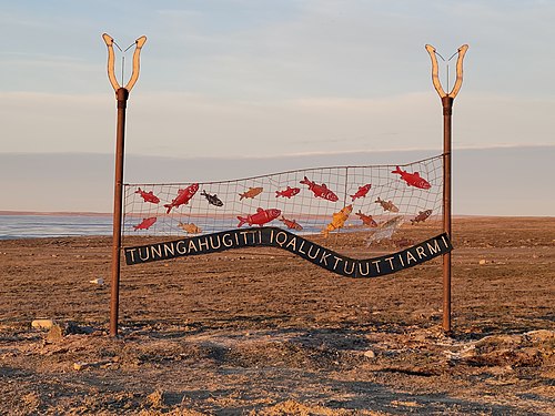
Tunngahugitti Iqaluktuuttiarmi - Welcome to Cambridge Bay

A Dorset culture stone longhouse near Cambridge Bay

Roald Amundsen's ship Maud at Cambridge Bay prior to being salvaged. This was not the ship in which Amundsen was the first to sail the Northwest Passage; that was the Gjøa.

View of the bay in front of the community, 2011