Northwest Arkansas (NWA) is a metropolitan area and region in Arkansas within the Ozark Mountains. It includes four of the ten largest cities in the state: Fayetteville, Springdale, Rogers, and Bentonville, the surrounding towns of Benton and Washington counties, and adjacent rural Madison County, Arkansas. The United States Census Bureau-defined Fayetteville–Springdale–Rogers Metropolitan Statistical Area includes 3,213.01 square miles (8,321.7 km2) and 576,403 residents, ranking NWA as the 98th most-populous metropolitan statistical area in the U.S. and the 13th fastest growing in the United States.
Image: Fayetteville, AR from I 49 (cropped)
Image: 09 02 06 RRS Ozarks
Image: Crystal Bridges at night
Image: Spring Creek Boardwalk in downtown Springdale, Arkansas
Arkansas is a landlocked state in the South Central region of the Southern United States. It borders Missouri to the north, Tennessee and Mississippi to the east, Louisiana to the south, Texas to the southwest, and Oklahoma to the west. Its name derives from the Osage language, and refers to their relatives, the Quapaw people. The state's diverse geography ranges from the mountainous regions of the Ozark and Ouachita Mountains, which make up the U.S. Interior Highlands, to the densely forested land in the south known as the Arkansas Timberlands, to the eastern lowlands along the Mississippi River and the Arkansas Delta.
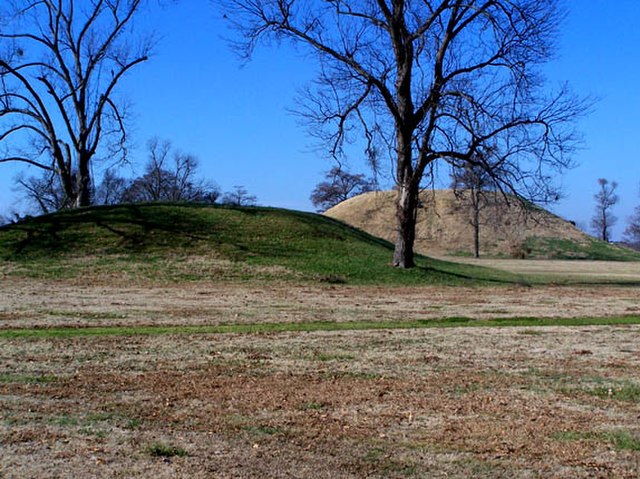
Platform mounds were constructed frequently during the Woodland and Mississippian periods.
Arkansas statehood, 100th anniversary issue; released on June 15, 1936, on the 100th anniversary of Arkansas statehood. The old state house is depicted at center, the fort surrounding the Arkansas Post at left with the present day state capitol building at right.
Lakeport Plantation, built c. 1859
Cannons at Battle of Pea Ridge site


