Occupied Enemy Territory Administration
The Occupied Enemy Territory Administration (OETA) was a joint British, French and Arab military administration over Levantine provinces of the former Ottoman Empire between 1917 and 1920, set up on 23 October 1917 following the Sinai and Palestine Campaign and Arab Revolt of World War I. Although it was declared by the British military, who were in control of the region, it was followed on 30 September 1918 by the 1918 Anglo-French Modus Vivendi in which it was agreed that the British would give the French control in certain areas, and the Hashemites were given joint control of the Eastern area per T.E. Lawrence's November 1918 "Sharifian plan".
Results of the King–Crane Commission Petitions received from OETA South (became Palestine), OETA West (became Lebanon and Western Syria) and OETA East (became Syria and Transjordan); it has been described as "the first-ever survey of Arab public opinion".
This draft British Telegram of September 1919, ordering the withdrawal of British troops from the French and Arab areas of the OETA, was prepared shortly after the Franco-British conference at Deauville. The line in point 5 became known as the "Deauville Line"
Image: Major General Sir Louis Jean Bols, KCB, DSO
Ottoman Syria refers to divisions of the Ottoman Empire within the region of Syria, usually defined as being east of the Mediterranean Sea, west of the Euphrates River, north of the Arabian Desert and south of the Taurus Mountains.
Mosque at Latakia, from Views in the Ottoman Dominions, in Europe, in Asia, and some of the Mediterranean islands (1810) illustrated by Luigi Mayer (1755–1803).
Town of Bethlehem, Ottoman Syria from an 1810 illustration by Luigi Mayer.
Tartus in Ottoman Syria, from an 1810 illustration by Luigi Mayer.
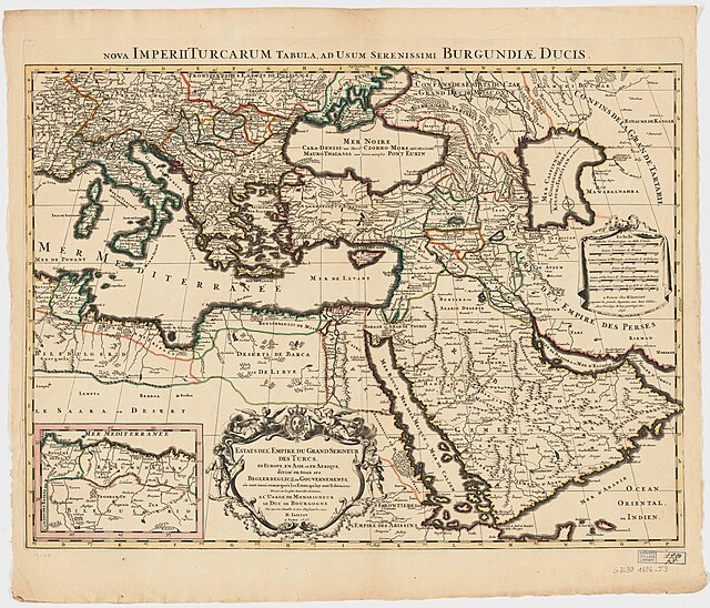
1696 (Jaillot), showing Eyalets


