Outflow channels
Videos
Photos
Outflow channels are extremely long, wide swathes of scoured ground on Mars. They extend many hundreds of kilometers in length and are typically greater than one kilometer in width. They are thought to have been carved by huge outburst floods.

Kasei Valles, seen in MOLA elevation data. Flow was from bottom left to right. North is up. Image is approx. 1,600 km (990 mi) across. The channel system extends another 1,200 km (750 mi) south of this image to Echus Chasma.
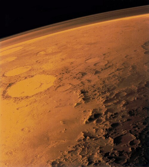
Mars
Videos
Photos
Mars is the fourth planet from the Sun. The surface of Mars is orange-red because it is covered in iron(III) oxide dust, giving it the nickname "the Red Planet". Mars is among the brightest objects in Earth's sky, and its high-contrast albedo features have made it a common subject for telescope viewing. It is classified as a terrestrial planet and is the second smallest of the Solar System's planets with a diameter of 6,779 km (4,212 mi). In terms of orbital motion, a Martian solar day (sol) is equal to 24.5 hours, and a Martian solar year is equal to 1.88 Earth years. Mars has two natural satellites that are small and irregular in shape: Phobos and Deimos.

Comparison: Earth and Mars

Curiosity's view of Martian soil and boulders after crossing the "Dingo Gap" sand dune

Valles Marineris, taken by the Viking 1 probe
Edge-on view of Mars atmosphere by Viking 1 probe