Pons Aelius
Videos
Page
Pons Aelius, or Newcastle Roman Fort, was an auxiliary castra and small Roman settlement on Hadrian's Wall in the Roman province of Britannia Inferior, situated on the north bank of the River Tyne close to the centre of present-day Newcastle upon Tyne, and occupied between the 2nd and 4th centuries AD.

An artist's impression of the fort and surrounding area from the south-east, with the Roman bridge and River Tyne in the foreground, and Hadrian's Wall in the background (far left and to the right)

An artist's impression of the fort layout, with Hadrian's Wall in the background – it is not currently known whether it was attached to the fort or not. Later the medieval Newcastle Castle was built on the same hilltop site above the River Tyne.
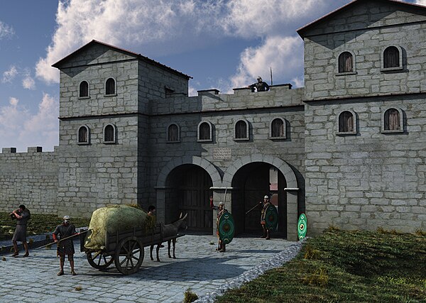
An artist's impression of the fort's gatehouse
Hadrian's Wall
Videos
Page
Hadrian's Wall is a former defensive fortification of the Roman province of Britannia, begun in AD 122 in the reign of the Emperor Hadrian. Running from Wallsend on the River Tyne in the east to Bowness-on-Solway in the west of what is now northern England, it was a stone wall with large ditches in front of it and behind it that crossed the whole width of the island. Soldiers were garrisoned along the line of the wall in large forts, smaller milecastles, and intervening turrets. In addition to the wall's defensive military role, its gates may have been customs posts.
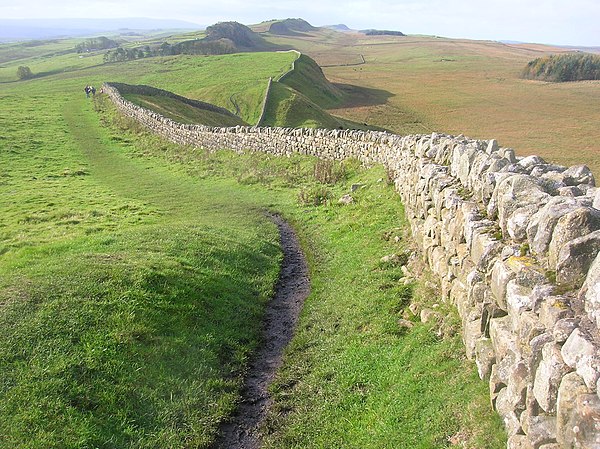
A view of Hadrian's Wall showing its length and height. The upright stones on top of it are modern, to deter people from walking on it.

Sections of Hadrian's Wall still remain, particularly in its hilly central sector. Little remains in lowland regions, where it was used as a source of stone for new buildings.

Hadrian's Wall facing east towards Crag Lough. The rocky outcrop is the Whin Sill, of volcanic origin.
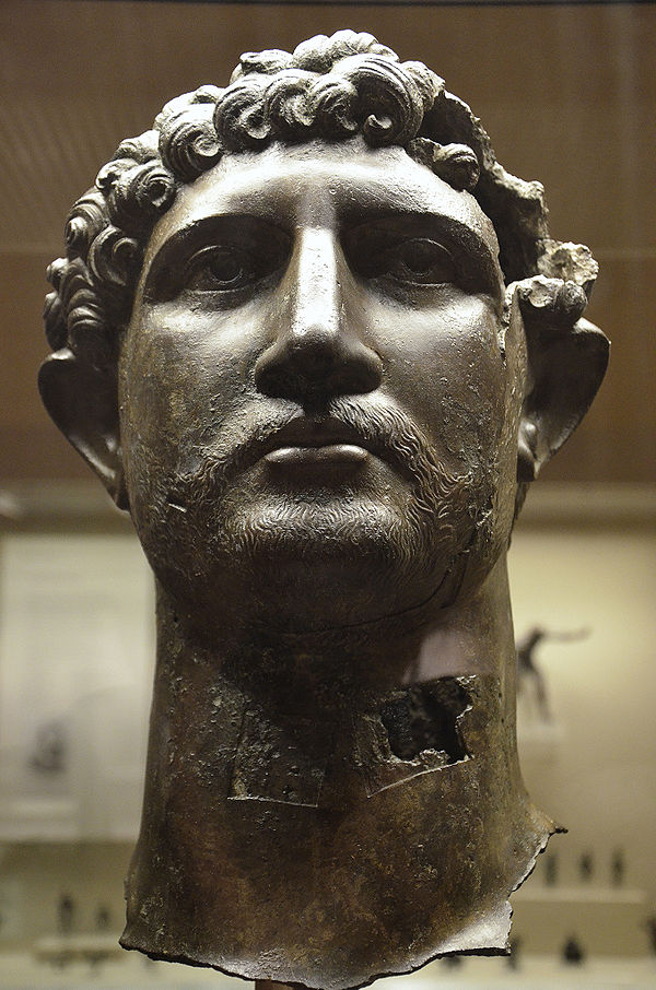
Bronze head of Hadrian, who commissioned the wall's construction, found in 1834 in the River Thames in London, around 280 miles (450 km) south of Hadrian's Wall