San Martín Base
San Martín Base is a permanent, all year-round Argentine Antarctic base and scientific research station named after General José de San Martín, the Libertador of Argentina and Perú. It is located on Marguerite Bay, Antarctic Peninsula. At the time of its foundation in 1951, it was the first human settlement south of the Antarctic Circle; as of 2014 it is Argentina's westernmost permanent base. As of 2014 San Martín is one of 13 research bases in Antarctica operated by Argentina; the increased Antarctic activity that Argentina developed since 1940, along with the longstanding national interest to exercise effective sovereignty over one of the most remote areas of Antarctica created the need for a scientific station located south of the Antarctic Circle. In order to transport the personnel and materials to Marguerite Bay, where the new settlement was to be built, the Argentine Navy hired the Santa Micaela. Commanded by Overseas Captain Santiago Farrell, it was a cargo ship belonging to the Argentine shipping company Pérez Companc S.
A.. The Santa Micaela left the port of Buenos Aires on 12 February 1951, on 8 March it anchored at Marguerite Bay; the last part of the trip it was escorted by the Argentine Navy tug ARA Sanavirón. Over twelve working days the crew built the two-story main house with double wooden walls, a main deposit, an emergency house, five metal warehouses for supplies, housing for the dog packs, a power generator and the four towers for the 25 metres high rhombic antenna. San Martín was inaugurated on 21 March 1951, in the presence of the Santa Micaela and ARA Sanavirón crews and the base personnel led by Colonel Hernán Pujato. Since the meteorological station within the base provides detailed weather records and develops forecasts indispensable for the navigation of the sea waters adjacent to the Antarctic Peninsula. On March 1952 the ARA Bahía Aguirre anchored at Marguerite Bay bringing a relief crew through a Sikorsky S-51 helicopter transfer, the first of its kind performed by the Argentine Armed Forces in Antarctica.
On 30 June 1952 a fire, exacerbated by the ongoing blizzard, devoured the main house and two food stores, the power plant and the radio station. With rationed food and fuel, activities continued carrying on with the explorations schedule as planned. During the 1952–53 season, thick ice blocked the way of relief ships, which aggravated the situation for the twenty base inhabitants. On 26 March 1953 the Argentine Air Force Avro Lincoln nicknamed Cruz del Sur airdropped food and other priceless items. Personnel at San Martín Base conducted several exploration expeditions to the northern and southern boundaries of the bay, they crossed the Antarctic Peninsula mountain range, reaching the Mobiloil Inlet on the Weddell Sea. In 1960 the base was closed. On 14 June 1962 an expedition led by First Lieutenant Gustavo Adolfo Giró Tapper left Esperanza looking for a passage that would link the village with San Martín. Using snowcats and sleigh dogs they explored Duse Bay, Prince Gustav Channel, Cape Longing, Foca Nunataks, Ameghino Peninsula, Jason Island, Cape Robinson and Carreta Bay, where they had to leave the snow cats and continue with sleds to cross the cordillera.
After reaching San Martín, they traveled back to Esperanza. During the trip the party overcame numerous obstacles and withstood temperatures below −43 °C and katabatic winds of 220 km/h; this feat is considered now as the most important made in the area. Some unused installations of the base, a cross, a flagpole and a monolith erected in 1951, have been designated as Historic Site or Monument, following a proposal by Argentina to the Antarctic Treaty Consultative Meeting. Marguerite Bay opens on the west coast of the Antarctic Peninsula. Wide and deep, the bay is closed between Belgrano and Alexander I islands, the Fallieres Coast, making its access difficult for most of the year due to the thick ice-covered waters. In this zone visited because of the difficulties and hazards for navigation, there are several groups of islands, islets and reefs that draw a network of channels and fjords frozen; some of the most important islands are the Pourquoi Pas, Herradura and Millerand, all of them next to the Debenham archipelago, where San Martín was built.
As of 2014 San Martín is composed of 14 buildings spanning a total area of 18 ha. The base has several facilities, namely: main house; the all-year capable airstrip is located on nearby Uspallata Glacier. The 20 m2 infirmary and basic operating suite is attended by a nurse. San Martín is responsible for the maintenance of several Argentine-built refuges in the area: 17 de Agosto, El Plumerillo, Paso de los Andes, Yapeyú, Maipo and Nogal de Saldán. San Martín Base in March 2011 The LASAN laboratory, managed by the Argentine Antarctic Institute, carries out active scientific research in the areas of geomagnetism, meteorology, ionospheric surveying through high altitude weather balloons, phytoplankton biology, satellite geodesy, etc. An ongoing bilateral agreement between Argentina and Germany has prompted cooperation on glacier movement observations. Refuge Ona is an Argentine Antarctic refuge installed and operated by the g
Australia
Australia the Commonwealth of Australia, is a sovereign country comprising the mainland of the Australian continent, the island of Tasmania and numerous smaller islands. It is the world's sixth-largest country by total area; the neighbouring countries are Papua New Guinea and East Timor to the north. The population of 25 million is urbanised and concentrated on the eastern seaboard. Australia's capital is Canberra, its largest city is Sydney; the country's other major metropolitan areas are Melbourne, Brisbane and Adelaide. Australia was inhabited by indigenous Australians for about 60,000 years before the first British settlement in the late 18th century, it is documented. After the European exploration of the continent by Dutch explorers in 1606, who named it New Holland, Australia's eastern half was claimed by Great Britain in 1770 and settled through penal transportation to the colony of New South Wales from 26 January 1788, a date which became Australia's national day; the population grew in subsequent decades, by the 1850s most of the continent had been explored and an additional five self-governing crown colonies established.
On 1 January 1901, the six colonies federated. Australia has since maintained a stable liberal democratic political system that functions as a federal parliamentary constitutional monarchy, comprising six states and ten territories. Being the oldest and driest inhabited continent, with the least fertile soils, Australia has a landmass of 7,617,930 square kilometres. A megadiverse country, its size gives it a wide variety of landscapes, with deserts in the centre, tropical rainforests in the north-east and mountain ranges in the south-east. A gold rush began in Australia in the early 1850s, its population density, 2.8 inhabitants per square kilometre, remains among the lowest in the world. Australia generates its income from various sources including mining-related exports, telecommunications and manufacturing. Indigenous Australian rock art is the oldest and richest in the world, dating as far back as 60,000 years and spread across hundreds of thousands of sites. Australia is a developed country, with the world's 14th-largest economy.
It has a high-income economy, with the world's tenth-highest per capita income. It is a regional power, has the world's 13th-highest military expenditure. Australia has the world's ninth-largest immigrant population, with immigrants accounting for 26% of the population. Having the third-highest human development index and the eighth-highest ranked democracy globally, the country ranks in quality of life, education, economic freedom, civil liberties and political rights, with all its major cities faring well in global comparative livability surveys. Australia is a member of the United Nations, G20, Commonwealth of Nations, ANZUS, Organisation for Economic Co-operation and Development, World Trade Organization, Asia-Pacific Economic Cooperation, Pacific Islands Forum and the ASEAN Plus Six mechanism; the name Australia is derived from the Latin Terra Australis, a name used for a hypothetical continent in the Southern Hemisphere since ancient times. When Europeans first began visiting and mapping Australia in the 17th century, the name Terra Australis was applied to the new territories.
Until the early 19th century, Australia was best known as "New Holland", a name first applied by the Dutch explorer Abel Tasman in 1644 and subsequently anglicised. Terra Australis still saw occasional usage, such as in scientific texts; the name Australia was popularised by the explorer Matthew Flinders, who said it was "more agreeable to the ear, an assimilation to the names of the other great portions of the earth". The first time that Australia appears to have been used was in April 1817, when Governor Lachlan Macquarie acknowledged the receipt of Flinders' charts of Australia from Lord Bathurst. In December 1817, Macquarie recommended to the Colonial Office. In 1824, the Admiralty agreed that the continent should be known by that name; the first official published use of the new name came with the publication in 1830 of The Australia Directory by the Hydrographic Office. Colloquial names for Australia include "Oz" and "the Land Down Under". Other epithets include "the Great Southern Land", "the Lucky Country", "the Sunburnt Country", "the Wide Brown Land".
The latter two both derive from Dorothea Mackellar's 1908 poem "My Country". Human habitation of the Australian continent is estimated to have begun around 65,000 to 70,000 years ago, with the migration of people by land bridges and short sea-crossings from what is now Southeast Asia; these first inhabitants were the ancestors of modern Indigenous Australians. Aboriginal Australian culture is one of the oldest continual civilisations on earth. At the time of first European contact, most Indigenous Australians were hunter-gatherers with complex economies and societies. Recent archaeological finds suggest. Indigenous Australians have an oral culture with spiritual values based on reverence for the land and a belief in the Dreamtime; the Torres Strait Islanders, ethnically Melanesian, obtained their livelihood from seasonal horticulture and the resources of their reefs and seas. The northern coasts and waters of Australia were visited s
Sunshine duration
Sunshine duration or sunshine hours is a climatological indicator, measuring duration of sunshine in given period for a given location on Earth expressed as an averaged value over several years. It is a general indicator of cloudiness of a location, thus differs from insolation, which measures the total energy delivered by sunlight over a given period. Sunshine duration is expressed in hours per year, or in hours per day; the first measure indicates the general sunniness of a location compared with other places, while the latter allows for comparison of sunshine in various seasons in the same location. Another often-used measure is percentage ratio of recorded bright sunshine duration and daylight duration in the observed period. An important use of sunshine duration data is to characterize the climate of sites of health resorts; this takes into account the psychological effect of strong solar light on human well-being. It is used to promote tourist destinations. If the Sun were to be above the horizon 50% of the time for a standard year consisting of 8,760 hours, apparent maximal daytime duration would be 4,380 hours for any point on Earth.
However, there are physical and astronomical effects. Namely, atmospheric refraction allows the Sun to be still visible when it physically sets below the horizon. For that reason, average daytime is longest in polar areas, where the apparent Sun spends the most time around the horizon. Places on the Arctic Circle have the longest total annual daytime, 4,647 hours, while the North Pole receives 4,575; because of elliptic nature of the Earth's orbit, the Southern Hemisphere is not symmetrical: the Antarctic Circle, with 4,530 hours of daylight, receives five days less of sunshine than its antipodes. The Equator has a total daytime of 4,422 hours per year. Given the theoretical maximum of daytime duration for a given location, there is a practical consideration at which point the amount of daylight is sufficient to be treated as a "sunshine hour". "Bright" sunshine hours represent the total hours when the sunlight is stronger than a specified threshold, as opposed to just "visible" hours. "Visible" sunshine, for example, occurs around sunrise and sunset, but is not strong enough to excite the sensor.
Measurement is performed by instruments called sunshine recorders. For the specific purpose of sunshine duration recording, Campbell–Stokes recorders are used, which use a spherical glass lens to focus the sun rays on a specially designed tape; when the intensity exceeds a pre-determined threshold, the tape burns. The total length of the burn trace is proportional to the number of bright hours. Another type of recorder is the Jordan sunshine recorder. Newer, electronic recorders have more stable sensitivity than that of the paper tape. In order to harmonize the data measured worldwide, in 1962 the World Meteorological Organization defined a standardized design of the Campbell–Stokes recorder, called an Interim Reference Sunshine Recorder. In 2003, the sunshine duration was defined as the period during which direct solar irradiance exceeds a threshold value of 120 W/m². Sunshine duration follows a general geographic pattern: subtropical latitudes have the highest sunshine values, because these are the locations of the eastern sides of the subtropical high pressure systems, associated with the large-scale descent of air from the upper-level tropopause.
Many of the world's driest climates are found adjacent to the eastern sides of the subtropical highs, which create stable atmospheric conditions, little convective overturning, little moisture and cloud cover. Desert regions, with nearly constant high pressure aloft and rare condensation—like North Africa, the Southwestern United States, Western Australia, the Middle East—are examples of hot, dry climates where sunshine duration values are high; the two major areas with the highest sunshine duration, measured as annual average, are the central and the eastern Sahara Desert—covering vast desert countries such as Egypt, Libya and Niger—and the Southwestern United States. The city claiming the official title of the sunniest in the world is Yuma, with over 4,000 hours of bright sunshine annually, but many climatological books suggest there may be sunnier areas in North Africa. In the belt encompassing northern Chad and the Tibesti Mountains, northern Sudan, southern Libya, Upper Egypt, annual sunshine duration is estimated at over 4,000 hours.
There is a smaller, isolated area of sunshine maximum in the heart of the western section of the Sahara Desert around the Eglab Massif and the Erg Chech, along the borders of Algeria and Mali where the 4,000-hour mark is exceeded, too. Some places in the interior of the Arabian Peninsula receive 3,600–3,800 hours of bright sunshine annually; the largest sun-baked region in the world is North Africa. The sunniest month in the world is December in Eastern Antarctica, with 23 hours of bright sun daily. Conversely, higher latitudes lying in stormy westerlies have much cloudier and more unstable and rainy weather, have the lowest values of sunshine duration annually. Temperate oceanic climates like those in northwestern Europe, the western coast of Canada, areas of New Zealand's South Island are examples of cool, wet, humid climates where cloudless sunshine duration values are low; the areas with the lowest sunshine duration annually lie over the polar oceans, as well as parts of northern Europe, southern Alaska, northern Russia, areas near the Sea of
Precipitation
In meteorology, precipitation is any product of the condensation of atmospheric water vapor that falls under gravity. The main forms of precipitation include drizzle, sleet, snow and hail. Precipitation occurs when a portion of the atmosphere becomes saturated with water vapor, so that the water condenses and "precipitates", thus and mist are not precipitation but suspensions, because the water vapor does not condense sufficiently to precipitate. Two processes acting together, can lead to air becoming saturated: cooling the air or adding water vapor to the air. Precipitation forms as smaller droplets coalesce via collision with other rain drops or ice crystals within a cloud. Short, intense periods of rain in scattered locations are called "showers."Moisture, lifted or otherwise forced to rise over a layer of sub-freezing air at the surface may be condensed into clouds and rain. This process is active when freezing rain occurs. A stationary front is present near the area of freezing rain and serves as the foci for forcing and rising air.
Provided necessary and sufficient atmospheric moisture content, the moisture within the rising air will condense into clouds, namely stratus and cumulonimbus. The cloud droplets will grow large enough to form raindrops and descend toward the Earth where they will freeze on contact with exposed objects. Where warm water bodies are present, for example due to water evaporation from lakes, lake-effect snowfall becomes a concern downwind of the warm lakes within the cold cyclonic flow around the backside of extratropical cyclones. Lake-effect snowfall can be locally heavy. Thundersnow is possible within lake effect precipitation bands. In mountainous areas, heavy precipitation is possible where upslope flow is maximized within windward sides of the terrain at elevation. On the leeward side of mountains, desert climates can exist due to the dry air caused by compressional heating. Most precipitation is caused by convection; the movement of the monsoon trough, or intertropical convergence zone, brings rainy seasons to savannah climes.
Precipitation is a major component of the water cycle, is responsible for depositing the fresh water on the planet. 505,000 cubic kilometres of water falls as precipitation each year. Given the Earth's surface area, that means the globally averaged annual precipitation is 990 millimetres, but over land it is only 715 millimetres. Climate classification systems such as the Köppen climate classification system use average annual rainfall to help differentiate between differing climate regimes. Precipitation may occur on other celestial bodies, e.g. when it gets cold, Mars has precipitation which most takes the form of frost, rather than rain or snow. Precipitation is a major component of the water cycle, is responsible for depositing most of the fresh water on the planet. 505,000 km3 of water falls as precipitation each year, 398,000 km3 of it over the oceans. Given the Earth's surface area, that means the globally averaged annual precipitation is 990 millimetres. Mechanisms of producing precipitation include convective and orographic rainfall.
Convective processes involve strong vertical motions that can cause the overturning of the atmosphere in that location within an hour and cause heavy precipitation, while stratiform processes involve weaker upward motions and less intense precipitation. Precipitation can be divided into three categories, based on whether it falls as liquid water, liquid water that freezes on contact with the surface, or ice. Mixtures of different types of precipitation, including types in different categories, can fall simultaneously. Liquid forms of precipitation include drizzle. Rain or drizzle that freezes on contact within a subfreezing air mass is called "freezing rain" or "freezing drizzle". Frozen forms of precipitation include snow, ice needles, ice pellets and graupel; the dew point is the temperature to which a parcel must be cooled in order to become saturated, condenses to water. Water vapor begins to condense on condensation nuclei such as dust and salt in order to form clouds. An elevated portion of a frontal zone forces broad areas of lift, which form clouds decks such as altostratus or cirrostratus.
Stratus is a stable cloud deck which tends to form when a cool, stable air mass is trapped underneath a warm air mass. It can form due to the lifting of advection fog during breezy conditions. There are four main mechanisms for cooling the air to its dew point: adiabatic cooling, conductive cooling, radiational cooling, evaporative cooling. Adiabatic cooling occurs when air expands; the air can rise due to convection, large-scale atmospheric motions, or a physical barrier such as a mountain. Conductive cooling occurs when the air comes into contact with a colder surface by being blown from one surface to another, for example from a liquid water surface to colder land. Radiational cooling occurs due to the emission of infrared radiation, either by the air or by the surface underneath. Evaporative cooling occurs when moisture is added to the air through evaporation, which forces the air temperature to cool to its wet-bulb temperature, or until it reaches saturation; the main ways water vapor is added to the air are: wind convergence into areas of upward motion, precipitation or virga falling from above, daytime heating evaporating water from the surface of oceans, water bodies or wet lan
Instituto Antártico Argentino
The Instituto Antártico Argentino is the Argentine federal agency in charge of orientating, controlling and performing scientific and technical research and studies in the Antarctic. Known as Argentine Antarctica the country claimed a sector as part of its national territory consisting of the Antarctic Peninsula and a triangular section extending to the South Pole, is delimited by the 25° West and 74° West meridians and the 60° South parallel. Administratively, Argentine Antarctica is a department of the province of Tierra del Fuego and South Atlantic Islands; this sector overlaps with Chilean and British claims but, under the Antarctic Treaty System, there are no attempts by Argentina or any other country to enforce territorial claims in Antarctica. According to the principles of its creation, the Instituto Antártico Argentino participates with its scientific and administrative staff, in a wide range of national and international programmes for a better understanding of the Antarctic. Scientists are trained and deployed on Argentine bases for researching on different fields of science, including Atmosphere, Oceanography, Chemistry, Ozone Layer, Global warming and CO2.
José María Sobral, considered in Argentina the father of the Argentine Antarctica and a national hero, began exploration at the end of 1901. In 1903, the Argentine Navy corvette ARA Uruguay commanded by Captain de Corbeta Julián Irízar rescued the Swedish expedition team of Otto Nordenskjöld. In 1904 the Argentine permanent presence in Antarctica began with the opening of Orcadas Base on Laurie Island. Argentina was the only nation to have an Antarctic base for 40 years until the British built a base on the same islands. On April 1, 1940, the first radio communication by radio hams was made between Orcadas Base and Buenos Aires. On February 7, 1942, an amphibious Stearman aircraft embarked on the ARA 1 de Mayo cargo ship made the first Argentine flight over Antarctica. On December 13, 1947 an Argentine Naval Aviation Douglas DC-4 piloted by Comodoro Gregorio Portillo flew over the Antarctic Circle in a 15 hours and 30 minutes flight. On 17 April 1951, Hernán Pujato founds the Instituto Antartico Argentino, by Decree Nº 7338.
In 1953 the San Martín Base started operations, Jubany base opened two years later. In 1958 the United States handed over the Ellsworth Station located in the Weddell Sea. In 1965 the Argentine military conducted a land military manoeuvre known as Operación 90 in order to reach the South Pole. In the winter of 1968 at the request by the British embassy in Buenos Aires, an Argentine Navy Douglas DC-4 delivered medical supplies to the British base EFE where one of its members, James K. Portwirie, was through a medical emergency. However, after a few days, Portwirie's situation worsened. An Argentine Air Force aircraft crashed without casualties. On August 9, in the middle of the Antarctic winter, the Argentine Navy icebreaker ARA General San Martín was sent to rescue Portwirie; the operation was successful, gaining the thanks of the British Antarctic Survey: ‘‘an internal campaign like this was never attempted before in Antarctic History‘‘. Marambio Base was founded in 1969 the most important Argentine base on the Antarctica.
In 1975 the Esperanza Base was built, in 1979 the General Belgrano II. In 1978, the first Antarctic baby, Emilio Palma, was born in the Fortín Sargento Cabral at the Esperanza Base. In 2002, the Argentine Navy mounted an internal operation sending Icebreaker ARA Almirante Irizar to rescue the trapped supply vessel Magdalena Oldendorff. Though Irízar failed to break the Oldendorff free, she managed to move it to a safe position and re-supply the ship with food and medical personnel until the ice melted and the ship could return to open sea. In 2003, under the Decree Nº 207/2003 issued by the Executive Power of Argentina, the Instituto Antártico Argentino became a part of the Ministry of Foreign Affairs On the 2009 summer campaign, the Argentine Air Force operated the Teniente Matienzo Base only with women for three months although there was an emergency link available with the Bell 212s helicopters stationed at Marambio Base On 2010 a Wind generator designed and built by Argentine government company CITEDEF was installed on Marambio Base On 2011, three heavy lift helicopters were deployed in the Base Marambio: two Mil Mi 17 helicopters, the remaining Chinook from the Argentine Air Force.
Viviana Alder Argentine Antarctica History ARA San Martin Icebreaker official site official site
Kerguelen Islands
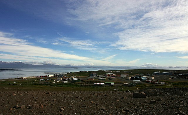
The Kerguelen Islands known as the Desolation Islands, are a group of islands in the Antarctic constituting one of the two exposed parts of the Kerguelen Plateau, a large igneous province submerged by the southern Indian Ocean. They are among the most isolated places on Earth, located 450 km northwest of the uninhabited Heard Island and McDonald Islands and more than 3,300 km from Madagascar, the nearest populated location; the islands, along with Adélie Land, the Crozet Islands and Saint Paul Islands, France's Scattered Islands in the Indian Ocean, are part of the French Southern and Antarctic Lands and are administered as a separate district. The main island, Grande Terre, is 6,675 km2 in area and is surrounded by a further 300 smaller islands and islets, forming an archipelago of 7,215 km2; the climate is chilly with frequent high winds throughout the year. The surrounding seas are rough and they remain ice-free year-round. There are no indigenous inhabitants, but France maintains a permanent presence of 45 to 100 soldiers, scientists and researchers.
There are no airports on the islands, so all travel and transport from the outside world is conducted by ship. Kerguelen Islands appear as the "Ile de Nachtegal" on Philippe Buache's map from 1754 before the island was discovered in 1772; the Buache map has the title Carte des Terres Australes comprises entre le Tropique du Capricorne et le Pôle Antarctique où se voyent les nouvelles découvertes faites en 1739 au Sud du Cap de Bonne Esperance. It is possible. On the Buache map, "Ile de Nachtegal" is located at 43°S, 72°E, about 6 degrees north and 2 degrees east of the accepted location of Grande Terre; the islands were discovered by the French navigator Yves-Joseph de Kerguelen-Trémarec on 12 February 1772. The next day Charles de Boisguehenneuc claimed the island for the French crown. Yves de Kerguelen organised a second expedition in 1773 and arrived at the "baie de l'Oiseau" by December of the same year. On 6 January 1774 he commanded his lieutenant, Henri Pascal de Rochegude, to leave a message notifying any passers-by of the two passages and of the French claim to the islands.
Thereafter, a number of expeditions visited the islands, including that of Captain James Cook in December 1776 during his third voyage, who verified and confirmed the passage of de Kerguelen by discovering and annotating the message left by the French navigator. Soon after their discovery, the archipelago was visited by whalers and sealers who hunted the resident populations of whales and seals to the point of near extinction, including fur seals in the 18th century and elephant seals in the 19th century; the sealing era lasted from 1781 to 1922 during which time 284 sealing visits are recorded, nine of which ended when the vessel was wrecked. Modern industrial sealing, associated with whaling stations, occurred intermittently between 1908 and 1956. Since the end of the whaling and sealing era, most of the islands' species have been able to increase their population again. Relics of the sealing period include trypots, hut ruins and inscriptions. In 1800, Hillsborough spent eight months whaling around the islands.
During this time Captain Robert Rhodes, her master, prepared a chart of the islands. That vessel returned to London in April 1801 with 450 tuns of sea elephant oil. In 1825, the British sealer John Nunn and three crew members from Favourite were shipwrecked on Kerguelen until they were rescued in 1827 by Captain Alexander Distant during his hunting campaign; the islands were not surveyed until the Ross expedition of 1840. The Australian James Kerguelen Robinson was the first human born south of the Antarctic Convergence, on board the sealing ship Offley in Gulf of Morbihan, Kerguelen Island on 11 March 1859. For the 1874 transit of Venus, George Biddell Airy at the Royal Observatory of the UK organised and equipped five expeditions to different parts of the world. Three of these were sent to the Kerguelen Islands; the Reverend Stephen Joseph Perry led the British expeditions to the Kerguelen Islands. He set up his main observation station at Observatory Bay and two auxiliary stations, one at Thumb Peak led by Sommerville Goodridge, the second at Supply Bay led by Cyril Corbet.
Observatory Bay was used by the German Antarctic Expedition led by Erich Dagobert von Drygalski in 1902–03. In January 2007, an archaeological excavation of this site was carried out. In 1874–1875, German and U. S. expeditions visited Kerguelen to observe the transit of Venus. In 1877 the French started a coal mining operation. In response to German operations in the area, France reasserted its sovereignty on the Kerguelen Islands, along with the islands of Amsterdam and St Paul, the Crozet archipelago in 1893, decided to administer these territories from Madagascar in 1924 (in addition to that portion of Antarctica claimed by France and known as Adélie Land.
Antarctic field camps
Many Antarctic research stations support satellite field camps which are, in general, seasonal camps. The type of field camp can vary – some are permanent structures used during the annual Antarctic summer, whereas others are little more than tents used to support short term activities. Field camps are used from logistics to dedicated scientific research. Research stations in Antarctica Demographics of Antarctica List of Antarctic expeditions Transport in Antarctica COMNAP Antarctic Facilities COMNAP Antarctic Facilities Map Antarctic Digital Database Map Viewer SCAR