Portolan chart
Videos
Page
Portolan charts are nautical charts, first made in the 13th century in the Mediterranean basin and later expanded to include other regions. The word portolan comes from the Italian portolano, meaning "related to ports or harbors", and which since at least the 17th century designates "a collection of sailing directions".
The oldest original cartographic artifact in the Library of Congress: a portolan nautical chart of the Mediterranean Sea. Second quarter of the 14th century.

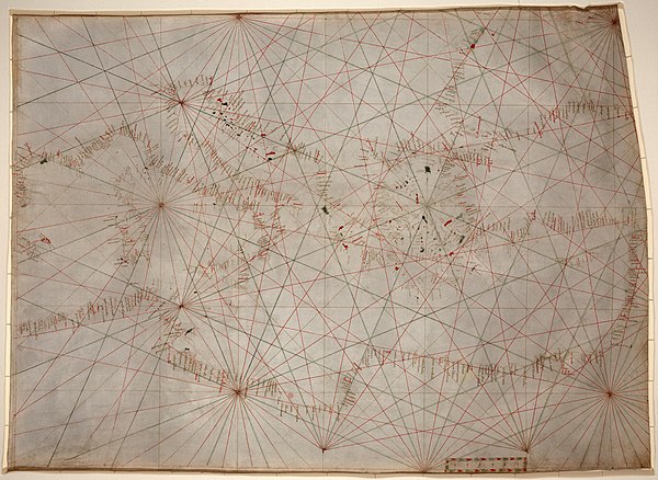
1439 portolan chart by Gabriel de Vallseca (Museu Maritim, Barcelona)
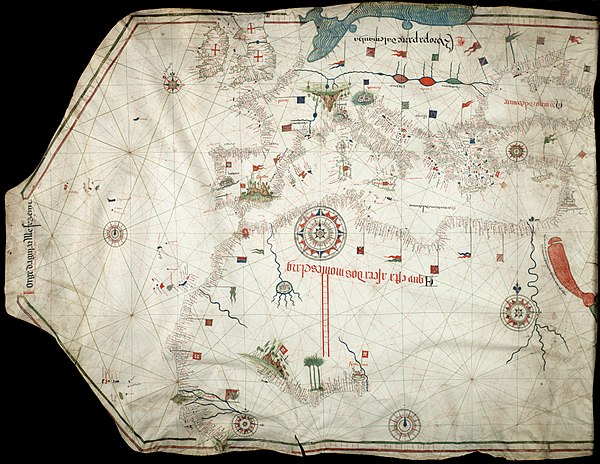
Portolan chart by Jorge de Aguiar (1492), the oldest known signed and dated chart of Portuguese origin (Beinecke Rare Book and Manuscript Library, Yale University, New Haven, USA)
Nautical chart
Videos
Page
A nautical chart or hydrographic chart is a graphic representation of a sea region or water body and adjacent coasts or banks. Depending on the scale of the chart, it may show depths of water (bathymetry) and heights of land (topography), natural features of the seabed, details of the coastline, navigational hazards, locations of natural and human-made aids to navigation, information on tides and currents, local details of the Earth's magnetic field, and human-made structures such as harbours, buildings, and bridges. Nautical charts are essential tools for marine navigation; many countries require vessels, especially commercial ships, to carry them. Nautical charting may take the form of charts printed on paper or computerized electronic navigational charts. Recent technologies have made available paper charts which are printed "on demand" with cartographic data that has been downloaded to the commercial printing company as recently as the night before printing. With each daily download, critical data such as Local Notices to Mariners are added to the on-demand chart files so that these charts are up to date at the time of printing.
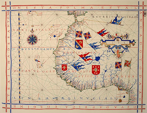
A pre-Mercator nautical chart of 1571, from Portuguese cartographer Fernão Vaz Dourado (c. 1520 – c. 1580). It belongs to the so-called plane chart model, where observed latitudes and magnetic directions are plotted directly into the plane, with a constant scale, as if the Earth's surface were a flat plane (Portuguese National Archives of Torre do Tombo, Lisbon)

Automatically labeled nautical chart