The Red River Trails were a network of ox cart routes connecting the Red River Colony and Fort Garry in British North America with the head of navigation on the Mississippi River in the United States. These trade routes ran from the location of present-day Winnipeg in the Canadian province of Manitoba across the Canada–United States border, and thence by a variety of routes through what is now the eastern part of North Dakota and western and central Minnesota to Mendota and Saint Paul, Minnesota on the Mississippi.
Métis drivers and ox carts at a rest stop
Fur trader and cart train operator Norman Kittson
An ox cart seen at the end of the trail in Saint Paul
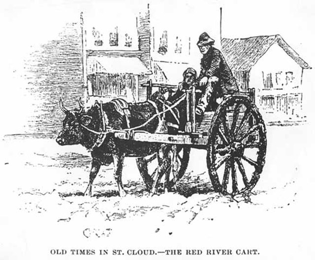
Red River cart at Saint Cloud
The Red River cart is a large two-wheeled cart made entirely of non-metallic materials. Often drawn by oxen, though also by horses or mules, these carts were used throughout most of the 19th century in the fur trade and in westward expansion in Canada and the United States, in the area of the Red River and on the plains west of the Red River Colony. The cart is a simple conveyance developed by Métis for use in their settlement on the Red River in what later became Manitoba. With carts, the Metis were not restricted to river travel to hunt bison. The Red River cart was largely responsible for commercializing the buffalo hunt.
Red River cart being repaired
Red River ox cart at a railway station
Métis trade caravan
Full size Red River cart replica in front of Pembina Hall at the University of Alberta