The River Neckinger is a reduced subterranean river that rises in Southwark and flows approximately 2.5 kilometres through that part of London to St Saviour's Dock where it enters the Thames. What remains of the river is enclosed and runs underground and most of its narrow catchment has been diverted into other combined and surface water sewers, flowing into the Southern Outfall Sewer and the Thames, respectively.
St Saviour's Dock is a deep-excavated and embanked inlet where the vestiges of the Neckinger meet the River Thames. Here the inlet divides the riverside districts of Shad Thames and Jacob's Island.
1813 engraving of Chapel of the Hospital for Lepers in Kent Street, Southwark, called Le Lock. The upper section of the Neckinger passed by the hospital site and was known as Lock Stream.
1820 engraving of the bridge and turnpike of Grange Road (now Grange Walk) over the River Neckinger.
Southwark is a district of Central London situated on the south bank of the River Thames, forming the north-western part of the wider modern London Borough of Southwark. The district, which is the oldest part of South London, developed due to its position at the southern end of the early versions of London Bridge, for centuries the only dry crossing on the river. Around 43 AD, engineers of the Roman Empire found the geographic features of the south bank here suitable for the placement and construction of the first bridge.
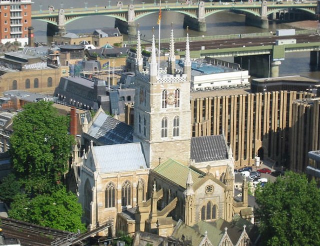
Southwark Cathedral, also called St Saviour's, for centuries known as St Mary's Overy, or Overie (short for "over-the-river")
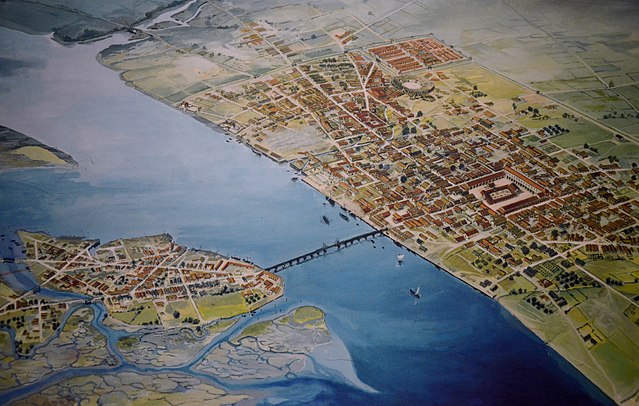
London in 120 AD, showing the original high-tide waterline around Southwark, to the left (south)
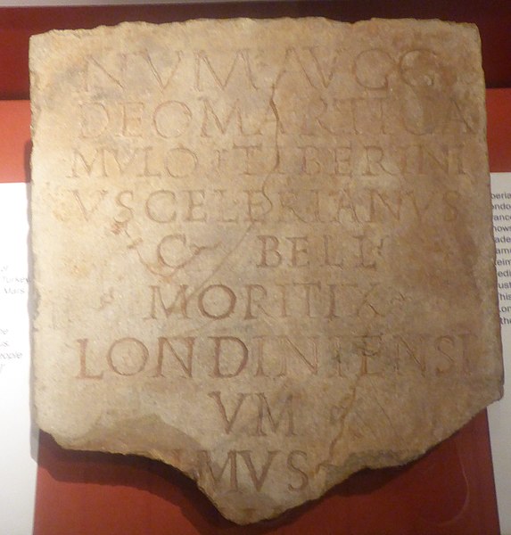
Museum of London, inscription on a stele that mentions 'Londoners' for the first time
St Olaf House, Southwark. Olaf, (or Olave), helped the English retake London Bridge, and with it London, from his fellow Norsemen.