SHARAD
Videos
Photos
SHARAD is a subsurface sounding radar embarked on the Mars Reconnaissance Orbiter (MRO) probe. It complements the MARSIS radar on Mars Express orbiter, providing lower penetration capabilities but much finer resolution.

Schematic view of SHARAD operation on Mars Reconnaissance Orbiter

Radargram of north pole layered deposits from SHARAD shallow ground-penetrating radar on Mars Reconnaissance Orbiter

Martian terrain

SHARAD finds ice by measuring its radar returns from the surface and from a deeper lower surface. The depth to the lower surface was found from HiRISE images of gaps in the surface.
Mars Reconnaissance Orbiter
Videos
Photos
The Mars Reconnaissance Orbiter (MRO) is a spacecraft designed to search for the existence of water on Mars and provide support for missions to Mars, as part of NASA's Mars Exploration Program. It was launched from Cape Canaveral on August 12, 2005, at 11:43 UTC and reached Mars on March 10, 2006, at 21:24 UTC. In November 2006, after six months of aerobraking, it entered its final science orbit and began its primary science phase.

Mars Reconnaissance Orbiter spacecraft
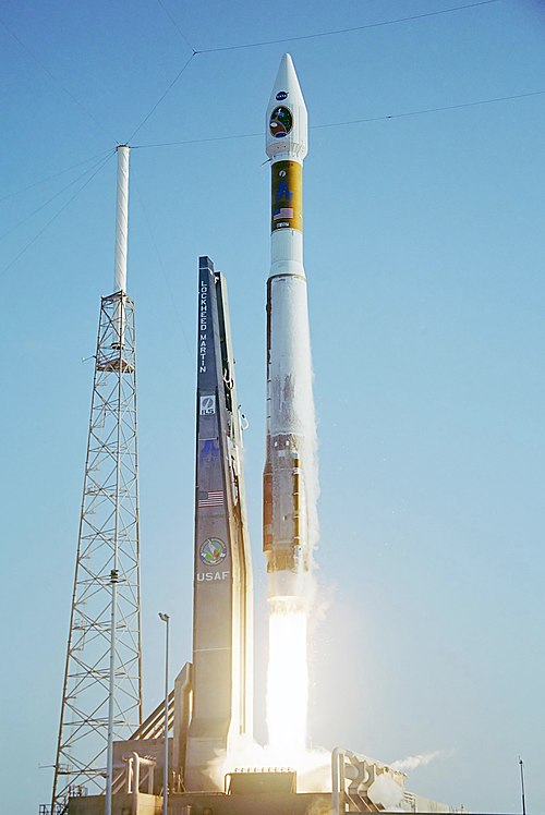
Launch of Atlas V carrying the MRO, 11:43:00 UTC August 12, 2005

Artwork of MRO aerobraking

Tectonic fractures within the Candor Chasma region of Valles Marineris, Mars, retain ridge-like shapes as the surrounding bedrock erodes away.