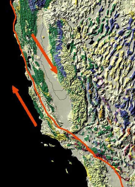
The San Andreas Fault is a continental right-lateral strike-slip transform fault that extends roughly 1,200 kilometers (750 mi) through the U.S. state of California. It forms part of the tectonic boundary between the Pacific Plate and the North American Plate. Traditionally, for scientific purposes, the fault has been classified into three main segments, each with different characteristics and a different degree of earthquake risk. The average slip rate along the entire fault ranges from 20 to 35 mm per year.
The fault (right) and the Carrizo Plain (left)
Arrows show relative motion of the North American Plate (southeastward) and the Pacific Plate (northwestward)
Aerial photo of the San Andreas Fault in the Carrizo Plain
The Vasquez Rocks in Agua Dulce, California are evidence of the San Andreas Fault and part of the 2,650-mile Pacific Crest Trail.
A transform fault or transform boundary, is a fault along a plate boundary where the motion is predominantly horizontal. It ends abruptly where it connects to another plate boundary, either another transform, a spreading ridge, or a subduction zone. A transform fault is a special case of a strike-slip fault that also forms a plate boundary.
The Southern Alps rise dramatically beside the Alpine Fault on New Zealand's West Coast. About 500 kilometres (300 mi) long; northwest at top.


