1.
Geographic coordinate system
–
A geographic coordinate system is a coordinate system used in geography that enables every location on Earth to be specified by a set of numbers, letters or symbols. The coordinates are chosen such that one of the numbers represents a vertical position. A common choice of coordinates is latitude, longitude and elevation, to specify a location on a two-dimensional map requires a map projection. The invention of a coordinate system is generally credited to Eratosthenes of Cyrene. Ptolemy credited him with the adoption of longitude and latitude. Ptolemys 2nd-century Geography used the prime meridian but measured latitude from the equator instead. Mathematical cartography resumed in Europe following Maximus Planudes recovery of Ptolemys text a little before 1300, in 1884, the United States hosted the International Meridian Conference, attended by representatives from twenty-five nations. Twenty-two of them agreed to adopt the longitude of the Royal Observatory in Greenwich, the Dominican Republic voted against the motion, while France and Brazil abstained. France adopted Greenwich Mean Time in place of local determinations by the Paris Observatory in 1911, the latitude of a point on Earths surface is the angle between the equatorial plane and the straight line that passes through that point and through the center of the Earth. Lines joining points of the same latitude trace circles on the surface of Earth called parallels, as they are parallel to the equator, the north pole is 90° N, the south pole is 90° S. The 0° parallel of latitude is designated the equator, the plane of all geographic coordinate systems. The equator divides the globe into Northern and Southern Hemispheres, the longitude of a point on Earths surface is the angle east or west of a reference meridian to another meridian that passes through that point. All meridians are halves of great ellipses, which converge at the north and south poles, the prime meridian determines the proper Eastern and Western Hemispheres, although maps often divide these hemispheres further west in order to keep the Old World on a single side. The antipodal meridian of Greenwich is both 180°W and 180°E, the combination of these two components specifies the position of any location on the surface of Earth, without consideration of altitude or depth. The grid formed by lines of latitude and longitude is known as a graticule, the origin/zero point of this system is located in the Gulf of Guinea about 625 km south of Tema, Ghana. To completely specify a location of a feature on, in, or above Earth. Earth is not a sphere, but a shape approximating a biaxial ellipsoid. It is nearly spherical, but has an equatorial bulge making the radius at the equator about 0. 3% larger than the radius measured through the poles, the shorter axis approximately coincides with the axis of rotation
2.
French language
–
French is a Romance language of the Indo-European family. It descended from the Vulgar Latin of the Roman Empire, as did all Romance languages, French has evolved from Gallo-Romance, the spoken Latin in Gaul, and more specifically in Northern Gaul. Its closest relatives are the other langues doïl—languages historically spoken in northern France and in southern Belgium, French was also influenced by native Celtic languages of Northern Roman Gaul like Gallia Belgica and by the Frankish language of the post-Roman Frankish invaders. Today, owing to Frances past overseas expansion, there are numerous French-based creole languages, a French-speaking person or nation may be referred to as Francophone in both English and French. French is a language in 29 countries, most of which are members of la francophonie. As of 2015, 40% of the population is in Europe, 35% in sub-Saharan Africa, 15% in North Africa and the Middle East, 8% in the Americas. French is the fourth-most widely spoken mother tongue in the European Union, 1/5 of Europeans who do not have French as a mother tongue speak French as a second language. As a result of French and Belgian colonialism from the 17th and 18th century onward, French was introduced to new territories in the Americas, Africa, most second-language speakers reside in Francophone Africa, in particular Gabon, Algeria, Mauritius, Senegal and Ivory Coast. In 2015, French was estimated to have 77 to 110 million native speakers, approximately 274 million people are able to speak the language. The Organisation internationale de la Francophonie estimates 700 million by 2050, in 2011, Bloomberg Businessweek ranked French the third most useful language for business, after English and Standard Mandarin Chinese. Under the Constitution of France, French has been the language of the Republic since 1992. France mandates the use of French in official government publications, public education except in specific cases, French is one of the four official languages of Switzerland and is spoken in the western part of Switzerland called Romandie, of which Geneva is the largest city. French is the language of about 23% of the Swiss population. French is also a language of Luxembourg, Monaco, and Aosta Valley, while French dialects remain spoken by minorities on the Channel Islands. A plurality of the worlds French-speaking population lives in Africa and this number does not include the people living in non-Francophone African countries who have learned French as a foreign language. Due to the rise of French in Africa, the total French-speaking population worldwide is expected to reach 700 million people in 2050, French is the fastest growing language on the continent. French is mostly a language in Africa, but it has become a first language in some urban areas, such as the region of Abidjan, Ivory Coast and in Libreville. There is not a single African French, but multiple forms that diverged through contact with various indigenous African languages, sub-Saharan Africa is the region where the French language is most likely to expand, because of the expansion of education and rapid population growth
3.
Flag of Senegal
–
The flag of Senegal is a tricolour consisting of three vertical green, yellow and red bands charged with a five-pointed green star at the centre. Adopted in 1960 to replace the flag of the Mali Federation, the present and previous flags were inspired by French Tricolour, which flew over Senegal until 1960. With the rise of the movement in Africa, the French were obliged to grant limited autonomy to Senegal as a self-governing republic within the French Community. Senegal was combined with French Soudan on April 4,1959 and that day, a new flag was adopted, a vertical green, yellow and red tricolour with a stylized depiction of a human being on the centre band. The federation attained independence from France on June 20,1960, the federation between the two former colonies did not last long and ended two months after independence. On August 20, Senegal separated from the federation and became an independent country, the new nations flag kept the colours and stripes of the federations flag, with the only change being the replacement of the kanaga with a green star. Niasse again produced what he flaunted as a document signed by the head of state. with a golden baobab instead of the green star. Niasse himself stated Only the Senegalese people is sovereign to decide any modification of the symbols of our Republic, much symbolism and many connotations are beholden to the stripes and singular star of the Senegalese flag. From a national perspective, green is highly symbolic within all of the primary religions. Additionally, yellow is denoted as the colour of arts, literature, red recalls the colour of blood, therefore colour of life and the sacrifice accepted by the nation, and also of the strong determination to fight against underdevelopment. Green, yellow and red are the colours of the Pan-Africanist movement and that pattern was replicated on Senegals flag as a sign of unity among African countries. The quinary points of the star are said to recall the human ideogram which was displayed in the middle of the flag of the former Mali Federation, the Pan-Africanist colours of Senegals flag is shared by several other countries in the region, including Cameroon, Guinea and Mali
4.
Coat of arms of Senegal
–
Adopted five years after Senegal gained independence, it has been the coat of arms of the Republic of Senegal since 1965. Both symbols on the shield had featured previously on earlier Senegalese emblems, Senegal gained independence on 20 August 1960, when it separated from the Mali Federation and became an independent country on its own. It took approximately five years to before Senegal adopted its own coat of arms and it was designed by Suzanne Gauthier, a French heraldist from Paris, in 1965. It incorporated the lion and the baobab tree - both symbols were previously utilised on earlier Senegalese emblems, the colours and objects on the coat of arms carry cultural, political, and regional meanings. The green star at the crest is identical to the one on Senegals flag and it alludes to Islam, the religion practiced by 94% of Senegals population. The dexter of the features a lion. A national symbol of Senegal, it stands for strength and represents the northern Senegalese ethnic group, historically it was a symbol of power for kings, before the French colonised Senegal. On the arms sinister, a tree is depicted, which is native to Senegal. Located just beneath it is a wavy line that epitomises the Senegal River. The order underneath the escutcheon is that of the National Order of the Lion, both the lion and the baobab tree, which featured previously on earlier Senegalese emblems, are now utilised on the countrys two seals. The countrys motto—One People, One Goal, One Faith —is exactly the same as Malis
5.
Pincez Tous vos Koras, Frappez les Balafons
–
Pincez tous vos koras, frappez les balafons known also as Le Lion rouge is the national anthem of Senegal. The lyrics were written by Léopold Sédar Senghor, who became Senegals first president, the music is by Herbert Pepper, who also wrote the national anthem of the Central African Republic, La Renaissance. The kora and balafon are Senegalese musical instruments
6.
Kora (instrument)
–
The kora is a 21-string lute-bridge-harp used extensively in West Africa. A kora is a mandinka harp built from a large cut in half. The skin is supported by two handles that run under it and it supports a notched double free-standing bridge. It doesnt fit any one category of musical instruments, but rather several. The strings run in two divided ranks, making it a double harp and they do not end in a soundboard but are held in notches on a bridge, making it a bridge harp. They originate from an arm or neck and cross a bridge directly supported by a resonating chamber. The sound of a kora resembles that of a harp, though when played in the style, it bears a closer resemblance to flamenco. The player uses only the thumb and index finger of both hands to pluck the strings in polyrhythmic patterns, ostinato riffs and improvised solo runs are played at the same time by skilled players. Kora players have come from griot families who are traditional historians, genealogists. The instrument is played in Guinea, Guinea-Bissau, Mali, Senegal, Burkina Faso, a traditional kora player is called a Jali, similar to a bard or oral historian. Most West African musicians prefer the term jali to griot, which is the French word, Traditional koras feature 21 strings, eleven played by the left hand and ten by the right. Modern koras made in the Casamance region of southern Senegal sometimes feature additional bass strings, a vital accessory in the past was the nyenyemo, a leaf-shaped plate of tin or brass with wire loops threaded around the edge. Clamped to the bridge, it produced sympathetic sounds, serving as an amplifier since the sound carried well in the open air, in todays environment players usually prefer or need an electric pickup. By moving leather tuning rings up and down the neck, a player can retune the instrument into one of four seven-note scales. These scales are close in tuning to western major, minor, the earliest European reference to the kora in Western literature is in Travels in Interior Districts of Africa by the Scottish Mungo Park. The kora is mentioned in the Senegalese national anthem Pincez Tous vos Koras, nowadays, increasingly, koras are made with guitar machine heads instead of the traditional leather rings. The advantage is that they are easier to tune. The disadvantage is that this limits the pitch of the instrument because string lengths are more fixed
7.
Balafon
–
The balafon is a kind of wooden xylophone or percussion idiophone which plays melodic tunes, and usually has between 16 and 27 keys. It has been played in Africa since the 14th century, it originated in Mali, according to the Manding history narrated by the griots. Balafon is a Manding name, but variations exist across West Africa, including the balangi in Sierra Leone, similar instruments are played in parts of Central Africa, with the ancient Kingdom of Kongo denoting the instrument as palaku. Records of the balafon go back to at least the 12th century CE, in 1352 CE, Moroccan traveller Ibn Battuta reported the existence of the ngoni and balafon at the court of Malian ruler Mansa Musa. European visitors to West Africa described balafons in the 17th century largely identical to the modern instrument, the Atlantic Slave Trade brought some balafon players to the Americas. The Virginia Gazette records African-Americans playing a barrafoo in 1776, which appears to be a balafon, other North American references to these instruments die out by the mid-19th century. The balafon has seen a resurgence since the 1980s in the growth of African Roots Music, most famous of these exponents is the Rail Band, led by Salif Keita. Even when not still played, its sound and traditional style has been exported to western instruments. Maninka from eastern Guinea play a type of music that adapts balafon playing style to the imported instrument. In the Malinké language balafon is a compound of two words, balan is the name of the instrument and fô is the verb to play, Balafon therefore is really the act of playing the bala. Bala still is used as the name of a large bass balafon in the region of Kolokani and these bala have especially long keys and huge calabashes for amplification. Balani is then used as the name of the high pitched, small balafon with small calabashes, the balani is carried with a strap and usually has 21 keys, while the number of keys on a bala vary with region. A balafon can be either fixed-key or free-key, the balafon usually has 17-21 keys, tuned to a tetratonic, pentatonic or heptatonic scale, depending on the culture of the musician. The balafon is generally capable of producing 18 to 21 notes, Balafon keys are traditionally made from béné wood, dried slowly over a low flame, and then tuned by shaving off bits of wood from the underside of the keys. Wood is taken off the middle to flatten the key or the end to sharpen it, in a fixed-key balafon, the keys are suspended by leather straps just above a wooden frame, under which are hung graduated-size calabash gourd resonators. As the balafon cultures vary across West Africa, so does the approach to the instrument itself, in many areas the balafon is played alone in a ritual context, in others as part of an ensemble. In Guinea and Mali, the balafon is often part of an ensemble of three, pitched low, medium and high, in Cameroon, six balafon of varying size perform together in an orchestra, called a komenchang. An Igbo variation exists with one large tuned key for each player
8.
African Union
–
The African Union is a continental union consisting of all 55 countries on the African continent. It was established on 26 May 2001 in Addis Ababa, Ethiopia, the most important decisions of the AU are made by the Assembly of the African Union, a semi-annual meeting of the heads of state and government of its member states. The AUs secretariat, the African Union Commission, is based in Addis Ababa, the objectives of the AU are, To achieve greater unity and solidarity between the African countries and Africans. To defend the sovereignty, territorial integrity and independence of its Member States, to accelerate the political and social-economic integration of the continent. To promote and defend African common positions on issues of interest to the continent, to encourage international cooperation, taking due account of the Charter of the United Nations and the Universal Declaration of Human Rights. To promote peace, security, and stability on the continent, to promote democratic principles and institutions, popular participation and good governance. To promote and protect human and peoples rights in accordance with the African Charter on Human and Peoples Rights, to establish the necessary conditions which enable the continent to play its rightful role in the global economy and in international negotiations. To promote sustainable development at the economic, social and cultural levels as well as the integration of African economies, to promote co-operation in all fields of human activity to raise the living standards of African peoples. To coordinate and harmonize the policies between the existing and future Regional Economic Communities for the attainment of the objectives of the Union. To advance the development of the continent by promoting research in all fields, in particular in science, to work with relevant international partners in the eradication of preventable diseases and the promotion of good health on the continent. The African Union is made up of political and administrative bodies. The highest decision-making organ is the Assembly of the African Union, the Assembly is chaired by Idriss Déby, President of Chad. The AU also has a body, the Pan African Parliament. Its president is Bethel Nnaemeka Amadi, the AU Commission, the secretariat to the political structures, is chaired by Nkosazana Dlamini-Zuma of South Africa. On 15 July 2012, Ms. Dlamini-Zuma won a contested vote to become the first female head of the African Union Commission. The main administrative capital of the African Union is in Addis Ababa, Ethiopia, a new headquarters complex, the AU Conference Center and Office Complex, was inaugurated on 28 January 2012, during the 18th AU summit. The tower is 99.9 meters high to signify the date 9 September 1999, the AU covers the entire continent except for several territories held by Spain, France, Portugal and the United Kingdom. AU troops were deployed in Sudan for peacekeeping during Darfur conflict
9.
Dakar
–
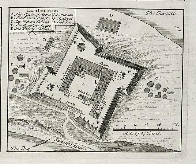
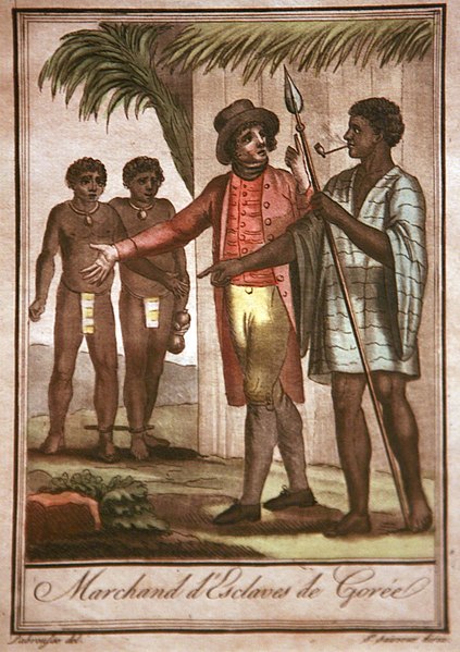
Dakar is the capital and largest city of Senegal. It is located on the Cap-Vert peninsula on the Atlantic coast and is the westernmost city in the Old World as well as on the African mainland. The city of Dakar proper has a population of 1,030,594, the area around Dakar was settled in the 15th century. The Portuguese established a presence on the island of Gorée off the coast of Cap-Vert, France took over the island in 1677. Following the abolition of the trade and French annexation of the mainland area in the 19th century, Dakar grew into a major regional port. In 1902, Dakar replaced Saint-Louis as the capital of French West Africa, from 1959 to 1960, Dakar was the capital of the short-lived Mali Federation. In 1960, it became the capital of the independent Republic of Senegal, Dakar is home to multiple national and regional banks as well as numerous international organizations. From 1978 to 2007, it was also the finishing point of the Dakar Rally. The Cap-Vert peninsula was settled no later than the 15th century, by the Lebou people, the original villages, Ouakam, Ngor, Yoff and Hann, still constitute distinctively Lebou neighborhoods of the city today. In 1444, the Portuguese reached the Bay of Dakar, initially as slave-raiders, peaceful contact was finally opened in 1456 by Diogo Gomes, and the bay was subsequently referred to as the Angra de Bezeguiche. The Portuguese eventually founded a settlement on the island of Gorée, the mainland of Cap-Vert, however, was under control of the Jolof Empire, as part of the western province of Cayor which seceded from Jolof in its own right in 1549. A new Lebou village, called Ndakaaru, was established directly across from Gorée in the 17th century to service the European trading factory with food, Gorée was captured by the United Netherlands in 1588, which gave it its present name. The island was to switch hands between the Portuguese and Dutch several more times before falling to the English under Admiral Robert Holmes on January 23,1664, and finally to the French in 1677. Though under continuous French administration since, métis families, descended from Dutch and French traders and African wives, the infamous House of Slaves was built at Gorée in 1776. In 1795 the Lebou of Cape Verde revolted against Cayor rule, a new theocratic state, subsequently called the Lebou Republic by the French, was established under the leadership of the Diop, a Muslim clerical family originally from Koki in Cayor. The capital of the republic was established at Ndakaaru, in 1857 the French established a military post at Ndakaaru and annexed the Lebou Republic, though its institutions continued to function nominally. The Serigne of Ndakaaru is still recognized as the political authority of the Lebou by the Senegalese State today. The slave trade was abolished by France in February 1794, however, Napoleon reinstated it in May 1802, then finally abolished it permanently in March 1815
10.
Wolof language
–
Wolof is a language of Senegal, the Gambia, and Mauritania, and the native language of the Wolof people. Like the neighbouring languages Serer and Fula, it belongs to the Senegambian branch of the Niger–Congo language family, unlike most other languages of Sub-Saharan Africa, Wolof is not a tonal language. Wolof originated as the language of the Lebu people and it is the most widely spoken language in Senegal, spoken natively by the Wolof people but also by most other Senegalese as a second language. Wolof dialects vary geographically and between rural and urban areas, dakar-Wolof, for instance, is an urban mixture of Wolof, French, and Arabic. Wolof is the spelling and may refer to the Wolof people or to Wolof culture. Variants include the older French Ouolof and the principally Gambian Wollof, Jolof, jollof, etc. now typically refers either to the Jolof Empire or to jollof rice, a common West African rice dish. Now-archaic forms include Volof and Olof, the English language is believed to have adopted some Wolof words, such as banana, via Spanish or Portuguese, and yum/yummy, from Wolof nyam to taste, nyam in Barbadian English meaning to eat. Wolof is spoken by more than 10 million people and about 40 percent of Senegals population speak Wolof as their native language, in the whole region from Dakar to Saint-Louis, and also west and southwest of Kaolack, Wolof is spoken by the vast majority of the people. Typically when various groups in Senegal come together in cities and towns. It is therefore spoken in almost every regional and departmental capital in Senegal, nevertheless, the official language of Senegal is French. In Serekunda, the Gambias largest town, although only a minority are ethnic Wolofs. The official language of the Gambia is English, Mandinka, Wolof, in Mauritania, about seven percent of the population speak Wolof because of the river that is shared with Senegal. There, the language is used only around the coastal regions. Wolof is one of the Senegambian languages, which are characterized by consonant mutation and it is often said to be closely related to the Fula language because of a misreading by Wilson of the data in Sapir that have long been used to classify the Atlantic languages. Senegalese/Mauritanian Wolof and Gambian Wolof are distinct national standards, they use different orthographies, however, both the spoken and written languages are mutually intelligible. Lebu Wolof, on the hand, is unintelligible with standard Wolof. Note, Phonetic transcriptions are printed between square brackets following the rules of the International Phonetic Alphabet, the Latin orthography of Wolof in Senegal was set by government decrees between 1971 and 1985. The language institute Centre de linguistique appliquée de Dakar is widely acknowledged as an authority when it comes to spelling rules for Wolof, Wolof is most often written in this orthography, in which phonemes have a clear one-to-one correspondence to graphemes
11.
National language
–
A national language is a that has some connection—de facto or de jure—with people and the territory they occupy. There is little consistency in the use of this term, one or more languages spoken as first languages in the territory of a country may be referred to informally or designated in legislation as national languages of the country. National and/or official languages are mentioned in over 150 world constitutions, the last is usually given the title of official language. Standard languages, such as Standard German, Standard French, and Standard Spanish, may serve as national, regional, National language and official language are best understood as two concepts or legal categories with ranges of meaning that may coincide, or may be intentionally separate. Stateless nations are not in the position to legislate an official language, some languages may be recognized popularly as national languages, while others may enjoy official recognition in use and/or promotion. Albanian is the language in Albania and Kosovo and a regional national language for parts of Macedonia. Arabic is the language in Algeria. Berber is also an official language, French has no official status but is widely used in education, business and the media. Andorras national language is Catalan, moreover Catalan is a language in several territories in Spain. Azerbaijan Azerbaijani language is the language in Azerbaijan. Australia has no language, but is largely monolingual with English being the de facto national language. A considerable proportion of first and second generation migrants are bilingual, according to Ethnologue, 81% of people spoke English at home, including L2 speakers. Other languages spoken at home included Chinese 2. 9%, Italian 1. 2%, Arabic 1. 1%, Greek 1%, Vietnamese 0. 9%, there were almost 400 languages spoken by Indigenous Australians prior to the arrival of Europeans. Only about 70 of these languages have survived and all but 30 of these are now endangered, bengali is the sole official language of Bangladesh. Bulgarian is the language in Bulgaria. Canadas official languages since the Official Languages Act of 1969 are English, Quebec nationalists consider Quebec French the national language of the Quebec nation. As well, two of Canadas northern territories legislate a variety of Indigenous languages, as these official languages are legislated at a territorial level, they can be construed as national languages. Notably the Cree language is spoken from Alberta to Labrador, Anishinaabemowin is spoken across central Canada, there are many languages spoken across China, with most people speaking one of several varieties of Chinese
12.
Hassaniya Arabic
–
It has almost completely replaced the Berber language originally spoken in this region. Although clearly a dialect, Hassānīya is relatively distant from other North African variants of Arabic. Its geographical location exposed it to influence from Zenaga-Berber and Wolof, there are several dialects of Hassaniya which differ primarily phonetically. Today, Hassaniya is spoken in Algeria, Libya, Morocco, Mauritania, Mali, Niger, Senegal, the phonological system of Hassānīya is both very innovative and very conservative. All phonemes of Classical Arabic are represented in the dialect, as in other Bedouin dialects, Classical /q/ corresponds mostly to dialectal /ɡ/, /dˤ/ and /ðˤ/ have merged into /ðˤ/ and the interdentals /θ/ and /ð/ have been preserved. In common with most Maghrebi Arabic varieties, the equivalent of Modern Standard Arabic /d͡ʒ/ is realised as /ʒ/, however, there is sometimes a double correspondence of a classical sound and its dialectal counterpart. Thus classical /q/ is represented by /ɡ/ in /ɡbaðˤ/ to take, similarly, /dˤ/ becomes /ðˤ/ in /ðˤəħk/ laugh, but /dˤ/ in /mrˤədˤ/ to be sick. Some consonant roots even have an appearance, /θaqiːl/ heavy vs. /θɡiːl/ heavy. Some of the forms are easily explained as recent loans from the literary language or from sedentary dialects in case of concepts pertaining to the sedentary way of life. For others, there is no obvious explanation, etymological /ðˤ/ appears constantly as /ðˤ/, never as /dˤ/. Nevertheless, the status of /q/ and /dˤ/ as well as /ɡ/ and /ðˤ/ appears very stable. Somewhat similarly, classical /ʔ/ has in most contexts disappeared or turned into /w/ or /j/, in some literary terms, however, it is clearly preserved, /mət. ʔal. lam/ suffering. Hassānīya has innovated many consonants by the spread of the distinction emphatic/non-emphatic, in addition to the above-mentioned, /rˤ/ and /lˤ/ have a clear phonemic status and /bˤ fˤ ɡˤ mˤ nˤ/ more marginally so. One additional emphatic phoneme /zˤ/ is acquired from the neighbouring Zenaga Berber language along with a palatal series /c ɟ ɲ/ from Niger–Congo languages of the south. At least some speakers make the distinction /p/–/b/ through borrowings from French, all in all, the number of consonant phonemes in Hassānīya is 33, or 39 if you count the marginal cases, too. On the phonetic level, the classical consonants /f/ and /θ/ are usually realised as voiced, the latter is still, however, pronounced differently from /ð/, the distinction probably being in the amount of air blown out. In geminated and word-final positions both phonemes are voiceless, for some speakers /θ/ apparently in all positions, the uvular fricative /ʁ/ is likewise realised voiceless in a geminated position, although not fricative but plosive. In other positions, etymological /ʁ/ seems to be in free variation with /q/, vowel phonemes come in two series, long and short
13.
Serer language
–
Serer, sometimes called Serer-Sine Serer proper after its prestige dialect, is a language of the Senegambian branch of Niger–Congo spoken by 1.2 million people in Senegal and 30,000 in the Gambia. It is the language of the Serer people. Serer is one of the Senegambian languages, which are characterized by consonant mutation, the traditional classification of Atlantic is that of Sapir, which found that Serer was closest to Fulani. However, a widely cited misreading of the data by Wilson inadvertently exchanged Serer for Wolof, dialects of Serer are Serer Sine, Segum, Fadyut-Palmerin, Dyegueme, and Niominka. Not all Serer people speak Serer, because the speakers are ethnically Serer, these are commonly thought to be Serer dialects. However, they are not closely related, Serer is significantly closer to Fulani than it is to Cangin, the voiceless implosives are also written ⟨ƥ ƭ ƈ ⟩, these are highly unusual sounds. The following greetings and responses are spoken in most regions of Senegal that have Serer speakers, in Senegalese culture, greetings are very important. Sometimes, people will spend several minutes greeting each other, the ethnolinguistic classification of Seereer in question. In Africa, Challenges of Multilingualism, ds Altmayer, Claus / Wolff, H. Ekkehard, Peter Lang, Frankfurt am Main, Berlin, Bern, Bruxelles, New York, Oxford, consonant mutation and reduplication in Seereer-Siin. Mc Laughlin, Fiona, Voiceless implosives in Seereer-Siin, Journal of the International Phonetic Association,35, 201–214, doi,10. 1017/S0025100305002215 Crétois, Dakar, Centre de Linguistique Appliquée de Dakar. Fal, A. Les nominaux en sereer-siin, Parler de Jaxaaw, senghor, L. S. Lharmonie vocalique en sérère. Journal de la Société des Linguistes
14.
Ethnic group
–
An ethnic group or ethnicity is a category of people who identify with each other based on similarities, such as common ancestral, language, social, cultural or national experiences. Unlike other social groups, ethnicity is often an inherited status based on the society in which one lives, in some cases, it can be adopted if a person moves into another society. Ethnic groups, derived from the historical founder population, often continue to speak related languages. By way of language shift, acculturation, adoption and religious conversion, it is possible for individuals or groups to leave one ethnic group. Ethnicity is often used synonymously with terms such as nation or people. In English, it can also have the connotation of something exotic, generally related to cultures of more recent immigrants, the largest ethnic groups in modern times comprise hundreds of millions of individuals, while the smallest are limited to a few dozen individuals. Conversely, formerly separate ethnicities can merge to form a pan-ethnicity, whether through division or amalgamation, the formation of a separate ethnic identity is referred to as ethnogenesis. The term ethnic is derived from the Greek word ἔθνος ethnos, the inherited English language term for this concept is folk, used alongside the latinate people since the late Middle English period. In Early Modern English and until the mid-19th century, ethnic was used to mean heathen or pagan, as the Septuagint used ta ethne to translate the Hebrew goyim the nations, non-Hebrews, non-Jews. The Greek term in antiquity could refer to any large group, a host of men. In the 19th century, the term came to be used in the sense of peculiar to a race, people or nation, the abstract ethnicity had been used for paganism in the 18th century, but now came to express the meaning of an ethnic character. The term ethnic group was first recorded in 1935 and entered the Oxford English Dictionary in 1972, depending on the context that is used, the term nationality may either be used synonymously with ethnicity, or synonymously with citizenship. The process that results in the emergence of an ethnicity is called ethnogenesis, the Greeks at this time did not describe foreign nations but had also developed a concept of their own ethnicity, which they grouped under the name of Hellenes. Herodotus gave an account of what defined Greek ethnic identity in his day, enumerating shared descent. Whether ethnicity qualifies as a universal is to some extent dependent on the exact definition used. Many social scientists, such as anthropologists Fredrik Barth and Eric Wolf and they regard ethnicity as a product of specific kinds of inter-group interactions, rather than an essential quality inherent to human groups. According to Thomas Hylland Eriksen, the study of ethnicity was dominated by two distinct debates until recently, one is between primordialism and instrumentalism. In the primordialist view, the participant perceives ethnic ties collectively, as a given, even coercive
15.
Wolof people
–
The Wolof people are a West African ethnic group found in northwestern Senegal, The Gambia, and southwestern coastal Mauritania. In Senegal, the Wolof are the largest ethnic group, while elsewhere they are a minority and they refer to themselves as Wolof, and speak the Wolof language – a West Atlantic branch of the Niger-Congo family of languages. Their early history is unclear and based on traditions that link the Wolof to the Almoravids. The Wolof belonged to the medieval era Wolof Empire of Senegambia region, details of the pre-Islamic religious traditions of Wolof are unknown, and their oral traditions state them to have been adherents of Islam since the founding king of Jolof. In and after the 18th century, the Wolofs were impacted by the violent jihads in West Africa, in the 19th century, as the colonial French forces launched a war against the Wolof kingdoms, the Wolof people resisted the French and converted to Islam. Contemporary Wolofs are predominantly Sufi Muslims belonging to Mouride and Tijaniyyah Islamic brotherhoods, the Wolof people, like other West African ethnic groups, have historically maintained a rigid, endogamous social stratification that included nobility, clerics, castes and slaves. The Wolof were close to the French colonial rulers, became integrated into the colonial administration and they are also referred to as Chelofes, Galofes, Lolof, Jolof, Olof, Volof, Wolluf and Yolof. The term Wolof also refers to the Wolof language and to their states, cultures, older French publications frequently employ the spelling Ouolof, up to the 19th century, the spellings Volof and Olof are also encountered. In English, Wollof and Woloff are found, particularly in reference to the Gambian Wolof, the spelling Jolof is often used, but in particular reference to the Wolof empire and kingdom in central Senegal that existed from the 14th to the 19th centuries. Similarly, a West African rice dish is known in English as jollof rice, the origins of the Wolof people are obscure, states David Gamble – a professor of Anthropology specializing on Senegambia and Africa studies. Their name as the Wolof first appears in the records of 15th century Portuguese travelers, according to Gamble, this migration likely occurred at the end of 11th century when the Ghana Empire fell to the Muslim armies from Sudan. Another oral tradition tells of a legend in Walo, which starts with two villages near a lake in a dispute, a mysterious person arose from the lake to settle the dispute. The villagers detained him, he settled among them and became the one who settled disputes and he was called Ndyadyane Ndyaye, and his descendants were called Ndiayes or Njie, and these led to ruling families of Wolof, Mali and Morocco, according to this mythical legend. The documented history, from 15th-century onwards is a story of rivalry between powerful families, wars, coups and conquests in Wolof society. The Jolof or Wolof Empire was a medieval West African state that parts of Senegal. Its final demise at the hands of French colonial forces in the 1870s-1890s also marks the beginning of the formation of Senegal as a unified state. By the end of the 15th century, the Wolof states of Jolof, Kayor, Baol, the position of king was held by the Burba Wolof and the rulers of the other component states owed loyalty and tribute payments to him. Slavery has been a part of the Wolof people since their earliest known history, in the pre-colonial era, slaves were either born or acquired through purchase or capture
16.
Fula people
–
The Fula people or Fulani or Fulɓe, numbering between 20 and 25 million people in total, are one of the largest and a widely dispersed Muslim ethnic group in Sahel and West Africa. The Fula people are believed to have roots in the people from North Africa and the Middle East. As an ethnic group they are bound together by the Fula language, culture, history, their religious affiliation and their efforts to spread Islam in Sahel region and the West Africa. A significant proportion of the Fula – a third, or an estimated 7 to 8 million – are pastoral people, the majority of the Fula ethnic group consisted of semi-sedentary people, as well as sedentary settled farmers, artisans, merchants and nobility. Spread over many countries, they are mainly in West Africa and northern parts of Central Africa. Many Fulbe was also taken to the New World during 16th to 19th century Atlantic Slave Trade and they were largely captured from the Senegal and Guinea with a significant percentage also taken from Mali and Cameroon. Some of the Fulbe of note were Bilali Muhammad, Ayuba Diallo, Salih Bilali, Abdulrahman Ibrahim Ibn Sori, some of Bilali Muhammads known descendants still live on Salepo Island Georgia and he also left descendants in the Bahama Archipelago who are not known. Abdulrahman Ibrahim Ibn Sori and many others have many descendants in the USA, there are many names used in other languages to refer to the Fulɓe. Fulani in English is borrowed from the Hausa term, Fula, from Manding languages, is also used in English, and sometimes spelled Fulah or Fullah. Fula and Fulani are commonly used in English, including within Africa, the French borrowed the Wolof term Pël, which is variously spelled, Peul, Peulh, and even Peuhl. More recently the Fulfulde / Pulaar term Fulɓe, which is a noun has been Anglicised as Fulbe. In Portuguese, the terms Fula or Futafula are used, the terms Fallata Fallatah or Fellata are of Kanuri origins, and are often the ethnonyms by which Fulani people are identified by in Sudan. The Fula people are distributed, across the Sahel from the Atlantic coast to the Red Sea. Alongside, many speak other languages of the countries they inhabit. Such languages include Hausa, Bambara, Wolof, and Arabic and this is the area known as the Fombina, literally meaning The South in Adamawa Fulfulde, because it represented the most southern and eastern reaches of Fulɓe hegemonic dominance in West Africa. In this area, Fulfulde is the lingua franca. Further east of this area, Fulani communities become predominantly nomadic, the Fulani People occupy a vast geographical expanse located roughly in a longitudinal East-West band immediately south of the Sahara, and just north of the coastal rain forest and swamps. There are an estimated 20-25 million Fulani people, there are generally three different types of Fulani based on settlement patterns, viz, the Nomadic/Pastoral or Mbororo, The Semi-Nomadic and the Settled or Town Fulani
17.
Serer people
–
The Serer people are a West African ethnoreligious group. They are the third largest ethnic group in Senegal making up 15% of the Senegalese population and they are also found in northern Gambia and southern Mauritania. They have had a sedentary settled culture and have known for their farming expertise. In the 20th century, most of them converted to Islam, the Serer society, like other ethnic groups in Senegal, has had social stratification featuring endogamous castes and slaves. The Serer people are referred to as Sérère, Sereer, Serere, Sarer, Kegueme, Seereer. The Serer people are found in contemporary Senegal, particularly in the west-central part of the country. In The Gambia, they occupy parts of old Nuimi and Baddibu as well as the Gambian Kombo, the Serer-Noon occupy the ancient area of Thiès in modern-day Senegal. The Serer-Ndut are found in southern Cayor and north west of ancient Thiès, the Serer-Njeghen occupy old Baol, the Serer-Palor occupies the west central, west southwest of Thiès and the Serer-Laalaa occupy west central, north of Thiès and the Tambacounda area. Senegal,1.84 million The Gambia,31,900 Mauritania,3500 The Serer occupy the Sine, the Serer people include the Seex, Serer-Noon, Serer-Ndut, Serer-Njeghene, Serer-Safene, Serer-Niominka, Serer-Palor, and the Serer-Laalaa. Each group speaks Serer or a Cangin language, Serer is the standard English spelling. Seereer or Sereer reflects the Serer pronunciation of the name and are used by Senegalese Serer historians or scholars. The meaning of the word Serer is uncertain, issa Laye Thiaw views it as possibly pre-Islamic and suggests four possible derivations,1. From the Serer Wolof word reer meaning misplaced, i. e. doubting the truth of Islam, from the Serer Wolof expression seer reer meaning to find something hidden or lost. From the Arabic word seereer meaning sahir magician or one who practices magic, from a Pulaar word, meaning separation, divorce, or break, again referring to refusing Islam. Professor Cheikh Anta Diop citing the work of the 19th century French archeologist and egyptologist - Paul Pierret, Diop went on to write, That would be consistent with their present religious position, they are one of the rare Senegalese populations who still reject Islam. Their route is marked by the stones found at about the same latitude from Ethiopia all the way to the Sine-Salum. Over generations these people, possibly Pulaar speaking herders originally, migrated through Wolof areas and entered the Siin and this lengthy period of Wolof-Serer contact has left us unsure of the origins of shared terminology, institutions, political structures, and practices. The actual Sereer ethnic group is a mixture of the two groups, and this may explain their complex bilinear kinship system and their own oral traditions recite legends on they being part of, or related to the Toucouleur people in the Senegal River valley area
18.
Jola people
–
The Jola are an ethnic group found in Senegal, the Gambia, and Guinea-Bissau. There are great numbers on the Atlantic coast between the banks of the Gambia River, the Casamance region of Senegal and the northern part of Guinea-Bissau. They migrated from southern Egypt into the Senegambia region around 13th - 14th century to where they brought palm seed, cotton, in the 1880s the Jolas were engaged in palm wine tapping in Bathurst. By the end of 19th century some Jola had moved to producing groundnuts as a cash crop and they also reared livestock and produced other crops including sweet potatoes, yams and watermelon. The Jola language is distinct from the Dioula language of the Dioula Mande people of the Gambia, Upper Niger and the Kong highlands of Burkina Faso. The Jola speak a variety of Jola dialects which may not, at times, be mutually intelligible, including, kuDiola spoken in a handful of villages south of Oussouye. Gusilay spoken in the village of Thionck Essyl, karon spoken along the coast of Casamance south of Diouloulou. Kuwaataay spoken along the coast south of the Casamance River, Mlomp spoken in the village of Mlomp. The Jolas were the last ethnic group in the Senegambian region to accept Islam, even though some accepted Islam after the Soninke-Marabout war, they honour the traditional use of palm wine in their rituals. They have one God that they associate with the phenomena like sky, rain. They have charms and sacred precincts that they honour and with which they communicate, the Jola people believe that spirits called Bakin or Eneerti can protect their families, their villages, and their rice fields, and can even protect them from conversion to Islam and Christianity. Jolas believed strongly in living a good life in this world. They believe that if one lives a bad life in this world, in the Jola Cassa subgroup this exile spirit is called a Holowa. This exile spirit becomes a spirit with no respect from the other spirits. Unlike most ethnic groups of the Senegambian region, the Jola have no system of griots, slaves, nobility, leather workers. Jolas are also able herbal medicine practitioners, but this does not mean they did not develop a sophisticated political system. In a sense the Jolas political achievement in the village was socialism and it was totally tied to their religious belief in the Bakin. This political achievement is not easy to reach if the society runs it does not have well-defined rules of administration
19.
Mandinka people
–
The Mandinka is a West African ethnic group with an estimated global population of eleven million. The Mandinka are the descendants of the Mali Empire, which rose to power under the rule of the Malinké/Maninka king Sundiata Keita, the Mandinka are a one ethnic group within the larger linguistic family of the Mandé peoples, who account for more than twenty million people. Originally from Mali, the Mandinka gained their independence from previous empires in the 13th century and they migrated west from the Niger River in search of better agricultural lands and more opportunities for conquest. Through a series of conflicts, the Fula jihads, particularly the Fula-led Imamate of Futa Jallon, over 99% of Mandinka in contemporary Africa are Muslim. The Mandinka people live primarily in West Africa, particularly in The Gambia, major populations of the Mandinka people also live in Mali, Sierra Leone, Ivory Coast, Senegal, Burkina Faso, Liberia, Guinea-Bissau, Niger and Mauritania. Although widespread, in most countries, the Mandingo are not the largest ethnic group, most Mandingos live in family-related compounds in traditional rural villages, their traditional society has featured socially stratified castes. Mandinka communities have been fairly autonomous and self-ruled, being led by a chief, Mandingo has been an oral society where mythologies, history and knowledge is verbally transmitted from one generation to next. Between the 16th and 19th century, many Muslim and non-Muslim Mandinka people and these intermixed, creating a Creole culture, with the Mandika people significantly influencing the African heritage peoples now found in the Caribbean, Brazil and the southern United States. The Mandés were initially a part of many fragmented kingdoms that formed after the collapse of Ghana empire in the 11th century, during the rule of Sundiata Keita, these kingdoms were consolidated, and the Mandinka expanded west from the Niger River basin under Sundiatas general Tiramakhan Traore. This expansion was a part of creating a region of conquest and this migration began in the later part of the 13th century. Another group of Mandinka people, under Faran Kamara – the son of the king of Tabou – expanded southeast of Mali, with the migration, many gold artisans and metal working Mandinka smiths settled along the coast and in the hilly Fouta Djallon and plateau areas of West Africa. Their presence and products attracted Mandika merchants and brought trading caravans from north Africa and it also brought conflicts with other ethnic groups, such as the Wolof people, particularly the Jolof Empire. The caravan trade to North Africa and Middle East brought Islamic people into Mandinka peoples original, the Muslim traders sought presence in the host Mandinka community, and this likely initiated proselytizing efforts to convert the Mandinka from their traditional religious beliefs into Islam. In Ghana, for example, the Almoravids had divided its capital into two parts by 1077, one part was Muslim and other non-Muslim, the Muslim influence from North Africa had arrived in the Mandinka region before this, via Islamic trading diasporas. In 1324, Sultan Mansa Musa who ruled Mali, went on Hajj pilgrimage to Mecca with caravan carrying gold. Shihab al-Umari, the Arabic historian, described his visit and stated that Musa built mosques in his kingdom, established Islamic prayers and took back Maliki school of Sunni jurists with him. According to Richard Turner – a professor of African American Religious History, Musa was highly influential in attracting North African, the Mandinka people of Mali converted early, but those who migrated to the west did not convert and retained their traditional religious rites. One of the legends among the Mandingo of western Africa is that the general Tiramakhan Traore led the migration, because people in Mali had converted to Islam, another legend gives a contrasting account, and states that Traore himself had converted and married Muhammads grand daughter
20.
Soninke people
–
They speak the Soninke language, also called Maraka language, which is one of the Mande languages. Predominantly Muslims, the Soninke were one of the ethnic groups from Sub-Saharan West Africa to convert to Islam in about the 10th century. The contemporary population of Soninke people is estimated to be over 2 million, Soninke people were the founders of the ancient empire of Ghana c. Subgroups of Soninke include the Maraka and Wangara, when the Ghana empire dispersed, the resulting diaspora brought Soninkes to Mali, Senegal, Mauritania, Gambia, Burkina Faso, and Guinea-Bissau where some of this trading diaspora was called Wangara. The cultural practices of Soninke people are similar to the Mandé peoples, and it includes traditional Islamic rites of marriages, circumcision and social stratification. Archaeological evidence suggests that the regions where Soninke people are found were inhabited in ancient times and these stone settlements were built on the rocky promontories of Tichit-Walata and the Tagant cliffs of Southern Mauritania. However, there are no surviving records to suggest which ethnic group these people were, a significant agro-pastoral society had developed in this pre-historic era. According to Soninke oral tradition history, the ancestor of the Soninke was Dinga and his sons included Dyabe Sisse, the founder of the Wagadu kingdom with its capital at Kumbi. The early written records about Soninke come from early Islamic historians, the Soninke, according to these records, were the founders of the ancient Ghana Empire, also called the Wagadu Empire. This empire has roots in the 5th-century CE and was destroyed by about the 12th century, in contemporary time, the total population of Soninke people is above 2 million. Soninke people are found throughout West Africa and in France, given their migration when Senegal, most of the Soninke people are found in the valley of the upper Senegal river and along the Mali – Senegal – Mauritania border between Nara and Nioro du Sahel. Migrations under French colonial rule have led many Soninke to build communities in Dakar, other cities in Africa, the Maraka - Soninke merchant communities and plantations were an economic mainspring under the Bambara Empire, and built trade routes in the West Africa region. The Soninke people were a trade link between the Berber people of Maghreb and the Empires in sub-Saharan West Africa. In their early history, they helped exchange salt from the north and this trade brought Muslim traders to them, particularly Arab traders interested in gold, after Islam arrived in North Africa. The rulers and Soninke people of the Ghana Empire converted to Islam in the 11th century, some Islamic sources suggest that the conversion was triggered after the 1076 Almoravid conquest of the Empire of Ghana. The Soninke people, like other Mande peoples, subscribe to the Maliki school of Sunni Islam, the Soninke society and its culture has historically many cultural practices with its neighboring ethnic groups, particularly the Mande peoples. This includes the religion of Islam, occupations, foods, the rites of passage, family structure, weddings, the Soninke society, like other Mande society, has social stratification. The Soninke strata have included a category called Horro or Horon, a caste system category called Namaxala or Nyaxamalo
21.
White Africans of European ancestry
–
White Africans are people of European descent residing in, or hailing from, Africa who identify themselves as white. In 1989, there were an estimated 4.6 million Africans of European ancestry on the continent, most are of Dutch, British, Portuguese, German, French, and to a lesser extent, Italian, Spanish, Greek, Ashkenazi Jewish, or Irish descent. The majority once lived along the Mediterranean coast, in South Africa, other groups of settlers appeared when France and Great Britain colonized Africa. A voluntary exodus of colonials accompanied independence in most African nations, Portuguese Mozambicans, who numbered about 200,000 in 1975, departed en masse because of economic policies directed against their wealth, they now number fewer than 50,000. In Zimbabwe, white flight was spurred by a land reform programme introduced by President Robert Mugabe. On the other hand, some, including the Belgian community in Burundi, were expelled by post-colonial governments. The African country with the largest white population of European descent both numerically and proportionally is South Africa, at approximately 4.5 million, although white minorities no longer hold exclusive political power in African states, some continue to retain significant economic influence. In contrast to western and central Africa, the milder, drier climates of northern, eastern, a modest annual rainfall of under forty inches was considered especially suitable for the temperate farming activities to which many were accustomed. The latter often resulted in friction between European settlers and black African tribes as they competed for land. By 1960, at least seven British, French, and Belgian colonies—in addition to the Union of South Africa—had passed legislation reserving a fixed percentage of land for white ownership. This allowed unscrupulous settlers to legitimise their land seizures and began a process that had the consequence of commodifying land in colonial Africa. Prior to 1914, colonial governments encouraged European settlement on a scale, based on the assumption that this was a prerequisite to long-term development. Some lost their sense of identification with Europe and created their own nationalist movements, namely in South Africa, permanent white settlers were regarded as an increasing liability by colonial administrations as they sought to dominate their adopted African homelands. This was a trend throughout African colonies from the late eighteenth to early twentieth centuries. Heated disputes between German settlers and the Matumbi and Ngoni peoples contributed significantly to the Maji Maji Rebellion of 1905–07, during the same period, British Kenyas European residents were largely responsible for provoking a military pacification campaign against the Masai. The advent of global decolonisation ushered in a change of perspectives towards European settlement in Africa. Metropolitan governments began to more emphasis on their relations with the indigenous peoples rather than the progressively independent settler populations. In direct opposition to the tide of African nationalism, whites of European descent in colonies such as Algeria began to forge new
22.
Lebanese people
–
The Lebanese people are the people inhabiting or originating from Lebanon. The religious groups among the Lebanese people are Shias, Sunnis, Maronites, Greek Orthodox, Druze, Melkites, there is a large diaspora in North America, South America, Europe, Australia and Africa. The term may include those who had inhabited Mount Lebanon and Anti-Lebanon mountains prior to the creation of the modern Lebanese state. As the relative proportion of the various sects is politically sensitive and it is therefore difficult to have an exact demographic analysis of Lebanese society. The largest concentration of people of Lebanese ancestry may be in Brazil having a population of 5. The Lebanese have always traveled the world, many of them settling permanently, descendants of Lebanese Christians make up the majority of Lebanese people worldwide, appearing principally in the diaspora. As the second of two languages of Judaism, Aramaic was also retained as a language in the sphere of religion among Lebanese Jews. Arab influence, nevertheless, applies to all aspects of the modern Lebanese culture. The total population of Lebanese people is estimated at 13-18 million, of these, the vast majority, or 8.6 -14 million, are in the Lebanese diaspora, and approximately 4.3 million in Lebanon itself. There are approximately 4.3 million Lebanese people in Lebanon, in addition to this figure, there are an additional 1 million foreign workers, mainly Syrians and about 400,000 Palestinian refugees in the nation. Lebanon is also a multi-ethnic society, prominent ethnic minorities in the country include the Armenians, the Kurds, the Turks, the Assyrians, the Iranians and many European ethnicities. The Lebanese diaspora consists of approximately 8.6 -14 million, the majority of the Lebanese in the diaspora are Christians, disproportionately so in the Americas where the vast majority reside. An estimate figure show that they represent about 75% of the Lebanese in total, Lebanese abroad are considered rich, educated and influential and over the course of time immigration has yielded Lebanese commercial networks throughout the world. The largest number of Lebanese is to be found in Brazil, in the rest of the Americas, significant communities are found in Argentina, Chile, Colombia and Venezuela, with almost every other Latin American country having at least a small presence. In Africa, Ghana and the Ivory Coast are home to over 100,000 Lebanese, there are significant Lebanese populations in other countries throughout Western and Central Africa. Australia hosts over 180,000 and Canada 250,000, in the Arab world, the Arab states of the Persian Gulf harbour around 400,000 Lebanese. Lebanese people also can be found in all of the 28 member states of the European Union, more than 2,500 ex-SLA members remain in Israel. They are denoted ** for this purpose, Lebanon has several different main religions
23.
Demonym
–
A demonym is a word that identifies residents or natives of a particular place, which is derived from the name of that particular place. It is a neologism, previously gentilic was recorded in English dictionaries, e. g. the Oxford English Dictionary, thus a Thai may be any resident or citizen of Thailand, of any ethnic group, or more narrowly a member of the Thai people. Conversely, some groups of people may be associated with multiple demonyms, for example, a native of the United Kingdom may be called a British person, a Brit, or a Briton. In some languages, when a parallel demonym does not exist, in English, demonyms are capitalized and are often the same as the adjectival form of the place, e. g. Egyptian, Japanese, or Greek. Significant exceptions exist, for instance the adjectival form of Spain is Spanish, English widely includes country-level demonyms such as Ethiopian or Guatemalan and more local demonyms such as Seoulite, Wisconsinite, Chicagoan, Michigander, Fluminense, and Paulista. Some places lack a commonly used and accepted demonym and this poses a particular challenge to those toponymists who research demonyms. The word gentilic comes from the Latin gentilis and the English suffix -ic, the word demonym was derived from the Greek word meaning populace with the suffix for name. National Geographic attributes the term demonym to Merriam-Webster editor Paul Dickson in a recent work from 1990 and it was subsequently popularized in this sense in 1997 by Dickson in his book Labels for Locals. However, in What Do You Call a Person From, a Dictionary of Resident Names attributed the term to George H. Scheetz, in his Names Names, A Descriptive and Prescriptive Onymicon, which is apparently where the term first appears. Several linguistic elements are used to create demonyms in the English language, the most common is to add a suffix to the end of the location name, slightly modified in some instances. Cairo → Cairene Cyrenaica → Cyrene Damascus → Damascene Greece → Greek Nazareth → Nazarene Slovenia → Slovene Often used for Middle Eastern locations and European locations. Kingston-upon-Hull → Hullensian Leeds → Leodensian Spain → Spaniard Savoy → Savoyard -ese is usually considered proper only as an adjective, thus, a Chinese person is used rather than a Chinese. Monaco → Monégasque Menton → Mentonasque Basque Country → Basque Often used for French locations, mostly they are from Africa and the Pacific, and are not generally known or used outside the country concerned. In much of East Africa, a person of an ethnic group will be denoted by a prefix. For example, a person of the Luba people would be a Muluba, the plural form Baluba, similar patterns with minor variations in the prefixes exist throughout on a tribal level. And Fijians who are indigenous Fijians are known as Kaiviti and these demonyms are usually more informal and colloquial. In the United States such informal demonyms frequently become associated with mascots of the sports teams of the state university system. In other countries the origins are often disputed and these will typically be formed using the standard models above
24.
Demographics of Senegal
–
About 70% of Senegals population is rural. In rural areas, population density varies from about 77 per square kilometer in the region to 2 per square kilometer in the arid eastern section. About 50,000 Europeans and Lebanese and Vietnamese reside in Senegal, french is the official language but is used regularly only by the literate minority. Almost all Senegalese speak a language, of which Wolof has the largest usage. Many Senegalese live in Europe, particularly in France, Italy, according to the 2010 revision of the World Population Prospects the total population was 12,434,000 in 2010, compared to only 2,416,000 in 1950. The proportion of children below the age of 15 in 2010 was 43. 7%,53. 9% was between 15 and 65 years of age, while 2. 4% was 65 years or older, registration of vital events is in Senegal not complete. The Population Departement of the United Nations prepared the following estimates
25.
Politics of Senegal
–
Politics in Senegal takes place within the framework of a semi-presidential, democratic republic. The President of Senegal is the head of state and the Prime Minister of Senegal is the head of government, executive power in Senegal is concentrated in the presidents hands. While legislative power is vested in both the government and the parliament, the parliament rarely introduces legislation or votes down legislation proposed by the government. Similarly, although the Judiciary is theoretically independent of the executive and the legislature, Senegal is one of the few African states that has never experienced a coup détat or exceptionally harsh authoritarianism. Léopold Senghor, the first president after independence, resigned in 1981, handing over the office of president to his Prime Minister, the present president, Macky Sall, was elected in competitive democratic elections in March 2012. Senegal has a reputation for transparency in government operations, the level of economic corruption that has damaged the development of the economies in other parts of the world is very low. Today Senegal has a political culture, being part of one of the most successful democratic transitions in Africa. The President is elected by adult suffrage to a 5-year term. The unicameral National Assembly has 150 members, who are elected separately from the President, the Socialist Party dominated the National Assembly until April 2001, when in free and fair legislative elections, President Wades coalition won a majority. The Cour Suprême and the Constitutional Council, the justices of which are named by the President, are the nations highest tribunals, Senegal is divided into 11 administrative regions, each headed by a governor appointed by and responsible to the President. The law on decentralization, which came into effect in January 1998, Senegals principal political party was for 40 years the Socialist Party. Under the terms of a 2016 amendment to the 2001 constitution, future presidents will serve for 5 years, Sall was the last President to be elected to a 7-year term. President Wade advanced an agenda for Senegal, including privatizations. He had a strong interest in raising Senegals regional and international profile, the country, nevertheless, has limited means with which to implement ambitious ideas. The liberalization of the economy is proceeding, but at a slow pace, Senegal continues to play a significant role in regional and international organizations. President Wade has made excellent relations with the United States a high priority, there are presently some 72 political parties, most of which are marginal and little more than platforms for their leaders. A flourishing independent media, largely free from official or informal control, however, the image of Wade as a constitutional democrat has been tarnished by events at the end of his mandate. When faced with internal dissent within his own party his main opponent Idrissa Seck was arrested, accused of treason, Wade refused to go along with holding presidential elections in 2006, arguing that there were economic reasons for wanting to hold the presidential and parliamentary elections simultaneously in 2007
26.
Unitary state
–
The majority of states in the world have a unitary system of government. Of the 193 UN member states,165 of them are governed as unitary states, unitary states are contrasted with federal states. In a unitary state, sub-national units are created and abolished, the United Kingdom of Great Britain and Northern Ireland is an example of a unitary state. Many unitary states have no areas possessing a degree of autonomy, in such countries, sub-national regions cannot decide their own laws. Examples are the Republic of Ireland and the Kingdom of Norway, in federal states, the sub-national governments share powers with the central government as equal actors through a written constitution, to which the consent of both is required to make amendments. This means that the units have a right of existence. The United States of America is an example of a federal state, under the U. S. Constitution, powers are shared between the federal government and the states
27.
Semi-presidential system
–
A semi-presidential system is a system of government in which a president exists alongside a prime minister and a cabinet, with the latter two being responsible to the legislature of a state. There are two subtypes of semi-presidentialism, premier-presidentialism and president-parliamentarism. Under the premier-presidential system, the minister and cabinet are exclusively accountable to parliament. The president chooses the prime minister and cabinet, but only the parliament may remove them from office with a vote of no confidence, the president does not have the right to dismiss the prime minister or the cabinet. However, in cases, the president can circumvent this limitation by exercising the discretionary power of dissolving the assembly. This subtype is used in Burkina Faso, France, Georgia, Lithuania, Madagascar, Mali, Mongolia, Niger, Poland, Portugal, Romania, Senegal, Sri Lanka and Ukraine. Under the president-parliamentary system, the minister and cabinet are dually accountable to the president. The president chooses the prime minister and the cabinet but must have the support of the parliament majority for his choice. In order to remove a prime minister or the cabinet from power. This form of semi-presidentialism is much closer to pure presidentialism and it is used in Armenia, Georgia between 2004 and 2013, Mozambique, Namibia, Russia, Taiwan and Ukraine between 1996 and 2005, and again from 2010 to 2014. It was used in Germany during the Weimarer Republik, as the regime between 1919 and 1933 is called unofficially. The powers that are divided between president and prime minister can vary greatly between countries and it is up to the president to decide, how much autonomy he leaves to his prime minister to act on his own. Semi-presidential systems may experience periods in which the President and the Prime Minister are from differing political parties. This is called cohabitation, a term originated in France when the situation first arose in the 1980s. In most cases, cohabitation results from a system in which the two executives are not elected at the time or for the same term. For example, in 1981, France elected both a Socialist president and legislature, which yielded a Socialist premier, but whereas the presidents term of office was for seven years, the National Assembly only served for five. When, in the 1986 legislative election, the French people elected a right-of-centre Assembly, however, in 2000, amendments to the French Constitution reduced the length of the French Presidents term from seven to five years. This has significantly lowered the chances of occurring, as parliamentary
28.
Macky Sall
–
Macky Sall is a Senegalese politician who has been President of Senegal since April 2012. Under President Abdoulaye Wade, Sall was Prime Minister of Senegal from April 2004 to June 2007 and he was the Mayor of Fatick from 2002 to 2008 and held that post again from 2009 to 2012. Sall was a member of the Senegalese Democratic Party. After coming into conflict with Wade, he was removed from his post as President of the National Assembly in November 2008, he founded his own party named APR. Placing second in the first round of the 2012 presidential election, he won the backing of other candidates and prevailed over Wade in the second round of voting. Sall was one of five born to Amadou Abdoul Sall and Coumba Thimbo, who was a state worker and then a caretaker, and Coumba Thimbo. He was raised in Fatick and Futa Tooro, as well as Mboro from age 2-5, Salls father was a member of the Socialist Party of Senegal, but, at the high school in Kaolack, Sall associated with the Maoists at the encouragement of his brother-in-law. During his studies at the University of Dakar he was involved in the Marxist-Leninist movement, And-Jëf, led by Landing Savané. Sall trained as an engineer at the Institute of Earth Sciences of the University of Dakar and then at the French Institute of Petroleum s National College of Petrol. He is a member of national and international associations of geologists. He met his wife Mariéme Faye Sall in 1992 when she was in school in the city of Diourbel. Sall joined Wades Senegalese Democratic Party in the late 1980s and he became Secretary-General of the PDS Regional Convention in Fatick in 1998 and served as the PDS National Secretary in charge of Mines and Industry. He was actively involved in the Sopi campaign which brought Wade to power in the Senegalese presidential election,2000 and he became Minister of Mines, Energy and Hydraulics on 12 May 2001, replacing Abdoulaye Bathily who had been appointed Vice-President of the National Assembly. Sall was promoted to the rank of Minister of State, while retaining his portfolio and he additionally became the Mayor of Fatick on 1 June 2002. On 21 April 2004, Macky Sall was appointed Prime Minister by President Wade, after Wade dismissed his predecessor, on 25 April 2004, Sall became Vice-President of the PDS Steering Committee. Although Sall was little known at the time of his appointment, Sall served as the director of Wades re-election campaign for the February 2007 presidential election, in which Wade was victorious, obtaining a majority in the first round. After Wade was sworn in, Sall submitted his resignation on 10 April and was immediately reappointed, Sall remained Prime Minister until 19 June 2007, making him the longest-serving of Wades prime ministers. In the June 2007 parliamentary election, Sall was elected to the National Assembly as a candidate on the national list of the Sopi Coalition, Sall said that he was proud of what he had accomplished as Prime Minister
29.
Prime Minister of Senegal
–
The Prime Minister of Senegal is the head of government of Senegal. The Prime Minister is appointed by the President of Senegal, who is elected for a seven-year term. The Prime Minister, in turn, appoints the Senegalese cabinet, the following is a list of Prime Ministers of Senegal, since the country gained independence from France in 1960. Political parties Other factions Senegal President of Senegal List of colonial governors of Senegal Politics of Senegal Lists of office-holders World Statesmen - Senegal
30.
National Assembly (Senegal)
–
The National Assembly is the unicameral legislature of Senegal. The current National Assembly, formed following elections held on 1 July 2012, has a total of 150 elected members who serve five-year terms, the electoral system is a mixed member majoritarian system. Ninety deputies are elected in 35 single and multi-member districts by simple majority party block vote, the remaining 60 seats are filled proportionally based on the national distribution of votes. Voters have a ballot and vote for the party list. This single ballot is applied to both the majoritarian and proportional vote counts, a The United in Hope coalition included the Alliance for the Republic. The Senegalese Progressive Union was the Socialist Partys predecessor, Senegal was a one-party state from 1966 to 1974. Only the Socialist Party fielded candidates in the 1968 and 1973 elections, let Us Unite Senegal was a coalition of three political parties - the National Democratic Rally, And Jëf-African Party for Democracy and Socialism, and Convention for Democrats and Patriots-Garab Gi. History of Senegal Legislative branch Senate List of Presidents of the National Assembly of Senegal Thomas, Melissa A. Sissokho, liaison legislature, the role of the National Assembly in Senegal
31.
History of Senegal
–
The history of Senegal is commonly divided into a number of periods, encompassing the prehistoric era, the precolonial period, colonialism, and the contemporary era. The earliest evidence of life is found in the valley of the Falémé in the south-east. There were also found stones shaped by the Levallois technique, characteristic of the Middle Paleolithic, mousterian Industry is represented mainly by scrapers found in the peninsula of Cap-Vert, as well in the low and middle valleys of the Senegal and the Falémé. In the Senegambia the period when humans became hunters, fishermen and this is when more elaborate objects and ceramics emerged. Although the characteristics and manifestations of civilization from the Neolithic have been identified their origins, what can be distinguished is, The dig of Cape Manuel, the Neolithic deposit Manueline Dakar was discovered in 1940. Basalt rocks including ankaramite were used for making tools such as axes or planes. Such tools have been found at Gorée and the Magdalen Islands, the dig of Bel-Air, Neolithic Bélarien tools, usually made out of flint, are present in the dunes of the west, near the current capital. This deposit is on the list of closed sites and monuments of Senegal, grinding equipment and pottery from the period are well represented at the site. The Neolithic civilization of the Senegal River valley and the Ferlo are the least well known due to not always being separated, in the case of Senegal, the periodization of prehistory remains controversial. It is often described as beginning with the age of metallurgy, funerary sites or tumuli were built there during the 8th to 16th centuries. They are also found in the north near Saint-Louis, and in the estuary of the Casamance. The West is rich in burial mounds of sand that the Wolof refer to as mbanaar, two of these sites are located within the territory of Senegal, Sine Ngayène and Sine Wanar, both located in the Department of Nioro Rip. Sine Ngayène has 52 stone circles including a double circle, at Wanar, they number 24 and the stones are smaller. There are stone-carved lyre in the laterite, Y- or A-shaped, the existence of proto-historic ruins in the middle Senegal River valley was confirmed in the late 1970s. Pottery, perforated ceramic discs or ornaments have been unearthed, excavations at thé site of Sinthiou Bara, near Matam, have proved particularly fruitful. They have revealed, for example, the flow of trade from distant parts of North Africa. The region of modern Senegal was a part of the region called Upper Guinea by European traders. Combining these data suggests that Senegal was first populated from the north and east in several waves of migration, the last being that of the Wolof, the Fulani and the Serer
32.
France
–
France, officially the French Republic, is a country with territory in western Europe and several overseas regions and territories. The European, or metropolitan, area of France extends from the Mediterranean Sea to the English Channel and the North Sea, Overseas France include French Guiana on the South American continent and several island territories in the Atlantic, Pacific and Indian oceans. France spans 643,801 square kilometres and had a population of almost 67 million people as of January 2017. It is a unitary republic with the capital in Paris. Other major urban centres include Marseille, Lyon, Lille, Nice, Toulouse, during the Iron Age, what is now metropolitan France was inhabited by the Gauls, a Celtic people. The area was annexed in 51 BC by Rome, which held Gaul until 486, France emerged as a major European power in the Late Middle Ages, with its victory in the Hundred Years War strengthening state-building and political centralisation. During the Renaissance, French culture flourished and a colonial empire was established. The 16th century was dominated by civil wars between Catholics and Protestants. France became Europes dominant cultural, political, and military power under Louis XIV, in the 19th century Napoleon took power and established the First French Empire, whose subsequent Napoleonic Wars shaped the course of continental Europe. Following the collapse of the Empire, France endured a succession of governments culminating with the establishment of the French Third Republic in 1870. Following liberation in 1944, a Fourth Republic was established and later dissolved in the course of the Algerian War, the Fifth Republic, led by Charles de Gaulle, was formed in 1958 and remains to this day. Algeria and nearly all the colonies became independent in the 1960s with minimal controversy and typically retained close economic. France has long been a centre of art, science. It hosts Europes fourth-largest number of cultural UNESCO World Heritage Sites and receives around 83 million foreign tourists annually, France is a developed country with the worlds sixth-largest economy by nominal GDP and ninth-largest by purchasing power parity. In terms of household wealth, it ranks fourth in the world. France performs well in international rankings of education, health care, life expectancy, France remains a great power in the world, being one of the five permanent members of the United Nations Security Council with the power to veto and an official nuclear-weapon state. It is a member state of the European Union and the Eurozone. It is also a member of the Group of 7, North Atlantic Treaty Organization, Organisation for Economic Co-operation and Development, the World Trade Organization, originally applied to the whole Frankish Empire, the name France comes from the Latin Francia, or country of the Franks
33.
Mali Federation
–
The Mali Federation was a Federation in West Africa linking the French colonies of Senegal and the Sudanese Republic for a period of only two months in 1960. It was founded on 4 April 1959 as a territory with self-rule within the French Community, the Sudanese Republic officials resisted this dissolution, cut off diplomatic relations with Senegal, and defiantly changed the name of their country to Mali. After World War II, the colonies of French West Africa began pushing significantly for increased self-determination, following the May 1958 crisis, the colonies of French West Africa were given the chance to vote for immediate independence or to join a reorganized French Community. Only Guinea voted for independence and the other colonies of French West Africa voted to join the French Community. In the 1958 election to decide the issue of independence, two parties split the countries of west Africa, the African Democratic Rally and the African Regroupment Party. The two regional groupings of parties struggled against one another on the issue of independence and the extent of ties with France. The RDA was the party in the Ivory Coast colony, the French Sudan colony. The two parties also were part of governments in French Upper Volta, Niger, and French Dahomey. While the two struggled with one another to shape the political future of the region, Mauritania often became a neutral party which would break any deadlocks. The vote of 1958 revealed a number of divisions within the parties, the resulting deadlock was so severe that the meeting was officially said to have never taken place. In late November 1958, French Sudan, Senegal, Upper Volta and Dahomey all declared the intention to join the French Community, French Sudan called for representatives of each of the four countries to Bamako on 28 to 30 December to discuss the formation of the federation. The result is only the colonies of French Sudan and Senegal were engaged in the discussions of the formation of the federation by 1959. Elections in March 1959 in both French Sudan and Senegal cemented the power of the major parties pushing for the formation of a federation, although Senghor won the elections by a large margin, some conservative Islamist marabouts supported the candidacy of Cheikh Tidjane Sy. Sy was arrested on election day as a result of rioting which was blamed on his party. After the elections, the assemblies of Senegal and French Sudan approved the federation and this involved three different political projects with the principle of parity enshrined in each, A federal government, united social movements, and a shared political party for both countries. The federal government was going to have an assembly composed of 20 members from each of the colonies, a President, until the President was elected, the Premier of the Mali Federation was to be Keïta and the vice-Premier was to be Mamadou Dia from Senegal. Further, as part of the parity principle, any legislative initiatives required a signature by both the Premier and the responsible for that issue. The colonies were to share the import and export taxes raised in the port of Dakar between them and this sharing was to the advantage of French Sudan which had almost a third of its 1959 budget provided by this tax income
34.
Geography of Senegal
–
Senegal is a coastal West African nation located 14 degrees north of the Equator and 14 degrees west of the Prime Meridian. The countrys total area is 196190 km² of which 192000 km² is land and 4190 km² is water, Senegal is bordered to the west by the North Atlantic Ocean. On land, the nations longest border is with Mauritania to the north, to the east is the 419 km border with Mali. In the southeast is Guinea and to the southsouthwest is Guinea-Bissau, Senegal is one of only a handful of countries to have a near-enclave within its borders—the small nation of the Gambia in the interior, which has a 740 km border with Senegal. The Gambia penetrates more than 320 km into Senegal, from the Atlantic coast to the center of Senegal along the Gambia River, in total, Senegal has 2640 km of land borders, and 531 km of coastline and shoreline. Senegal makes maritime claims of a 24 nmi contiguous zone, a 12 nmi territorial sea, and it also claims a 200 nmi continental shelf, or to the edge of the continental margin. The lowest point in Senegal is the Atlantic Ocean, at sea level, the highest point is an unnamed feature 2.7 km southeast of Nepen Diakha at 648 m. Tropical, hot, humid, rainy season has strong southeast winds, dry season dominated by hot, dry, well-defined dry and humid seasons result from northeast winter winds and southwest summer winds. Interior temperatures are higher than along the coast, and rainfall increases substantially farther south, extremes in annual precipitation range from 250mm in the extreme north, to 1800mm in extreme southern coastal areas. In the far interior of the country, in the region of Tambacounda, particularly on the border of Mali, Senegal has a number of vegetation zones, sahel, Sahel-Soudan, Sudan_, Soudan-Guinea, tropical rainforest, and Guinean mangroves. Most of the southern Casamance arm of the country has classified by the World Wildlife Fund as part of the Guinean forest-savanna mosaic ecoregion. Finally, its worth looking out these 2 last maps, although they include other zones as well, Vegetation zones of Senegal 2 Vegetation zones of Senegal 3 Terrain, generally low, rolling, plains rising to foothills in the southeast. Natural resources, fish, phosphates, iron ore Land use and this is a list of the extreme points of Senegal, the points that are farther north, south, east or west than any other location
35.
Gross domestic product
–
Gross Domestic Product is a monetary measure of the market value of all final goods and services produced in a period. Nominal GDP estimates are used to determine the economic performance of a whole country or region. The OECD defines GDP as a measure of production equal to the sum of the gross values added of all resident and institutional units engaged in production. ”An IMF publication states that GDP measures the monetary value of final goods and services - that is. Total GDP can also be broken down into the contribution of industry or sector of the economy. The ratio of GDP to the population of the region is the per capita GDP. William Petty came up with a concept of GDP to defend landlords against unfair taxation during warfare between the Dutch and the English between 1652 and 1674. Charles Davenant developed the method further in 1695, the modern concept of GDP was first developed by Simon Kuznets for a US Congress report in 1934. In this report, Kuznets warned against its use as a measure of welfare, after the Bretton Woods conference in 1944, GDP became the main tool for measuring a countrys economy. The switch from GNP to GDP in the US was in 1991, the history of the concept of GDP should be distinguished from the history of changes in ways of estimating it. The value added by firms is relatively easy to calculate from their accounts, but the value added by the sector, by financial industries. GDP can be determined in three ways, all of which should, in principle, give the same result and they are the production approach, the income approach, or the expenditure approach. The most direct of the three is the approach, which sums the outputs of every class of enterprise to arrive at the total. The income approach works on the principle that the incomes of the factors must be equal to the value of their product. This approach mirrors the OECD definition given above, deduct intermediate consumption from gross value to obtain the gross value added. Gross value added = gross value of output – value of intermediate consumption, value of output = value of the total sales of goods and services plus value of changes in the inventories. The sum of the value added in the various economic activities is known as GDP at factor cost. GDP at factor cost plus indirect taxes less subsidies on products = GDP at producer price, for measuring output of domestic product, economic activities are classified into various sectors. Subtracting each sectors intermediate consumption from gross output gives the GDP at factor cost, adding indirect tax minus subsidies in GDP at factor cost gives the GDP at producer prices
36.
Purchasing power parity
–
Observed deviations of the exchange rate from purchasing power parity are measured by deviations of the real exchange rate from its PPP value of 1. PPP exchange rates help to minimize misleading international comparisons that can arise with the use of exchange rates. For example, suppose that two countries produce the same amounts of goods as each other in each of two different years. But if one countrys GDP is converted into the countrys currency using PPP exchange rates instead of observed market exchange rates. The idea originated with the School of Salamanca in the 16th century, the best-known purchasing power adjustment is the Geary–Khamis dollar. The real exchange rate is equal to the nominal exchange rate. If purchasing power parity held exactly, then the exchange rate would always equal one. However, in practice the exchange rates exhibit both short run and long run deviations from this value, for example due to reasons illuminated in the Balassa–Samuelson theorem. There can be marked differences between purchasing power adjusted incomes and those converted via market exchange rates. This discrepancy has large implications, for instance, when converted via the exchange rates GDP per capita in India is about US$1,965 while on a PPP basis it is about US$7,197. At the other extreme, Denmarks nominal GDP per capita is around US$62,100, the purchasing power parity exchange rate serves two main functions. PPP exchange rates can be useful for making comparisons between countries because they stay fairly constant from day to day or week to week and only change modestly, if at all, from year to year. The PPP exchange-rate calculation is controversial because of the difficulties of finding comparable baskets of goods to compare purchasing power across countries, people in different countries typically consume different baskets of goods. It is necessary to compare the cost of baskets of goods and this is a difficult task because purchasing patterns and even the goods available to purchase differ across countries. Thus, it is necessary to make adjustments for differences in the quality of goods, furthermore, the basket of goods representative of one economy will vary from that of another, Americans eat more bread, Chinese more rice. Hence a PPP calculated using the US consumption as a base will differ from that calculated using China as a base, additional statistical difficulties arise with multilateral comparisons when more than two countries are to be compared. Various ways of averaging bilateral PPPs can provide a stable multilateral comparison. These are all issues of indexing, as with other price indices there is no way to reduce complexity to a single number that is equally satisfying for all purposes
37.
Gini coefficient
–
The Gini coefficient is a measure of statistical dispersion intended to represent the income or wealth distribution of a nations residents, and is the most commonly used measure of inequality. It was developed by the Italian statistician and sociologist Corrado Gini, the Gini coefficient measures the inequality among values of a frequency distribution. A Gini coefficient of zero expresses perfect equality, where all values are the same, a Gini coefficient of 1 expresses maximal inequality among values. However, a greater than one may occur if some persons represent negative contribution to the total. For larger groups, values close to or above 1 are very unlikely in practice, the exception to this is in the redistribution of wealth resulting in a minimum income for all people. When the population is sorted, if their distribution were to approximate a well known function. The Gini coefficient was proposed by Gini as a measure of inequality of income or wealth, the global income Gini coefficient in 2005 has been estimated to be between 0.61 and 0.68 by various sources. There are some issues in interpreting a Gini coefficient, the same value may result from many different distribution curves. The demographic structure should be taken into account, Countries with an aging population, or with a baby boom, experience an increasing pre-tax Gini coefficient even if real income distribution for working adults remains constant. Scholars have devised over a dozen variants of the Gini coefficient, the line at 45 degrees thus represents perfect equality of incomes. The Gini coefficient can then be thought of as the ratio of the area lies between the line of equality and the Lorenz curve over the total area under the line of equality. It is also equal to 2A and to 1 - 2B due to the fact that A + B =0.5. If all people have non-negative income, the Gini coefficient can theoretically range from 0 to 1, in practice, both extreme values are not quite reached. If negative values are possible, then the Gini coefficient could theoretically be more than 1, normally the mean is assumed positive, which rules out a Gini coefficient less than zero. An alternative approach would be to consider the Gini coefficient as half of the mean absolute difference. The effects of income policy due to redistribution can be seen in the linear relationships. An informative simplified case just distinguishes two levels of income, low and high, if the high income group is u % of the population and earns a fraction f % of all income, then the Gini coefficient is f − u. An actual more graded distribution with these same values u and f will always have a higher Gini coefficient than f − u, the proverbial case where the richest 20% have 80% of all income would lead to an income Gini coefficient of at least 60%
38.
Human Development Index
–
The Human Development Index is a composite statistic of life expectancy, education, and per capita income indicators, which are used to rank countries into four tiers of human development. A country scores higher HDI when the lifespan is higher, the level is higher. The 2010 Human Development Report introduced an Inequality-adjusted Human Development Index, while the simple HDI remains useful, it stated that the IHDI is the actual level of human development, and the HDI can be viewed as an index of potential human development. The origins of the HDI are found in the annual Human Development Reports produced by the Human Development Reports Office of the United Nations Development Programme, nobel laureate Amartya Sen, utilized Haqs work in his own work on human capabilities. The following three indices are used,1, Life Expectancy Index = LE −2085 −20 LEI is 1 when Life expectancy at birth is 85 and 0 when Life expectancy at birth is 20. Education Index = MYSI + EYSI22.1 Mean Years of Schooling Index = MYS15 Fifteen is the maximum of this indicator for 2025. 2.2 Expected Years of Schooling Index = EYS18 Eighteen is equivalent to achieving a degree in most countries. Income Index = ln − ln ln − ln II is 1 when GNI per capita is $75,000 and 0 when GNI per capita is $100. Finally, the HDI is the mean of the previous three normalized indices, HDI = LEI ⋅ EI ⋅ II3. Standard of living, as indicated by the logarithm of gross domestic product per capita at purchasing power parity. This methodology was used by the UNDP until their 2011 report, the formula defining the HDI is promulgated by the United Nations Development Programme. The 2016 Human Development Report by the United Nations Development Programme was released on March 21,2017, below is the list of the very high human development countries, = increase. The number in brackets represents the number of ranks the country has climbed relative to the ranking in the 2015 report, the Inequality-adjusted Human Development Index is a measure of the average level of human development of people in a society once inequality is taken into account. The rankings are not relative to the HDI list above due to the exclusion of countries which are missing IHDI data. Countries in the top quartile of HDI with a missing IHDI, New Zealand, Singapore, Hong Kong, Liechtenstein, Brunei, Qatar, Saudi Arabia, Andorra, United Arab Emirates, Bahrain, and Kuwait. The 2015 Human Development Report by the United Nations Development Programme was released on December 14,2015, below is the list of the very high human development countries, = increase. The number in brackets represents the number of ranks the country has climbed relative to the ranking in the 2014 report, the Inequality-adjusted Human Development Index is a measure of the average level of human development of people in a society once inequality is taken into account. Note, The green arrows, red arrows, and blue dashes represent changes in rank, the rankings are not relative to the HDI list above due to the exclusion of countries which are missing IHDI data
39.
West African CFA franc
–
The West African CFA franc is the currency of eight independent states in West Africa, Benin, Burkina Faso, Guinea-Bissau, Ivory Coast, Mali, Niger, Senegal and Togo. These eight countries have a population of 105.7 million people. The acronym CFA stands for Communauté Financière dAfrique or Communauté Financière Africaine, the currency is issued by the BCEAO, located in Dakar, Senegal, for the members of the UEMOA. The franc is nominally subdivided into 100 centimes but no centime denominations have been issued, the Central African CFA franc is of equal value to the West African CFA franc, and is in circulation in several central African states. They are both the CFA franc, the CFA franc was introduced to the French colonies in West Africa in 1945, replacing the French West African franc. The West African colonies and territories using the CFA franc were Ivory Coast, Dahomey, French Sudan, Mauritania, Niger, Sénégal, Togo and Upper Volta. The currency continued in use when these colonies gained their independence, except in Mali, in 1973, Mauritania replaced the CFA franc with the ouguiya at a rate of 1 ouguiya =5 francs. Mali readopted the CFA franc in 1984, at a rate of 1 CFA franc =2 Malian francs, the former Portuguese colony of Guinea-Bissau adopted the CFA franc in 1997, replacing the Guinea Bissau peso at a rate of 1 CFA franc =65 pesos. In 1948, aluminium 1- and 2-franc coins were introduced and these were followed in 1956 by aluminium-bronze 5,10 and 25 francs. All carried the name Afrique Occidentale Française, in 1957, 10- and 25-franc coins were issued with the name of Togo added. From 1959, coins have been issued by the BCEAO, nickel 100-franc coins were introduced in 1967, followed by the cupro-nickel 50-franc coins in 1972. Small, steel 1-franc coins were introduced in 1976, followed by bimetallic 250 francs in 1992, in 2003, bimetallic 200- and 500-franc coins were introduced. When the CFA franc was introduced, notes issued by the Banque Centrale des États de lAfrique Occidentale in denominations of 5,10,25,50,100 and 1000 francs were in circulation. 500-franc notes were added in 1946, followed by those of 5,000 francs in 1948, in 1955, the Institut dEmission de lA. O. F. Et du Togo took over the production of money, issuing notes for 50,100,500 and 1000 francs. In 1959, the BCEAO took over the issuance of money and reintroduced a 5. With the exception of a few issues, the notes of the BCEAO carry a letter to indicate the country of issuance. 50-franc notes were last issued in 1959, with 100 francs not issued since 1965, the newer notes contain updated security features and are more modern in design
40.
ISO 4217
–
The ISO4217 code list is used in banking and business globally. ISO4217 codes are used on tickets and international train tickets to remove any ambiguity about the price. The first two letters of the code are the two letters of the ISO 3166-1 alpha-2 country codes and the third is usually the initial of the currency itself, so Japans currency code is JPY—JP for Japan and Y for yen. This eliminates the problem caused by the dollar, franc, peso and pound being used in dozens of different countries. Also, if a currency is revalued, the currency codes last letter is changed to distinguish it from the old currency. Other changes can be seen, however, the Russian ruble, for example, changed from RUR to RUB and these currency units are denominated as one troy ounce of the specified metal as opposed to USD1 or EUR1. The code XTS is reserved for use in testing, the code XXX is used to denote a transaction involving no currency. There are also codes specifying certain monetary instruments used in international finance, the codes for most supranational currencies, such as the East Caribbean dollar, the CFP franc, the CFA franc BEAC and the CFA franc BCEAO. The predecessor to the euro, the European Currency Unit, had the code XEU, the use of an initial letter X for these purposes is facilitated by the ISO3166 rule that no official country code beginning with X will ever be assigned. Because of this rule ISO4217 can use X codes without risk of clashing with a country code. ISO3166 country codes beginning with X are used for private custom use, consequently, ISO4217 can use X codes for non-country-specific currencies without risk of clashing with future country codes. The inclusion of EU in the ISO 3166-1 reserved codes list, the ISO4217 standard includes a crude mechanism for expressing the relationship between a major currency unit and its corresponding minor currency unit. This mechanism is called the exponent and assumes a base of 10. For example, USD is equal to 100 of its currency unit the cent. So the USD has exponent 2, the code JPY is given the exponent 0, because its minor unit, the sen, although nominally valued at 1/100 of a yen, is of such negligible value that it is no longer used. Usually, as with the USD, the currency unit has a value that is 1/100 of the major unit, but in some cases 1/1000 is used. Mauritania does not use a decimal division of units, setting 1 ouguiya equal to 5 khoums, some currencies do not have any minor currency unit at all and these are given an exponent of 0, as with currencies whose minor units are unused due to negligible value. There is also a code number assigned to each currency
41.
Greenwich Mean Time
–
Greenwich Mean Time is the mean solar time at the Royal Observatory in Greenwich, London. GMT was formerly used as the civil time standard, now superseded in that function by Coordinated Universal Time. Today GMT is considered equivalent to UTC for UK civil purposes and for navigation is considered equivalent to UT1, consequently, the term GMT should not be used for precise purposes. Due to Earths uneven speed in its orbit and its axial tilt, noon GMT is rarely the exact moment the sun crosses the Greenwich meridian. This event may occur up to 16 minutes before or after noon GMT, noon GMT is the annual average moment of this event, which accounts for the word mean in Greenwich Mean Time. Originally, astronomers considered a GMT day to start at noon while for almost everyone else it started at midnight, to avoid confusion, the name Universal Time was introduced to denote GMT as counted from midnight. Astronomers preferred the old convention to simplify their observational data, so each night was logged under a single calendar date. Today Universal Time usually refers to UTC or UT1, in some countries Greenwich Mean Time is the legal time in the winter and the population uses the term. For an explanation of why this is, see GMT in legislation below, synchronisation of the chronometer on GMT did not affect shipboard time, which was still solar time. Most time zones were based upon GMT, as an offset of a number of hours ahead of GMT or behind GMT and it was gradually adopted for other purposes, but a legal case in 1858 held local mean time to be the official time. On 14 May 1880, a signed by Clerk to Justices appeared in The Times, stating that Greenwich time is now kept almost throughout England. For example, our polling booths were opened, say, at 813 and closed at 413 PM. This was changed later in 1880, GMT was adopted on the Isle of Man in 1883, Jersey in 1898 and Guernsey in 1913. Ireland adopted GMT in 1916, supplanting Dublin Mean Time, hourly time signals from Greenwich Observatory were first broadcast on 5 February 1924, rendering the time ball at the observatory redundant in the process. The daily rotation of the Earth is irregular and constantly slows, on 1 January 1972, GMT was superseded as the international civil time standard by Coordinated Universal Time, maintained by an ensemble of atomic clocks around the world. Indeed, even the Greenwich meridian itself is not quite what it used to be—defined by the centre of the instrument at the Observatory at Greenwich. Nevertheless, the line in the old observatorys courtyard today differs no more than a few metres from that line which is now the prime meridian of the world. Historically GMT has been used two different conventions for numbering hours. The long-standing astronomical convention dating from the work of Ptolemy, was to refer to noon as zero hours and this contrasted with the civil convention of referring to midnight as zero hours dating from the Romans