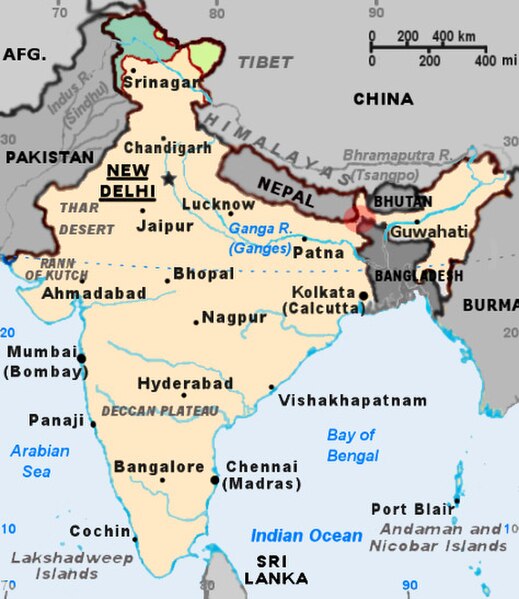
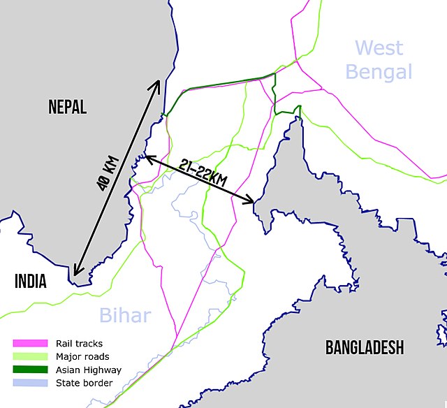
The Siliguri Corridor, also known as the Chicken's Neck, is a stretch of land around the city of Siliguri in West Bengal, India. 20–22 kilometres (12–14 mi) at the narrowest section, this geo-political and geo-economical corridor connects the seven states of northeast India to the rest of the Indian Republic. The countries of Nepal and Bangladesh lie on each side of the corridor and the Kingdom of Bhutan lies at the northern end of the corridor. The Kingdom of Sikkim formerly lay on the northern side of the corridor, until its merging with India in 1975.
The Siliguri Corridor is the strip of Indian territory within the red highlighted circle.
AH2 of the Asian Highway goes through the Siliguri Corridor.
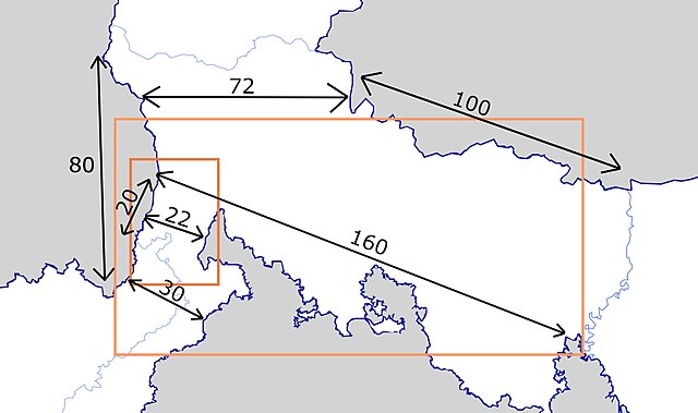
Dimensions of the corridor. Distances in kilometers.
Siliguri is a major tier-II city in West Bengal. It forms "Twin Cities" with the neighbouring district capital of Jalpaiguri. The city spans areas of the Darjeeling and Jalpaiguri districts in the Indian state of West Bengal. Known as the "Gateway of Northeast India", Siliguri is popular for three Ts: tea, timber and tourism. It is located on the banks of the Mahananda River and the Teesta River at the foothills of the Himalayas. Siliguri is the third largest urban agglomeration in West Bengal, after Kolkata and Asansol.
Image: Siliguri view 3
Image: Siliguri view 11
Image: Siliguri view
Image: Siliguri view 16