Pembrokeshire
Pembrokeshire is a county in the southwest of Wales. It is bordered by Carmarthenshire to the east, Ceredigion to the northeast, the sea everywhere else; the county is home to Pembrokeshire Coast National Park, the only national park in the United Kingdom established because of the coastline. Industry is nowadays focused on agriculture and gas, tourism. Mining and fishing were important activities; the county has a diverse geography with a wide range of geological features and wildlife. Its prehistory and modern history have been extensively studied, from tribal occupation, through Roman times, to Welsh and Flemish influences. Pembrokeshire County Council's headquarters are in the county town of Haverfordwest; the council has a majority of Independent members, but the county's representatives in both the Welsh and Westminster Parliaments are Conservative. Pembrokeshire's population was 122,439 at the 2011 census, an increase of 7.2 per cent from the 2001 figure of 114,131. Ethnically, the county is 99 per cent white and, for historical reasons, Welsh is more spoken in the north of the county than in the south.
The county town is Haverfordwest. Other towns include Pembroke, Pembroke Dock, Milford Haven, Tenby, Narberth and Newport. In the west of the county, St Davids is the United Kingdom's smallest city in terms of both size and population. Saundersfoot is the most populous village in Pembrokeshire. Less than 4 per cent of the county, according to CORINE, is green urban. See List of places in Pembrokeshire for a comprehensive list of settlements in Pembrokeshire. There are three weather stations in Pembrokeshire: at Tenby, Milford Haven and Penycwm, all on the coast. Milford Haven enjoys a mild climate and Tenby shows a similar range of temperatures throughout the year, while at Penycwm, on the west coast and 100m above sea level, temperatures are lower. Pembrokeshire, featured twice in the 2016 wettest places in Wales at Whitechurch in the north of the county and Scolton Country Park, near Haverfordwest. Orielton was the tenth driest place in Wales in 2016; the county has on average the highest coastal winter temperatures in Wales due to its proximity to the warm Atlantic Ocean.
Inland, average temperatures tend to fall 0.5 °C for each 100 metres increase in height. The air pollution rating of Pembrokeshire is "Good", the lowest rating; the rocks in the county were formed between 290 million years ago. More recent rock formations were eroded when sea levels rose 80 million years ago, at the end of the Cretaceous Period. Around 60 million years ago, the Pembrokeshire landmass emerged through a combination of uplift and falling sea levels; the landscape was subject to considerable change as a result of ice ages. While Pembrokeshire is not a seismically active area, in August 1892 there was a series of pronounced activities over a six-day period; the Pembrokeshire coastline includes sandy beaches. The Pembrokeshire Coast National Park, the only park in the UK established because of its coastline, occupies more than a third of the county; the park contains the Pembrokeshire Coast Path, a near-continuous 186-mile long-distance trail from Amroth, by the Carmarthenshire border in the southeast, to St Dogmaels just down the River Teifi estuary from Cardigan, Ceredigion, in the north.
The National Trust owns 60 miles of Pembrokeshire's coast. Nowhere in the county is more than 10 miles from tidal water; the large estuary and natural harbour of Milford Haven cuts deep into the coast. Since 1975, the estuary has been bridged by the Cleddau Bridge, a toll bridge carrying the A477 between Neyland and Pembroke Dock. Large bays are Fishguard Bay, St Bride's Bay and western Carmarthen Bay. There are several small islands off the Pembrokeshire coast, the largest of which are Ramsey, Skokholm and Caldey. There are many known shipwrecks off the Pembrokeshire coast with many more undiscovered. A Viking wreck off The Smalls has protected status; the county has six lifeboat stations, the earliest of, established in 1822. Pembrokeshire's diverse range of geological features was a key factor in the establishment of the Pembrokeshire Coast National Park and a number of sites of special scientific interest. In the north of the county are the Preseli Hills, a wide stretch of high moorland supporting sheep farming and some forestry, with many prehistoric sites and the probable source of the bluestones used in the construction of the inner circle of Stonehenge in England.
The highest point is Foel Cwmcerwyn at 1,759 feet, the highest point in Pembrokeshire. Elsewhere in the county most of the land is used for farming, compared with 60 per cent for Wales as a whole. Pembrokeshire has a number of seasonal seabird breeding sites, including for razorbill, guillemot
Cornwall
Cornwall is a county in South West England in the United Kingdom. The county is bordered to the north and west by the Celtic Sea, to the south by the English Channel, to the east by the county of Devon, over the River Tamar which forms most of the border between them. Cornwall forms the westernmost part of the South West Peninsula of the island of Great Britain; the furthest southwestern point of Great Britain is Land's End. Cornwall has a population of 563,600 and covers an area of 3,563 km2; the county has been administered since 2009 by Cornwall Council. The ceremonial county of Cornwall includes the Isles of Scilly, which are administered separately; the administrative centre of Cornwall, its only city, is Truro. Cornwall is the homeland of the Cornish people and the cultural and ethnic origin of the Cornish diaspora, it retains a distinct cultural identity that reflects its history, is recognised as one of the Celtic nations. It was a Brythonic kingdom and subsequently a royal duchy; the Cornish nationalist movement contests the present constitutional status of Cornwall and seeks greater autonomy within the United Kingdom in the form of a devolved legislative Cornish Assembly with powers similar to those in Wales and Scotland.
In 2014, Cornish people were granted minority status under the European Framework Convention for the Protection of National Minorities, giving them recognition as a distinct ethnic group. First inhabited in the Palaeolithic and Mesolithic periods, Cornwall continued to be occupied by Neolithic and Bronze Age peoples, by Brythons with strong ethnic, linguistic and cultural links to Wales and Brittany the latter of, settled by Britons from the region. Mining in Cornwall and Devon in the south-west of England began in the early Bronze Age. Few Roman remains have been found in Cornwall, there is little evidence that the Romans settled or had much military presence there. After the collapse of the Roman Empire, Cornwall was a part of the Brittonic kingdom of Dumnonia, ruled by chieftains of the Cornovii who may have included figures regarded as semi-historical or legendary, such as King Mark of Cornwall and King Arthur, evidenced by folklore traditions derived from the Historia Regum Britanniae.
The Cornovii division of the Dumnonii tribe were separated from their fellow Brythons of Wales after the Battle of Deorham in 577 AD, came into conflict with the expanding English kingdom of Wessex. The regions of Dumnonia outside of Cornwall had been annexed by the English by 838 AD. King Athelstan in 936 AD set the boundary between the English and Cornish at the high water mark of the eastern bank of the River Tamar. From the early Middle Ages and culture were shared by Brythons trading across both sides of the Channel, resulting in the corresponding high medieval Breton kingdoms of Domnonée and Cornouaille and the Celtic Christianity common to both areas. Tin mining was important in the Cornish economy. In the mid-19th century, the tin and copper mines entered a period of decline. Subsequently, china clay extraction became more important, metal mining had ended by the 1990s. Traditionally and agriculture were the other important sectors of the economy. Railways led to a growth of tourism in the 20th century.
Cornwall is noted for coastal scenery. A large part of the Cornubian batholith is within Cornwall; the north coast has many cliffs. The area is noted for its wild moorland landscapes, its long and varied coastline, its attractive villages, its many place-names derived from the Cornish language, its mild climate. Extensive stretches of Cornwall's coastline, Bodmin Moor, are protected as an Area of Outstanding Natural Beauty; the modern English name Cornwall is a compound of two ancient demonyms coming from two different language groups: Corn- originates from the Brythonic tribe, the Cornovii. The Celtic word "kernou" is cognate with the English word "horn". -wall derives from the Old English exonym walh, meaning "foreigner" or "Roman". In the Cornish language, Cornwall is known as Kernow which stems from a similar linguistic background; the present human history of Cornwall begins with the reoccupation of Britain after the last Ice Age. The area now known as Cornwall was first inhabited in the Mesolithic periods.
It continued to be occupied by Neolithic and Bronze Age people. According to John T. Koch and others, Cornwall in the Late Bronze Age was part of a maritime trading-networked culture called the Atlantic Bronze Age, in modern-day Ireland, Wales, France and Portugal. During the British Iron Age, like all of Britain, was inhabited by a Celtic people known as the Britons with distinctive cultural relations to neighbouring Brittany; the Common Brittonic spoken at the time developed into several distinct tongues, including Cornish, Breton and Pictish. The first account of Cornwall comes from the 1st-century BC Sicilian Greek historian Diodorus Siculus quoting or paraphrasing the 4th-century BCE geographer P
World War II
World War II known as the Second World War, was a global war that lasted from 1939 to 1945. The vast majority of the world's countries—including all the great powers—eventually formed two opposing military alliances: the Allies and the Axis. A state of total war emerged, directly involving more than 100 million people from over 30 countries; the major participants threw their entire economic and scientific capabilities behind the war effort, blurring the distinction between civilian and military resources. World War II was the deadliest conflict in human history, marked by 50 to 85 million fatalities, most of whom were civilians in the Soviet Union and China, it included massacres, the genocide of the Holocaust, strategic bombing, premeditated death from starvation and disease, the only use of nuclear weapons in war. Japan, which aimed to dominate Asia and the Pacific, was at war with China by 1937, though neither side had declared war on the other. World War II is said to have begun on 1 September 1939, with the invasion of Poland by Germany and subsequent declarations of war on Germany by France and the United Kingdom.
From late 1939 to early 1941, in a series of campaigns and treaties, Germany conquered or controlled much of continental Europe, formed the Axis alliance with Italy and Japan. Under the Molotov–Ribbentrop Pact of August 1939, Germany and the Soviet Union partitioned and annexed territories of their European neighbours, Finland and the Baltic states. Following the onset of campaigns in North Africa and East Africa, the fall of France in mid 1940, the war continued between the European Axis powers and the British Empire. War in the Balkans, the aerial Battle of Britain, the Blitz, the long Battle of the Atlantic followed. On 22 June 1941, the European Axis powers launched an invasion of the Soviet Union, opening the largest land theatre of war in history; this Eastern Front trapped most crucially the German Wehrmacht, into a war of attrition. In December 1941, Japan launched a surprise attack on the United States as well as European colonies in the Pacific. Following an immediate U. S. declaration of war against Japan, supported by one from Great Britain, the European Axis powers declared war on the U.
S. in solidarity with their Japanese ally. Rapid Japanese conquests over much of the Western Pacific ensued, perceived by many in Asia as liberation from Western dominance and resulting in the support of several armies from defeated territories; the Axis advance in the Pacific halted in 1942. Key setbacks in 1943, which included a series of German defeats on the Eastern Front, the Allied invasions of Sicily and Italy, Allied victories in the Pacific, cost the Axis its initiative and forced it into strategic retreat on all fronts. In 1944, the Western Allies invaded German-occupied France, while the Soviet Union regained its territorial losses and turned toward Germany and its allies. During 1944 and 1945 the Japanese suffered major reverses in mainland Asia in Central China, South China and Burma, while the Allies crippled the Japanese Navy and captured key Western Pacific islands; the war in Europe concluded with an invasion of Germany by the Western Allies and the Soviet Union, culminating in the capture of Berlin by Soviet troops, the suicide of Adolf Hitler and the German unconditional surrender on 8 May 1945.
Following the Potsdam Declaration by the Allies on 26 July 1945 and the refusal of Japan to surrender under its terms, the United States dropped atomic bombs on the Japanese cities of Hiroshima and Nagasaki on 6 and 9 August respectively. With an invasion of the Japanese archipelago imminent, the possibility of additional atomic bombings, the Soviet entry into the war against Japan and its invasion of Manchuria, Japan announced its intention to surrender on 15 August 1945, cementing total victory in Asia for the Allies. Tribunals were set up by fiat by the Allies and war crimes trials were conducted in the wake of the war both against the Germans and the Japanese. World War II changed the political social structure of the globe; the United Nations was established to foster international co-operation and prevent future conflicts. The Soviet Union and United States emerged as rival superpowers, setting the stage for the nearly half-century long Cold War. In the wake of European devastation, the influence of its great powers waned, triggering the decolonisation of Africa and Asia.
Most countries whose industries had been damaged moved towards economic expansion. Political integration in Europe, emerged as an effort to end pre-war enmities and create a common identity; the start of the war in Europe is held to be 1 September 1939, beginning with the German invasion of Poland. The dates for the beginning of war in the Pacific include the start of the Second Sino-Japanese War on 7 July 1937, or the Japanese invasion of Manchuria on 19 September 1931. Others follow the British historian A. J. P. Taylor, who held that the Sino-Japanese War and war in Europe and its colonies occurred and the two wars merged in 1941; this article uses the conventional dating. Other starting dates sometimes used for World War II include the Italian invasion of Abyssinia on 3 October 1935; the British historian Antony Beevor views the beginning of World War II as the Battles of Khalkhin Gol fought between Japan and the fo
Nantlle Valley
The Nantlle Valley is an area in Gwynedd, north Wales, characterised by its large number of small settlements. The area is historically important geologically, featured in one of the most contentious disputes of the 19th century, between the'Diluvialists' who believed in the Biblical flood, the ‘Glacialists’, who supported the Glacial Theory, established by studies of the drift sediments on Moel Tryfan. Between 85-90% of the population of the Nantlle Valley speak Welsh as their first language; some of the communities came into being as a result of slate quarrying in the late eighteenth or early nineteenth centuries and some have a history stretching back to antiquity. There are Iron Age forts at Caer Engan in Pen-y-groes and on the coast at Dinas Dinlle and evidence of Bronze Age settlement on the higher ground; the valley was important during the Middle Ages - with a clas or ecclesiastical college developed at Clynnog Fawr. The Glynllifon estate can trace its foundation to the 8th century and there is evidence of occupation on the site going back to the Iron Age.
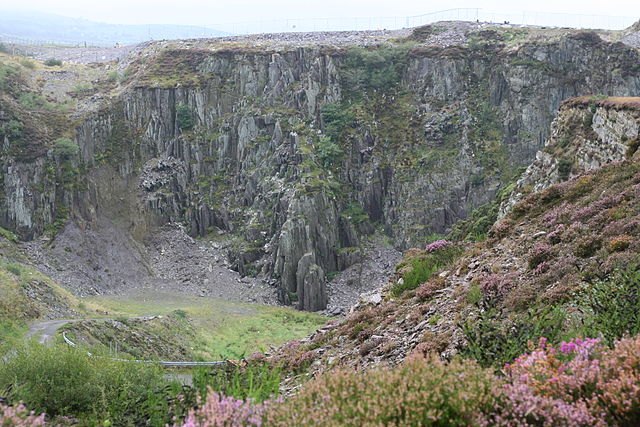
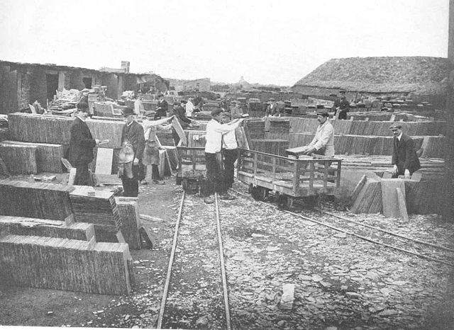
There were a number of quarries in the valley, the largest being the Dorothea and Pen yr Orsedd quarries. Although the major quarries are worked out, there remains demand for slate waste for garden decoration. In 1991 Antur Nantlle Cyf was established as a community enterprise to work for the benefit of the Nantlle Valley and its surrounding area. Dyffryn Nantlle was one of the major slate quarrying regions of Wales during the nineteenth and twentieth centuries, having at least 37 operating slate quarries at one given time, it was an innovative region in the development of the slate industry. The Cilgwyn quarry on the north side of the valley is the oldest in Wales and one of the oldest in Europe, dating from the 12th century; the first steam engine to be used in the slate industry was a pump installed at the Hafodlas quarry in the valley in 1807. Slate roofing tiles have been excavated at Segontium Roman camp in Caernarfon and are thought to have originated in the Nantlle Valley; the quarries of the area are being considered as a World Heritage site.
Unlike most of the other slate producing regions in Wales the Nantlle Valley developed a large number of small, independent quarries because most of the land in the valley was owned by a number of small landowners rather than a single large landowner. At the height of the industry there were over 50 quarries being worked in the valley; because of this the quarries were never managed as a large single concern as they were in the Penrhyn and Ffestiniog quarries and this led to the industry in the area being much more vulnerable to any downturns in the economy. This led to the development of an industrial landscape, quite different from the other slate quarrying regions in that there are a large number of small waste slate heaps around the valley. There were considerable difficulties involved in raising slate from the pits and in keeping them free from water, the ingenious ways which were found to solve these problems, including blondins, chain inclines and vast revetments, are some of the principal reasons why the slate quarrying remains in this area, many of which are unique, are so important.
Some of the principal features include the 1906 Cornish beam-engine at Dorothea, a unique survival in Wales, the mill and a number of pyramids unique, the blondins at Pen-yr-Orsedd. There were two lakes on the valley floor but one has now disappeared and the water is contained by the Dorothea quarry pit. A dispute between local crofter-quarrymen and the local large landowner, Lord Newborough of the Wynn family from Glynllifon became an important legal landmark in the early 19th century. In 1823, Lord Newborough tried to have a law passed to give him control of all the Moel Tryfan Commons, including recent encroachments, to extinguish the rights of common use; this move was met with fearsome opposition, not least from one John Evans, concerned that enclosure around the Cilgwyn quarries would affect his own interests over a dam and watercourse that he had constructed on Crown land in 1816. He organised a commoners' petition with seven hundred signatures; the petitioners claimed that their cottages had been built over forty years earlier, that the land had been too wild for cultivation, that they had improved it by hard work.
This led to a change in the land enclosure law in the United Kingdom. Another dispute much celebrated in the area took place a generation centred on the largest quarry in the valley. Dorothea Quarry was bought in 1835 by an Englishman called Muskett, he spent on new equipment to raise the wagons from the quarry bottom. But he overspent, was declared bankrupt a few years later; the quarry was closed with three months wages owing to most of the workers. They revolted and demolished the new house Muskett had built for himself - Plas y Cilgwyn. A ballad was written about the occasion by a local poet called Richard Owen who did not support the action taken by the men; the horse-drawn 3' 6" gauge Nantlle Railway served the quarries from 1828 to 1963, although from 1865 the line was cut back to Tyddyn Bengam, in 1871 only the portion from the standard gauge railhead at Nantlle station in Tal-y-sarn was in use. The Nantlle railway has a long history as an industrial and passenger line; the line received its Act of Parliament in 1825 and was constructed underthe supervision of Robert Stephenson, brother of George Stephenson.
It was operated using horse power. Although built for the transport of slate, the line is known to have carried passengers at various times between Caernarfon and Pen-y-groes, it is the last rec
Bethesda, Gwynedd
Bethesda is a town and community on the River Ogwen and the A5 road on the edge of Snowdonia, in Gwynedd, north-west Wales. It is the 5th largest Community in Gwynedd. In 1823, the Bethesda Chapel was built and the town subsequently grew around it; the chapel has now been converted into flats and is known as Arafa Don. The town grew around the slate quarrying industries. At its peak, the town exported purple slate all over the world. Penrhyn Quarry suffered a three-year strike led by the North Wales Quarrymen's Union between 1900 and 1903; this led to the creation of the nearby village of Tregarth, built by the quarry owners, which housed the families of those workers who had not struck. The A5 road runs through Bethesda and marked the border between Lord Penrhyn's land, the freehold land. Most of the town is to the east and north east of the road, with housing packed onto the hillside in irregular rows, built on the commons. On the current high street, all the public houses are found on the north side of the road.
The narrow gauge Penrhyn Quarry Railway opened in 1801 to serve Penrhyn Quarry. It connected the quarry with Port Penrhyn on the coast and operated until 1962. In 1884, a branch of the London and North Western Railway's network from Bangor was opened; the line closed to passengers in 1951 and to freight in 1963. The trackbed of the Penrhyn Quarry Railway towards Porth Penrhyn is taken over by the Lôn Las Ogwen cycle path; the peak population of Bethesda was 10,000. Current opportunities for employment in the town are limited: there are a few manufacturing businesses. For employment with higher earning potential, residents tend to commute to towns along the North Wales coast. Bangor is the most popular destination. Ysgol Dyffryn Ogwen is a bilingual comprehensive school, with 374 pupils, established in 1951. Zip World Velocity in Penrhyn Quarry is the longest zipline in Europe, at just over 1,600 metres long, brings the town hundreds of visitors; the architecture and layout of the town is utilitarian.
Most of the buildings are constructed of stone with slate roofs. Some are constructed wholly of slate blocks, although such buildings tend to suffer from damp and structural slippage because the flat and smooth surfaces of slate do not bind well to mortar; the town has 40 Grade II listed buildings, including three pubs, in addition to the substantial and imposing Grade I listed Nonconformist Jerusalem ChapelThe upper parts of Carneddi and Tan y Foel owe more to stone quarrying on the nearby hills rather than slate quarrying that supported the lower end of the town. At the eastern limits, the town is bounded by the rising land of the Carneddau mountains which form some of the more remote landscapes of Snowdonia. Much of Bethesda once consisted of discrete villages such as Gerlan, Tregarth and Braichmelyn. Bethesda is noted for both the number of chapels in the town; the town was named after the Bethesda Chapel, converted into residential flats. Llanllechid, on the outskirts of Bethesda, is the home of the Popty Bakery, the origins of which date back to the bakery opened by O. J. Williams in the early 1900s.
The product range focuses on traditional Welsh cakes and Bara Brith and these lines are retailed throughout Wales and parts of England through outlets including Aldi, Asda, Co-Op, Morrisons and Tesco. There are ten pubs not including Tregarth; the Douglas Arms, on the High Street, was named after the family which owned the nearby Penrhyn Quarry. Other pubs include the Bull, The Kings Head, Y Sior, The Victoria Arms, the Llangollen; the village has its own micro brewery known as Cwrw Ogwen. It manufactures one beer named Cwrw Caradog, named after the writer Caradog Prichard; the dominant language of the town is Welsh, can be seen written and heard spoken in most settings. According to the United Kingdom Census 2001, 77.0% of the residents are Welsh-speaking, higher than the average for both Gwynedd and Wales as a whole. The S4C series Amdani! was based on a fictitious women's rugby team in Bethesda, many of the location shots were filmed in the area. The series was based by Bethan Gwanas, who lived in the town.
In June 2012 Tabernacl Cyf. A non-profit co-operative based in the town, was awarded a grant of around £1 million to renovate Neuadd Ogwen, a performance venue on the High Street, it was due to reopen as a community arts centre in June 2013. In the 1970s and 1980s Bethesda developed a reputation as a hub of musical creativity. Jam sessions and small home studios abounded alongside a burgeoning pub rock scene; as well as the now well-established'Pesda Roc' festival, Bethesda has nurtured the Welsh language bands Maffia Mr Huws and experimentalists Y Jeycsyn Ffeif. In more recent years it continues to spring up bands from the local community such as Radio Rhydd. Bobby Atherton - footballer Ellis William Davies - politician Idris Foster - Jesus Professor of Celtic Studies at the University of Oxford David Ffrangcon-Davies - a Welsh operatic baritone Bethan Gwanas - the author lived and worked in Bethesda. Esyllt Harker - singer and storyteller. Mikael Madeg - Breton language writer, French language assistant at Ysgol Dyffryn Ogwen 1971–72 Frederick Llewellyn-Jones - politician Leila Megane - singer Gwenlyn Parry - writer William John Parry - first
Llangollen
Llangollen is a small town and community in Denbighshire, north-east Wales, on the River Dee at the edge of the Berwyn mountains and the Clwydian Range and Dee Valley AONB. It had a population of 3,658 at the 2011 census. Llangollen takes its name from the Welsh llan meaning "a religious settlement" and Saint Collen, a 6th-century monk who founded a church beside the river. St Collen is said to have arrived in Llangollen by coracle. There are no other churches in Wales dedicated to St Collen, he may have had connections with Colan in Cornwall and with Langolen in Brittany. Above the town to the north is Castell Dinas Brân, a stronghold of the Princes of Powys. Beyond the castle is the limestone escarpment known as the Eglwyseg Rocks; the outcrop continues north to World's End in Wrexham. The area nearest the castle is the Panorama Walk, a monument to poet I. D. Hooson from the village of Rhosllannerchrugog can be found there; the ancient parish of Llangollen was divided into three traeanau: Llangollen Traean, Trefor Traean, Glyn Traean.
Llangollen Traean contained the townships of Bachau, Llangollen Abad, Llangollen Fawr, Llangollen Fechan, Feifod and Rhisgog. Trefor Traean contained the townships of Cilmediw, Eglwysegl, Trefor Isaf and Trefor Uchaf. Glyn Traean contained the townships of Cilcochwyn, Crogenwladus, Hafodgynfor, Nantygwryd and Talygarth. Valle Crucis Abbey was established at Llantysilio in about 1201, under the patronage of Madog ap Gruffydd Maelor of Castell Dinas Brân; the bridge at Llangollen was built across the Dee in the 16th century to replace a previous bridge built in about 1345 by John Trevor, of Trevor Hall, which replaced an earlier bridge built in the reign of King Henry I. In the 1860s the present bridge was extended by adding an extra arch and a two-storey stone tower with a castellated parapet; this became a café before being demolished in the 1930s to improve traffic flow. The bridge was widened in 1873 and again in 1968, using masonry which blended in with the older structure, it is a Scheduled Ancient Monument.
On the outskirts of the town is Plas Newydd, from 1780 the home of the Ladies of Llangollen, the Honourable Sarah Ponsonby, Lady Eleanor Butler and their maid Mary Caryll. The Pillar of Eliseg is another old monument. Llangollen Community Hospital was completed in 1876. There is an electoral ward of the same name; this ward includes Llantysilio community and has a total population taken at the 2011 census of 4,079. Today Llangollen relies on the tourist industry, but still gains substantial income from farming. Most of the farms in the hills around the town were sheep farms, the domestic wool industry, both spinning and weaving, was important in the area for centuries. Several factories were built along the banks of the River Dee, where both wool and cotton were processed; the water mill opposite Llangollen railway station is over 600 years old, was used to grind flour for local farmers. In the late 19th century, Llangollen had the Llangollen Advertiser. Llangollen hosted the National Eisteddfod in 1908.
The Gorsedd ceremony was held on the Hermitage Field, next to Plas Newydd, the circle of stones was moved into the grounds of the hall. The eisteddfod itself took place on the old Vicarage Field at Fronhyfryd and was visited by David Lloyd George, accompanied by Winston Churchill; the annual Llangollen International Eisteddfod ends on the following Sunday. It opens with a parade led by the Llangollen Silver Band, in which both locals and visitors take part in dancing and playing musical instruments; the Llangollen Fringe Festival is an independent arts festival held in mid July in the town hall. The Fringe includes music, theatre and workshops. Artists who have taken part in the Llangollen Fringe include Clement Freud, Rhys Ifans, the Damned, Cerys Matthews, Tracey Emin, Damien Hirst, Juan Martín, the Black Seeds, John Cooper Clarke, Will Self, Gang of Four, Lee Scratch Perry and Victoria Coren Mitchell Dee Rocks is a local fundraising music festival held during May when the town hall is transformed into a music venue.
The inaugural event took place on 29 May 2004, the now annual fixture raises in excess of £12,000 for local good causes. "Llangollen Market", traditional "Ladies of Llangollen", Ian Chesterman "Pastai Fawr Llangollen", Arfon Gwilym According to an anonymous rhyme, the bridge over the Dee is one of the Seven Wonders of Wales. The nursery rhyme "Mary had a little lamb" is but incorrectly, linked with Llangollen, its true origins are in the United States: "This is a lovely folklore story, but sadly Mary Thomas of Llangollen was not the heroine of the nursery rhyme... The Mary of the rhyme was Mary Sawyer and the school was the Redstone Schoolhouse in Sterling Massachusetts, U. S. A." Llangollen was an important coaching stop for the mail coach on the old mail route, now the A5 road from London to Holyhead. Arriva buses Wales run a service to Wrexham every 30 minutes. There is a service to Barmouth from Wrexham via Llangollen run by Lloyd's coaches. Services connect villages such as Fron and Chirk. Coastline taxis run a service to corwen numbered x5.
National Express Coaches operate through the town on route 418, offering journeys to Wrexham and to London via Shrewsbury and Birmingham. The Ellesmere Canal was intended to connect the coal mines and ironworks at Ruabon and Wrexham to the canal network and thence to the sea via the River Mersey and
Llanberis
Llanberis is a village and electoral ward in Gwynedd, northwest Wales, on the southern bank of the lake Llyn Padarn and at the foot of Snowdon, the highest mountain in Wales. It is a popular centre for outdoor activities in Snowdonia, including walking, climbing, mountain biking and pony trekking as well as water sports such as Scuba Diving; the international fell race known as the Snowdon Race to the summit of Snowdon begins in the village. Llanberis takes its name from an early Welsh saint, it is twinned with the Italian town of Morbegno in Lombardy. The ruins of Dolbadarn Castle, which were famously painted by Richard Wilson and J. M. W. Turner, stand above the village; the 13th century fortress is a grade I listed building. The church of St Padarn is grade II * listed. In the 18th century Llanberis was the home of the legendary strong woman Marged ferch Ifan. According to the United Kingdom Census 2011, the population of Llanberis was 1.844, with 74.7% of those aged 3 years and over able to speak Welsh, compared to 61.6% across Anglesey according to the Annual Population Survey.
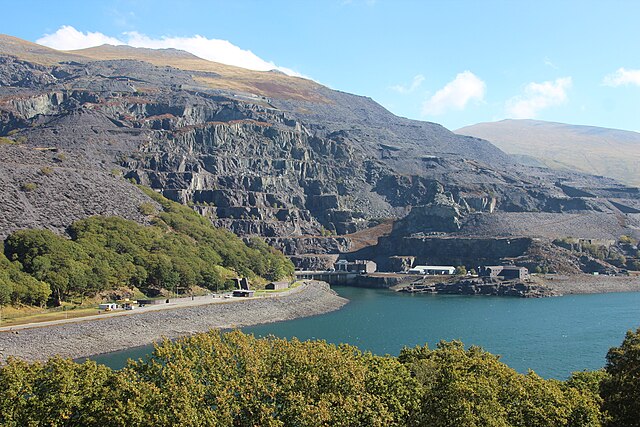
Places of interest in and near the village include the Snowdon Mountain Railway, the National Slate Museum, the Llanberis Lake Railway, Llyn Padarn country park and Electric Mountain. Tours of Dinorwig Power Station are available from a purpose-built visitor centre; the village is a popular starting point for ascents of Snowdon because the Llanberis Path begins in the village. Although it is the longest route, it is the least strenuous route to the summit following the line of the Snowdon Mountain Railway; this makes it the most popular walking route on the mountain. Dolbadarn Castle, a fortification built by the Welsh prince Llywelyn the Great during the early 13th century, at the base of the Llanberis Pass; the castle was important both militarily and as a symbol of Llywelyn's authority. The castle features a large stone keep, which historian Richard Avent considers "the finest surviving example of a Welsh round tower". In 1284 Dolbadarn was taken by Edward I of England, who removed some of its timbers to build his new castle at Caernarfon.
Dolbadarn was used as a manor house before falling into ruin. In the 18th and 19th century it was a popular destination for painters interested in Sublime and Picturesque landscapes, it is now owned by Cadw and managed as a tourist attraction, is protected as a grade I listed building. Llanberis Mountain Rescue Team deals with 150–200 incidents a year and is one of the busiest mountain rescue teams in the country; the team is run by volunteers who rely on donations from the public for funding. Llanberis Mountain Film Festival, held in annually in February, began in 2004, it is the home of the Slateman Triathlon. It attracts over many more spectators over two days, it is a mountain triathlon which begins in Llyn Padarn, follows on the bike up to Capel Curig, finishes with a run in the Snowdonian mountains. It is the start and finish of the Snowdonia Marathon Bus services to Llanberis are provided by Arriva Buses Wales and Gwynfor Coaches. Former operator Padarn Bus, which went into receivership in 2014, was based in the town and ran several routes to it.
Another local bus company Express Motors, based in Penygroes, ran services to Llanberis but had its bus licence revoked in 2017. The village used to be served by Llanberis railway station on a branch line of the Carnarvonshire Railway. Passenger services ceased in 1932; the heritage Snowdon Mountain Railway and Llanberis Lake Railway both have stations in the town, but serve as tourist attractions rather than local transport links. Llanberis Pass St Padarn's Church, Llanberis Llanberis' Website Llanberis Tourism Llanberis Mountain Rescue - Online home of the country's busiest mountain rescue team www.geograph.co.uk: photos of Llanberis and surrounding area