Southeast San Diego refers to the southeastern portion of the City of San Diego, including the neighborhoods south of State Route 94 and east of Downtown San Diego. Southeast San Diego has no official definition, but it may be considered coterminous with three official planning areas: Skyline-Paradise Hills, Encanto Neighborhoods, and Southeastern.
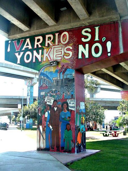
Mural in Chicano Park, Southeast San Diego
On the intersection of N Harbison Ave. and Division St., at the border of National City and Alta Vista
San Diego Trolley, Orange Line train over 47th Street. Chollas View
43rd St. Overpass by Interstate 805. Lincoln Park
Barrio Logan is a neighborhood in south central San Diego, California. It is bordered by the neighborhoods of East Village and Logan Heights to the north, Shelltown and Southcrest to the east, San Diego Bay to the southwest, and National City to the southeast. Interstate 5 forms the northeastern boundary. The Barrio Logan Community Plan Area comprises approximately 1,000 acres, of which slightly more than half is under the jurisdiction of the Port of San Diego or the United States Navy rather than the city of San Diego. The community is subject to the California Coastal Act. Though located near the City's Central core, it has long been considered part of Southeast San Diego by many locals, being directly Southeast of Downtown, and with previous historical records labeling it as part of "Western Southeast San Diego."
Barrio Logan neighborhood sign near corner of Cesar E. Chavez Parkway and Main Street
An industrial area and port facilities on the San Diego Bay
Murals in Chicano Park
San Diego Trolley station in Logan


