The Stanegate was an important Roman road and early frontier built in what is now northern England. It linked many forts including two that guarded important river crossings: Corstopitum (Corbridge) on the River Tyne in the east and Luguvalium (Carlisle) in the west. The Stanegate ran through the natural gap formed by the valleys of the River Tyne in Northumberland and the River Irthing in Cumbria. It predated the Hadrian's Wall frontier by several decades; the Wall would later follow a similar route, albeit slightly to the north.
Route of the Stanegate
The line of the Stanegate looking east, within the Corbridge Roman Site
An in situ Roman milestone on the Stanegate adjoining Vindolanda fort
Coria was a fort and town 2.5 miles (4.0 km) south of Hadrian's Wall, in the Roman province of Britannia. It was strategically located on the junction of a major Roman north–south road with the River Tyne and the Roman Stanegate road, which was also the first frontier line which ran east–west between Coria and Luguvalium. Corbridge Roman Site is in the village of Corbridge in the county of Northumberland.
Ruins of Corbridge’s Roman granaries
The Stanegate, Corbridge Roman Site
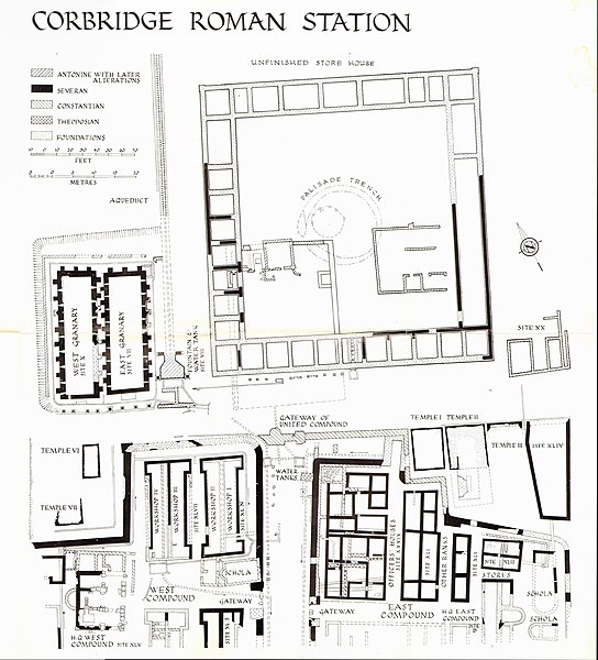
Plan of Coria showing the various stages of building; the twin granaries are at left
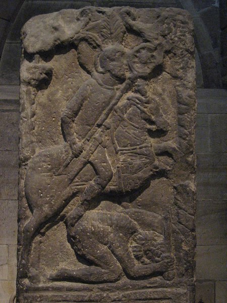
Tombstone of Flavinus, a Roman Standard Bearer, on display in Hexham Abbey, where it was found reused