Tanba Province was a province of Japan in the area of central Kyoto and east-central Hyōgo Prefectures. Tanba bordered on Harima, Ōmi, Settsu, Tajima. Tango, Wakasa, and Yamashiro provinces. Its abbreviated form name was Tanshū (丹州). In terms of the Gokishichidō system, Tanba was one of the provinces of the San'indō circuit. Under the Engishiki classification system, Tanba was ranked as one of the "superior countries" (上国) in terms of importance, and one of the "near countries" (近国) in terms of distance from the capital. The provincial capital is believed to have been located in what is now the city of Kameoka, although the exact location remains uncertain. The ichinomiya of the province is the Izumo-daijingū also located in Kameoka. The province had an area of 1,283.43 square kilometres (495.54 sq mi).
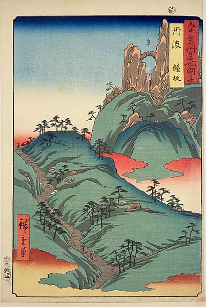
Hiroshige ukiyo-e "Tanba" in "The Famous Scenes of the Sixty States" (六十余州名所図会), depicting the Kanegasaka Pass
Izumo-daijingū, ichinomiya of the province
Ruins of Tanba Kokubun-ji
Kameyama Castle
Kyoto Prefecture is a prefecture of Japan located in the Kansai region of Honshu. Kyoto Prefecture has a population of 2,561,358 and has a geographic area of 4,612 square kilometres (1,781 sq mi). Kyoto Prefecture borders Fukui Prefecture to the northeast, Shiga Prefecture to the east, Mie Prefecture to the southeast, Nara Prefecture and Osaka Prefecture to the south, and Hyōgo Prefecture to the west.
Image: Amanohashidate view from Mt Moju 02s 3s 4592
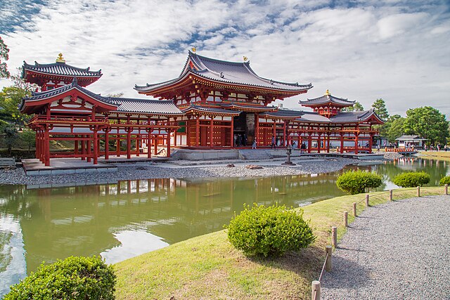
Image: Phoenix Hall
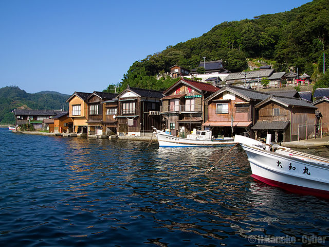
Image: 伊根の舟屋群 (Funaya houses at Ine), september 2014 (15428372595)
Image: Iwashimizu Hachimangu 4