Taupō Volcanic Zone
Videos
Photos
The Taupō Volcanic Zone (TVZ) is a volcanic area in the North Island of New Zealand that has been active for at least the past two million years and is still highly active.
Mount Ruapehu marks its south-western end and the zone runs north-eastward through the Taupō and Rotorua areas and offshore into the Bay of Plenty. It is part of a larger Central Volcanic Region that extends to the Coromandel Peninsula and has been active for four million years. The zone is contained within the tectonic intra-arc continental Taupō Rift and this rift volcanic zone is widening unevenly east–west with the greatest rate of widening at the Bay of Plenty coast, the least at Mount Ruapehu and a rate of about 8 mm (0.31 in) per year at Taupō. The zone is named after Lake Taupō, the flooded caldera of the largest volcano in the zone, the Taupō Volcano and contains a large central volcanic plateau as well as other landforms.

Mount Ngauruhoe

Whakaari / White Island
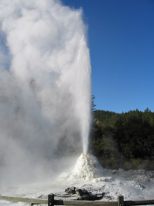
Lady Knox Geyser, Waiotapu geothermal area

In 1886, Mount Tarawera produced New Zealand's largest historic eruption since European colonisation
New Zealand
Videos
Photos
New Zealand is an island country in the southwestern Pacific Ocean. It consists of two main landmasses—the North Island and the South Island —and over 700 smaller islands. It is the sixth-largest island country by area and lies east of Australia across the Tasman Sea and south of the islands of New Caledonia, Fiji, and Tonga. The country's varied topography and sharp mountain peaks, including the Southern Alps, owe much to tectonic uplift and volcanic eruptions. New Zealand's capital city is Wellington, and its most populous city is Auckland.
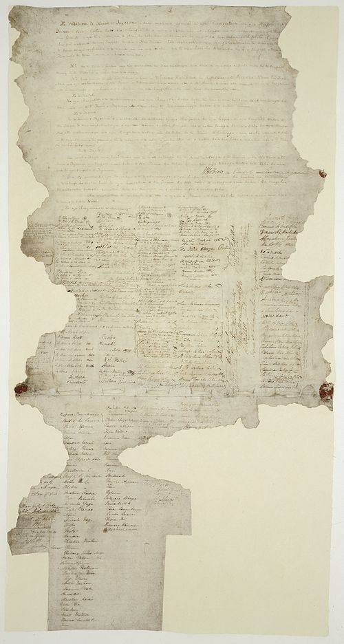
The Waitangi sheet from the Treaty of Waitangi

A meeting of European and Māori residents of Hawke's Bay Province. Engraving, 1863.
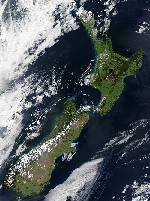
The snow-capped Southern Alps dominate the South Island, while the North Island's Northland Peninsula stretches towards the subtropics.

Aoraki / Mount Cook is the highest point in New Zealand, at 3,724 metres.