Tharsis
Videos
Photos
Tharsis is a vast volcanic plateau centered near the equator in the western hemisphere of Mars. The region is home to the largest volcanoes in the Solar System, including the three enormous shield volcanoes Arsia Mons, Pavonis Mons, and Ascraeus Mons, which are collectively known as the Tharsis Montes. The tallest volcano on the planet, Olympus Mons, is often associated with the Tharsis region but is actually located off the western edge of the plateau. The name Tharsis is the Greco-Latin transliteration of the biblical Tarshish, the land at the western extremity of the known world.

MOLA topography of the Thaumasia Plateau (Syria-Thaumasia block) and southern Tharsis. The volcano shown at the left is Arsia Mons. Valles Marineris extends across the northern edge. The areas in brown have the highest elevations on the Tharsis Plateau and may be considered the "summit region" of the Tharsis bulge.

Orographic water ice clouds hover over the volcanic peaks of the central Tharsis region in this color image mosaic from Mars Global Surveyor. Olympus Mons dominates at upper left. At center are the three Tharsis Montes: Arsia Mons at bottom, Pavonis Mons at center, and Ascraeus Mons at top.

Images of ice water clouds over Tharsis taken by the ExoMars Trace Gas Orbiter, 2016
Mars
Videos
Photos
Mars is the fourth planet from the Sun. The surface of Mars is orange-red because it is covered in iron(III) oxide dust, giving it the nickname "the Red Planet". Mars is among the brightest objects in Earth's sky, and its high-contrast albedo features have made it a common subject for telescope viewing. It is classified as a terrestrial planet and is the second smallest of the Solar System's planets with a diameter of 6,779 km (4,212 mi). In terms of orbital motion, a Martian solar day (sol) is equal to 24.5 hours, and a Martian solar year is equal to 1.88 Earth years. Mars has two natural satellites that are small and irregular in shape: Phobos and Deimos.

Comparison: Earth and Mars

Curiosity's view of Martian soil and boulders after crossing the "Dingo Gap" sand dune

Valles Marineris, taken by the Viking 1 probe
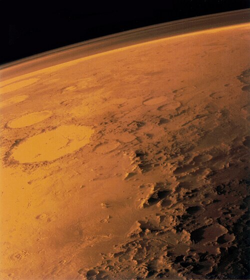
Edge-on view of Mars atmosphere by Viking 1 probe