The Black Tusk
Videos
Page
The Black Tusk, known as Q̓elqámtensa ti Skenknápa in the St'at'imcets (Lillooet) language and as T'ákt'akmúten tl'a Ín7inyáx̱a7en in the Sḵwx̱wú7mesh (Squamish) language, is a stratovolcano and a pinnacle of volcanic rock in Garibaldi Provincial Park of British Columbia, Canada. At 2,319 m (7,608 ft) above sea level, the upper spire is visible from a great distance in all directions. It is particularly noticeable from the Sea-to-Sky Highway just south of Whistler, British Columbia. Distinctive and immediately identifiable, The Black Tusk is among the best known mountains in the Garibaldi Ranges of the Coast Mountains. The volcano is part of the Garibaldi Volcanic Belt which is a segment of the Canadian Cascade Arc, but it is not within the geographic boundary of the Cascade Range.

The Black Tusk viewed from the southeast

Part of the trail from Garibaldi Lake to The Black Tusk.

Close-up view of The Black Tusk.
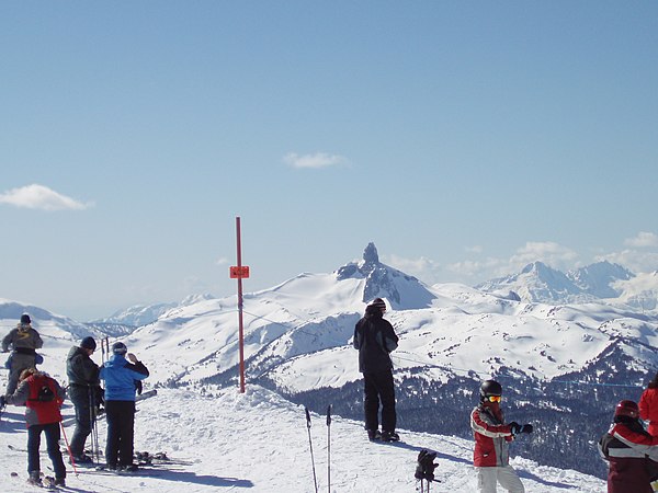
The Black Tusk as seen from the top of the Peak Express at Whistler Blackcomb
Garibaldi Provincial Park
Videos
Page
Garibaldi Provincial Park, also called Garibaldi Park, is a wilderness park located on the coastal mainland of British Columbia, Canada, 70 kilometres (43.5 mi) north of Vancouver. It was established in 1920 and named a Class A Provincial Park of British Columbia in 1927. The park is a popular destination for outdoor recreation, with over 30,000 overnight campers and over 106,000 day users in the 2017/2018 season.
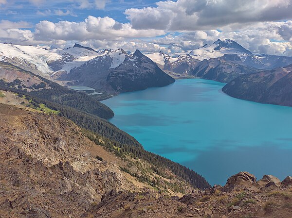
Sphinx Glacier, Garibaldi Lake and the north face of Mount Garibaldi, looking south from Panorama Ridge at 6,900 ft (2,100 m).
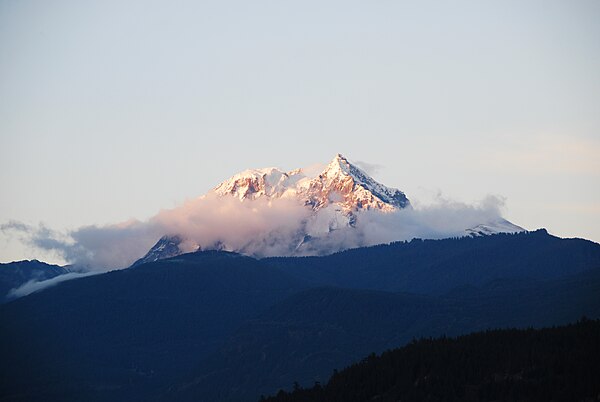
Mount Garibaldi's south face, as seen from Squamish. This is the view George Henry Richards had when he named the peak during the survey in Howe Sound. Garibaldi Park takes its name from this peak.

The Black Tusk, as seen from the trail to Panorama Ridge.
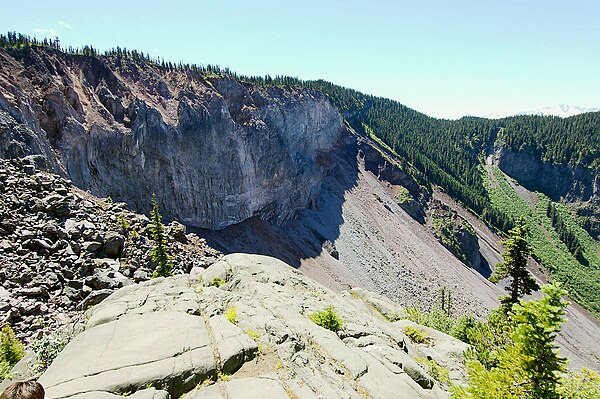
View of The Barrier, which was declared unstable in 1981 and resulted in the evacuation of the village of Garibaldi.