The Thompson Plateau forms the southern portion of the Interior Plateau of British Columbia, Canada, lying to the west of Okanagan Lake, south of the Thompson River and east of the Fraser River. At its most southern point the plateau is squeezed by the mountainous terrain of the Cascade Range abutting closer to the Okanagan Valley. Its southwestern edge abuts the Canadian Cascades portion of that extensive range, more or less following the line of the Similkameen River, its tributary the Tulameen River, and a series of passes from the area of Tulameen, British Columbia to the confluence of the Thompson River with the Nicoamen River, a few kilometres (miles) east of Lytton, British Columbia, which is in the Fraser Canyon. Its northeastern edge runs approximately from the city of Vernon, British Columbia through the valley of Monte Creek to the junction of the same name just east of the city of Kamloops. Northeast of that line is the Shuswap Highland.

Thompson Plateau, near the Dominion Radio Astrophysical Observatory
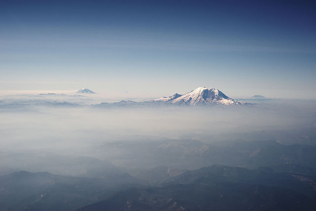
The Cascade Range or Cascades is a major mountain range of western North America, extending from southern British Columbia through Washington and Oregon to Northern California. It includes both non-volcanic mountains, such as many of those in the North Cascades, and the notable volcanoes known as the High Cascades. The small part of the range in British Columbia is referred to as the Canadian Cascades or, locally, as the Cascade Mountains. The highest peak in the range is Mount Rainier in Washington at 14,411 feet (4,392 m).
The Cascades in Washington, with Mount Rainier, the range's highest mountain, standing at 14,411 ft (4,392 m). Seen in the background (left to right) are Mount Adams, Mount Hood, and Mount St. Helens.
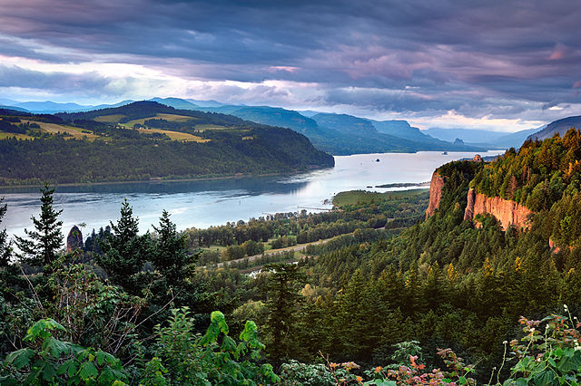
The Columbia Gorge marks where the Columbia River splits the Cascade Range between the states of Washington and Oregon.
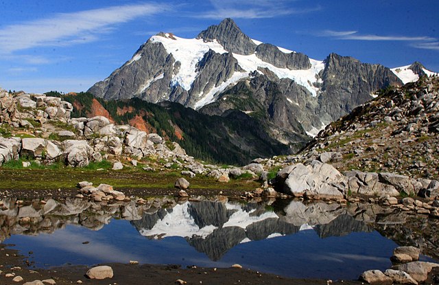
West side view of Mount Shuksan in summer as seen from Artist Point in Washington
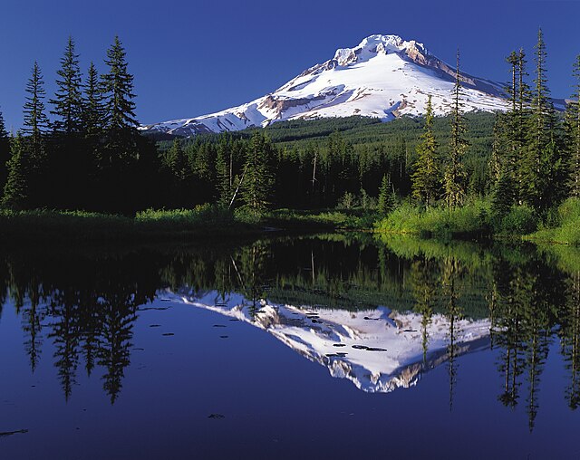
Mount Hood is the tallest point in the U.S. state of Oregon.