Todos Santos Cuchumatán is a municipality in the Guatemalan department of Huehuetenango. It is situated in the Sierra de los Cuchumatanes at an elevation of 2,500 m. The municipality covers an area of approximately 269 km2 and is formed by the town of Todos Santos Cuchumatán, 6 villages, and 69 smaller rural communities, called caserios, parajes, and cantones. The village of San Martin Cuchumatán is the second largest urbanized centre in the municipality of Todos Santos. San Martin is also the agricultural heart of the Cuchumateca valley which produces crops like potatoes, broccoli and large scale cultivation of coffee on the lower mountain slopes of the municipality.
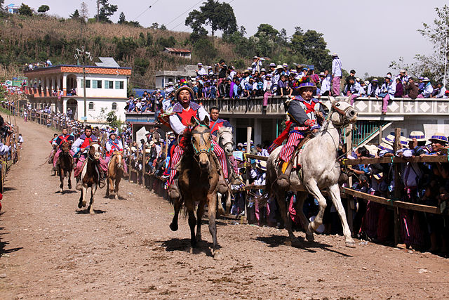
Horse races in Todos Santos Cuchumatán
Scenery of Todos Santos Cuchumatán
Image: Guatemala todos santos 3145a
Image: Guatemala todos santos 3022a
Huehuetenango is one of the 22 departments of Guatemala. It is located in the western highlands and shares the borders with the Mexican state of Chiapas in the north and west; with El Quiché in the east, and Totonicapán, Quetzaltenango and San Marcos in the south. The capital is the city of Huehuetenango.
Counterclockwise from top: Zaculeu in the city of Huehuetenango, Cenotes de Candelaria in Nenton, Hoyo Cimarron in La Trinidad Nenton, Catarata de Pajaj in San Pedro Soloma, Lagartero river in Nenton and Laguna Brava in Nenton Huehuetenango
Bridge over the San Juan River near its source which is one of the principal tourist attractions in the department.
San Mateo Ixtatán.
The Maya ruins of Zaculeu, near Huehuetenango city


