Toledo War
Videos
The Toledo War (1835–36), also known as the Michigan–Ohio War or the Ohio–Michigan War, was a boundary dispute between the U.S. state of Ohio and the adjoining territory of Michigan over what is now known as the Toledo Strip. Control of the mouth of the Maumee River and the inland shipping opportunities it represented, and the good farmland to the west were seen by both parties as valuable economic assets.

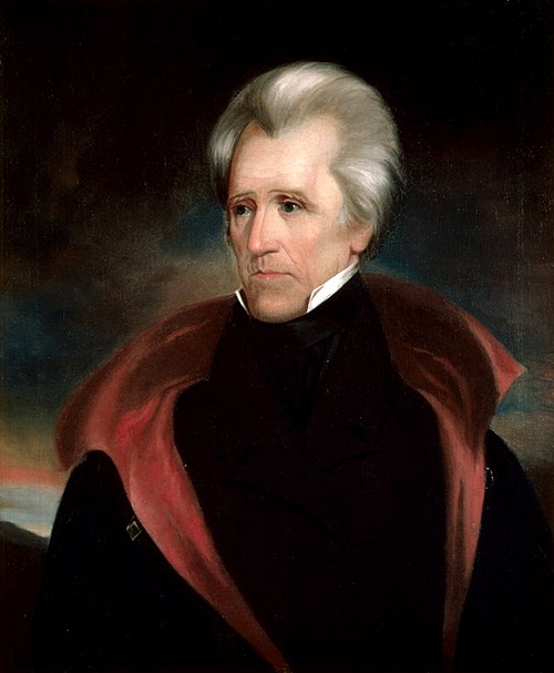
U.S. President Andrew Jackson, who sided with Ohio in the conflict and dismissed Mason as governor

A box labeled "Toledo, Mi" that may have been used by the Michigan Militia during the Toledo War

Site of the Battle of Phillips Corners
Michigan Territory
Videos
The Territory of Michigan was an organized incorporated territory of the United States that existed from June 30, 1805, until January 26, 1837, when the final extent of the territory was admitted to the Union as the State of Michigan. Detroit was the territorial capital.


Stevens T. Mason ran for governor in the first state elections in 1835.