Tyldesley
Videos
Photos
Tyldesley is a market town in Metropolitan Borough of Wigan in Greater Manchester, England. Within the boundaries of the historic county of Lancashire, it is north of Chat Moss near the foothills of the West Pennine Moors, 8 miles (12.9 km) southeast of Wigan and 9 miles (14.5 km) northwest of Manchester. At the United Kingdom Census 2001, the Tyldesley built-up area subdivision, excluding Shakerley, had a population of 16,142.

Marklands Buildings and Elliott Street

Garrett Hall is now a farmhouse

Miners outside the Miners Hall during the 1926 General Strike

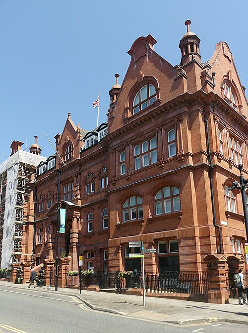
Tyldesley Town Hall, from 1924 the headquarters of the former Tyldesley Urban District Council. It was built as the Liberal Club in 1881.
Metropolitan Borough of Wigan
Videos
Photos
The Metropolitan Borough of Wigan is a metropolitan borough of Greater Manchester, England. It is named after its largest town, Wigan but covers a far larger area which includes the towns of Atherton, Ashton-in-Makerfield, Golborne, Hindley, Ince-in-Makerfield, Leigh and Tyldesley. The borough also covers the villages and suburbs of Abram, Aspull, Astley, Bryn, Hindley Green, Lowton, Mosley Common, Orrell, Pemberton, Shevington, Standish, Winstanley and Worsley Mesnes. The borough is also the second-most populous district in Greater Manchester.
Wigan Town Hall in 2023