Upper Norwood
Videos
Photos
Upper Norwood is an area of south London, England, within the London Boroughs of Bromley, Croydon, Lambeth and Southwark. It is north of Croydon. The eastern part of it is better known as the Crystal Palace area. The SE19 London postcode covers the entirety of the district.

Upper Norwood from the air, with the Croydon transmitting station in the centre

Hermitage Road, a Victorian suburban street in Upper Norwood

A misty day on Central Hill, Upper Norwood. To the right of the line of parked cars is the chapel of Virgo Fidelis Convent Senior School.

All Saints' Church, an Anglican parish church at Upper Norwood
London Borough of Croydon
Videos
Photos
The London Borough of Croydon is a London borough in south London, part of Outer London. It covers an area of 87 km2 (33.6 sq mi). It is the southernmost borough of London. At its centre is the historic town of Croydon from which the borough takes its name; while other urban centres include Coulsdon, Purley, South Norwood, Norbury, New Addington, Selsdon and Thornton Heath. Croydon is mentioned in Domesday Book, and from a small market town has expanded into one of the most populous areas on the fringe of London. The borough is now one of London's leading business, financial and cultural centres, and its influence in entertainment and the arts contribute to its status as a major metropolitan centre. Its population is 390,719, making it the largest London borough and sixteenth largest English district.

London Borough of Croydon
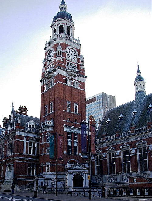
Croydon Town Hall

Croydon Council's offices were in Taberner House until September 2013

Bernard Weatherill House, home to Croydon Council from September 2013