Valles Marineris
Videos
Valles Marineris is a system of canyons that runs along the Martian surface east of the Tharsis region. At more than 4,000 km long, 200 km wide and up to 7 km deep, Valles Marineris is the largest can
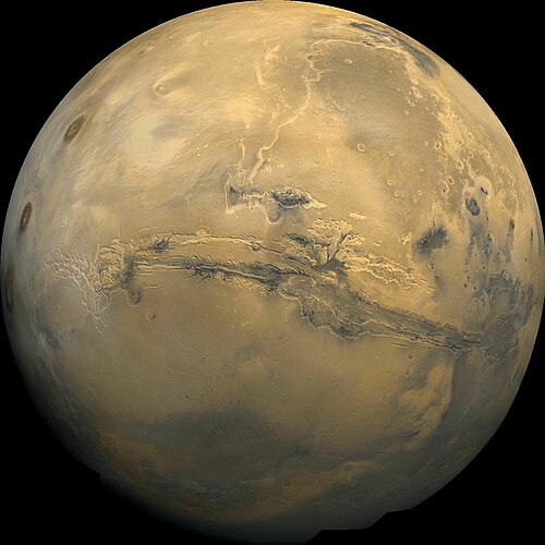
Valles Marineris stretches over 4,000 km (2,500 mi) across Mars, mostly east-west just below the equator, as seen in this Viking 1 orbiter image mosaic.

Valles Marineris in mosaic of THEMIS infrared images from 2001 Mars Odyssey

Valles Marineris with major features labeled.

Morning water ice fog spills out of Noctis Labyrinthus (Viking 1 orbiter image)
Phaeton is a hypothetical planet hypothesized by the Titius–Bode law to have existed between the orbits of Mars and Jupiter, the destruction of which supposedly led to the formation of the asteroid be
Valles Marineris
…of the fourth season of Star Trek: Strange New Worlds, Valles Marineris was created approximately 65 million years ago when the inhabitants of the then-fifth planet Dol'drm crash landed on Mars and began eating away at the planet, forcing the native Martians to "rip away" that part of the planet to prevent consumption…

Sturz des Phaeton (Fall of the Phaeton) by Johann Michael Franz

Heinrich Wilhelm Matthäus Olbers, who formulated the planet Phaeton hypothesis